 Paikkatietohakemisto

Type of resources
Available actions
Topics
Keywords
Contact for the resource
Provided by
Years
Formats
Representation types
Update frequencies
status
Service types
Scale
Resolution
-
NLS-FI INSPIRE Administrative Units Theme Dataset is a dataset depicting Administrative Units covering the land area and Maritime Units covering the sea area of Finland. Administrative Units contain the following INSPIRE feature types: AdministrativeUnit, AdministrativeBoundary. Maritime Units contain the following INSPIRE feature types: Baseline, MaritimeZone, MaritimeBoundary. Administrative Units are updated once a year from the NLS Cadastral Index Map database. Maritime Units are quite stable and have no regular update cycle. The dataset is available via the NLS-FI INSPIRE Download Service (WFS) for Administrative Units Theme and it can be viewed via the NLS-FI INSPIRE View Service (WMS) for Administrative Units.
-
The Regional Stream Water Geochemical Mapping data set gives information on the elemental concentrations in organic sediments of small headwater streams. The samples have been taken from small headwater streams (catchment area under 30 km2) in the late summer of 1990. Sampling has been repeated for about every fourth point during the years 1995, 2000 and 2006. The number of samples was 1162 in 1990 (at a density of one sample / 300 km2), 286 in 1995, 286 in 2000 and 249 in 2006. The data set covers the whole of Finland. Stream water samples have also been taken at the same time. Sampling, processing and analysis methods have been described in the Geochemical Atlas of Finland, Part 3, p. 27 - 30 (Lahermo et. al 1996). Field observations, coordinates and element concentrations determined from samples have been made into a database, in which each record represents one sample point. The data for each sampling year have been recorded on different tables. The method of analysis is referred to with a four-character method code. The codes are as follows: 503H = mercury determination using the cold vapour method 503P = nitric acid extraction in a microwave oven, measurement with ICP-AES 503M = nitric acid extraction in a microwave oven, measurement with ICP-MS 820L = carbon, hydrogen and nitrogen determination with a LECO analyser. The element concentration data include a numerical concentration value (as mg kg-1 or ppm) and possibly a check mark. The concentration is recorded as a variable, which has a name that comprises the chemical symbol for the element and the code for the method of analysis. For example AS_503M is arsenic (As) concentration, which is determined with the ICP-MS method (503M). The next variable has a check mark, for example AS_503MT. If the numerical value following the check mark is ‘>’ or '‘<’ then the number recorded in the concentration field is the determination limit of the chemical analytical method used and the actual concentration is less than this value. If the check mark is an exclamation mark (!), the analytical result is smaller than the determination limit of the analytical method use but the (unreliable) value obtained with the measuring instrument has been entered in the database. There is no data are if the check mark is a 'x'. The original purpose of the Regional Stream Water Geochemical Mapping data set was national general geochemical mapping and the basic assessment of environmental state. Other uses are, for example, the assessment of changes in environmental state and determination of the baseline concentrations of surface water as part of the evaluation of the chemical state of catchment areas in accordance with the Water Framework Directive of the EU.
-
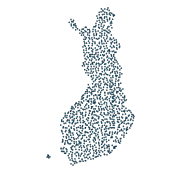
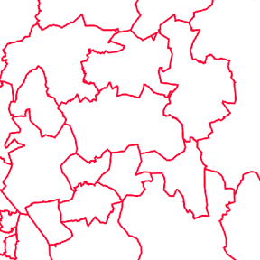
Statistics Finland's Web Service is a WFS interface service through which the following data required by INSPIRE and national legislation on geographic information are available: 1) Statistical units: Regional divisions (municipality, major region, region, sub-regional unit, Regional State Administrative Agency (AVI), Centre for Economic Development, Transport and the Environment (ELY), electoral district) and grid 1 km x 1 km 2) Non-profit and public services: Educational institutions (comprehensive schools, upper secondary general schools) 3) Production and industrial facilities: Production and industrial facilities 4) Population distribution by the regional divisions used in statistics and by 1 km x 1 km grids. Other data published: - Population distribution by 5 km x 5 km grids - Open data by postal code area (Paavo) The data are administered by Statistics Finland. The service is free of charge and does not require authentication or identification with a user ID and password. The general Terms of Use must be observed when using the data: http://tilastokeskus.fi/org/lainsaadanto/copyright_en.html.
-
The GTK’s Mineral Deposit database contains all mineral deposits, occurrences and prospects in Finland. Structure of the new database was created in 2012 and it is based on global geostan-dards (GeoSciML and EarthResourceML) and classifications related to them. The database is in Oracle, data products are extracted from the primary database. During 2013 GTK’s separate mineral deposit databases (Au, Zn, Ni, PGE, U, Cu, Industrial minerals, FODD, old ore deposit database) were combined into a single entity. New database contains extensive amount of information about mineral occurrence feature along with its associated commodities, exploration activities, holding history, mineral resource and re-serve estimates, mining activity, production and geology (genetic type, host and wall rocks, min-erals, metamorphism, alteration, age, texture, structure etc.) Database will be updated whenever new data (e.g. resource estimate) is available or new deposit is found. Entries contain references to all published literature and other primary sources of data. Also figures (maps, cross sections, photographs etc.) can be linked to mineral deposit data. Data is based on all public information on the deposits available including published literature, archive reports, press releases, companies’ web pages, and interviews of exploration geologists. Database contains 33 linked tables with 216 data fields. Detailed description of the tables and fields can be found in separate document. (http://tupa/metaviite/MDD_FieldDescription.pdf) The data products extracted from the database are available on Mineral Deposits and Exploration map service (http://gtkdata.gtk.fi/MDaE/index.html) and from Hakku -service (http://hakku.gtk.fi).
-
LUOMUS WFS is an API to the geospatial information provided by the Finnish Museum of Natural History. The use of the service is free and doesn't require authentication.
-
NLS-FI INSPIRE View Service for Administrative Units Theme is an INSPIRE compliant Web Map Service. It contains the following harmonized INSPIRE map layers: AdministrativeUnit, AdministrativeBoundary, Baseline, TerritorialSea, ExclusiveEconomicZone, MaritimeBoundary.InternalWaters, MaritimeBoundary.TerritorialSea ,MaritimeBoundary.ExclusiveEconomicZone. The service is based on the NLS-FI INSPIRE Administrative Units dataset. The dataset is administrated by the National Land Survey of Finland.
-
Please note that this dataset is deprecated from 30 May 2025 onwards. For more information, please check https://www.maanmittauslaitos.fi/en/service-messages/changes-inspire-services-concerning-buildings-and-addresses DVV INSPIRE Addresses Theme Dataset is a dataset depicting the Addresses of Buildings in Finland. It contains the following INSPIRE feature types: Address, AdminUnitName, PostalDescriptor, ThoroughfareName. The elements are updated weekly. The dataset is based on "Väestötietojärjestelmän rakennus- ja huoneistotiedot" by the Digital and Population Data Services Agency (Digi- ja väestötietovirasto). The dataset is available via the DVV INSPIRE Download Service (WFS) for Addresses Theme and it can be viewed via the DVV INSPIRE View Service (WMS) for Addresses.
-
NLS-FI INSPIRE Cadastral Parcels Theme Dataset is a dataset depicting the Cadastral Parcels and Basic Property Units covering the whole of Finland. It contains the following INSPIRE feature types: BasicPropertyUnit, CadastralParcel, CadastralBoundary. The elements are updated weekly. The dataset is based on the NLS Cadastral Index Map database. The dataset is available via the NLS-FI INSPIRE Download Service (WFS) for Cadastral Parcels Theme and it can be viewed via the NLS-FI INSPIRE View Service (WMS) for Cadastral Parcels.
-
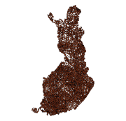
The Rock Geochemical Database of Finland data set describes the concentrations of major and trace elements in the bedrock of Finland. In all, 6544 samples were analysed for the total and partial concentrations of 57 elements using several different methods (XRF, ICP-MS, ICP-AES, GFAAS). The samples were taken during 1990-1995 with a mini-drill from rock that was as unaltered as possible. The sampling density varies between one sample per 30 km2 and one sample per 120 km2. The chemical analyses of the data were performed during 1992-2001. The reproducibility of the analytical results and the analytical drift were estimated using 375 duplicate sample pairs. The lowest reliable concentration was determined for each element and analytical method. In addition to the chemical concentrations, the database contains spatial data and several geological attributes for each sample. The data set and its manual were published in 2007 and they are available via the web site of the Geological Survey of Finland (GTK).
-
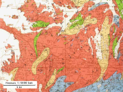
The 1:100 000 scale bedrock map data of the Geological Survey of Finland (GTK) include material produced during 1948-2007 for the needs of the mapping of mineral resources, for the sustainable exploitation of aggregate resources and for scientific research. These data include lithological information as polygons, bedrock observation points and drilling sites as well as essential tectonic observations, and information on lithological primary structures, ore minerals and metamorphic index minerals. Some 1:100 000 map sheets give both stratigraphical information as well as lithological data. An explanatory text accompanies most map sheets.