 Paikkatietohakemisto
2017
Type of resources
Available actions
Topics
Keywords
Contact for the resource
Provided by
Years
Formats
Representation types
Update frequencies
Service types
Scale
Resolution
-
The Arctic SDI Gazetteer Service is a service that contains authoritative place names data from the arctic area. The service can be used for searching place names and performing reverse geocoding. The service contains about 2.87 million place name locations with about 3.15 million place names. It contains data from following sources: * Canada (Natural Resources Canada, updated: 02/2018) * Denmark (including Greenland) (SDFE, updated: 05/2017) * Finland (National Land Survey of Finland, updated: 04/2017) * GEBCO Undersea feature names gazetteer (updated: 04/2019) * Iceland (National Land Survey of Iceland, updated: 08/2017) * Norway (Norwegian Mapping Authority, updated: 08/2017) * Russia (Russian Mapping Agency, updated: 04/2019) * Sweden (Swedish National Mapping Agency, updated: 05/2017) * USA (US Geological Survey, updated: 05/2017)
-
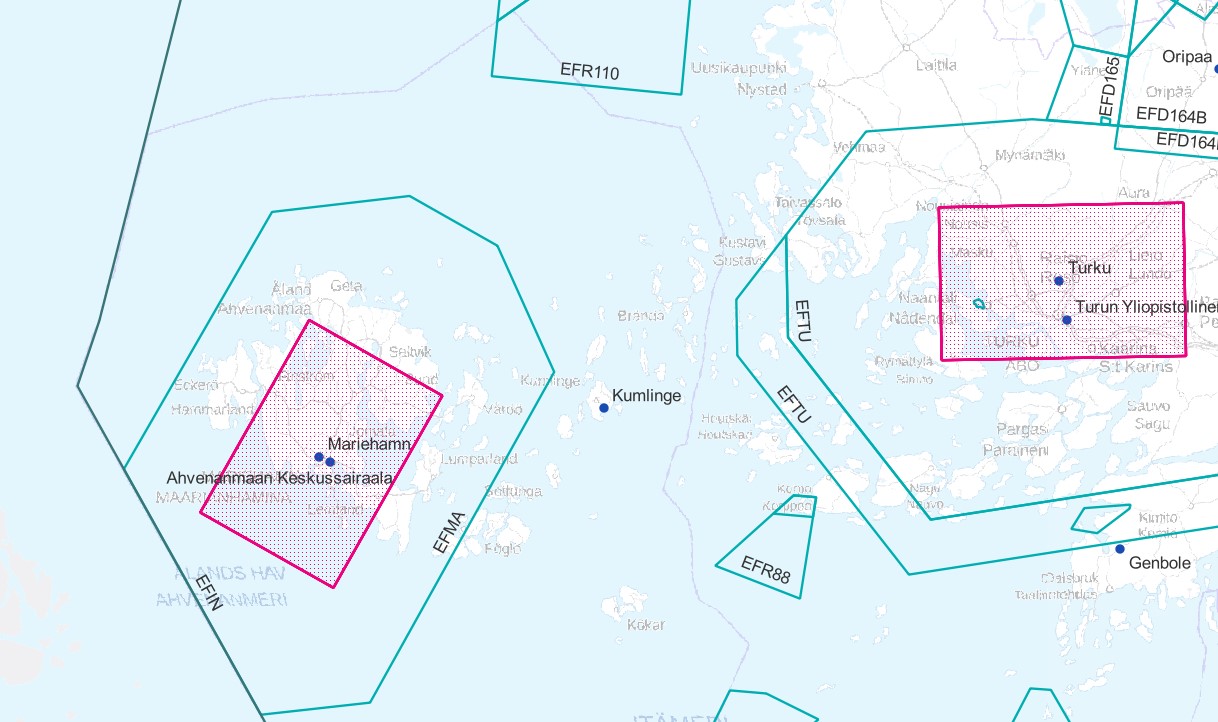
Air traffic network-product is a link-knot routing dataset compliant with INSPIRE requirements. It includes f.ex. flight routes and aerodromes. Data shall not be used for operational flight activities or flight planning. INSPIRE Air Traffic Network-product includes spatial information of air traffic network in accordance with the INSPIRE Directive. The data has been retrieved from the EAD database maintained by Eurocontrol. Information is updated regularly but is not constantly up to date. Data can be used for purposes that are in accordance with the INSPIRE Directive, but shall not be used for operational flight activities or flight planning. ANS Finland www.ais.fi –site provides information for operational flight activities or flight planning Available layers Aerodrome Node: Node located at the aerodrome reference point of an airport/heliport, which is used to represent it in a simplified way.DEFINITION Aerodrome Reference Point (ARP): The designated geographical location of an aerodrome, located near the initial or planned geometric centre of the aerodrome and normally remaining where originally established [AIXM3.3].DEFINITION Airport/heliport: A defined area on land or water (including any buildings, installations and equipment) intended to be used either wholly or in part for the arrival, departure and surface movement of aircraft/helicopters [AIXM5.0]. Air Route Link: A portion of a route to be flown usually without an intermediate stop, as defined by two consecutive significant points Air Space Area: A defined volume in the air, described as horizontal projection with vertical limits. Designated Point: A geographical location not marked by the site of a radio navigation aid, used in defining an ATS route, the flight path of an aircraft or for other navigation or ATS purposes. Instrument Approach Procedure: A series of predetermined manoeuvres by reference to flight instruments with specified protection from obstacles from the initial approach fix, or where applicable, from the beginning of a defined arrival route to a point from which a landing can be completed and thereafter, if a landing is not completed, to a position at which holding or en route obstacle clearance criteria apply. Navaid: One or more Navaid Equipments providing navigation services.DEFINITION Navaid equipment: A physical navaid equipment like VOR, DME, localizer, TACAN or etc. Procedure Link: A series of predetermined manoeuvres with specified protection from obstacles. Runway Area: A defined rectangular area on a land aerodrome/heliport prepared for the landing and take-off of aircraft. Runway Centerline Point: An operationally significant position on the center line of a runway direction. Standard Instrument Arrival: A designated instrument flight rule (IFR) arrival route linking a significant point, normally on an ATS route, with a point from which a published instrument approach procedure can be commenced. Standard Instrument Departure: A designated instrument flight rule (IFR) departure route linking the aerodrome or a specific runway of the aerodrome with a specified significant point, normally on a designated ATS route, at which the en-route phase of a flight commences. Surface Composition: Runway surface material CTR (Not INSPIRE): A control zone (CTR) is a block of Controlled Airspace extending from the surface of the earth to a specified upper limit.
-
This dataset represents the density of all IMO registered ships operating in the Baltic Sea. Density is defined as the number of ships crossing a 1 x 1km grid cell. It is based on HELCOM AIS (Automatic Identification System) data. The HELCOM AIS network hosts all the AIS signals received by the Baltic Sea States since 2005. The AIS Explorer allows to compare density maps of different ship types per month: http://maps.helcom.fi/website/AISexplorer/ The data was processed to produce density maps and traffic statistics. All scripts are available in GitHub: https://github.com/helcomsecretariat. The production of these maps have been carried out 2016-2017 through the HELCOM project on the assessment of maritime activities in the Baltic Sea. The underlying AIS data processing work has been co-financed by EU projects Baltic Scope (2015-2017 EASME/EMFF/2014/1.2.1.5) and Baltic Lines (2016-2019, Interreg Baltic Sea Region). In addition, the Ministry of the Environment of Finland supported the work with a special contribution in view of the use of the results in the HOLAS II process.
-
Syken Avoin tieto-palvelussa on Atom-syöte, jonka kautta on ladattavissa Syken INSPIRE-direktiivin liitteeseen I , II ja III kuuluvat tietotuotteet.Palvelu perustuu Avoin tieto-palvelussa ladattavana oleviin paikkatietoaineistoihin. Aineistoja hallinnoi Suomen ympäristökeskus.Palvelun käyttö on maksutonta eikä vaadi autentikointia eli tunnistautumista käyttäjätunnuksen ja salasanan avulla.Aineistot kuuluvat Syken avoimiin aineistoihin (CC BY 4.0).
-
Ympäristönsuojelulaissa (527/2014, YSL) määritellään siirtymäaika viemäriverkostojen ulkopuolisten ennen vuotta 2004 voimassa olleisiin rakentamisajankohdan mukaisiin vaatimuksiin tai myönnettyyn rakennuslupaan perustuvien jätevedenkäsittelyjärjestelmien tehostamiselle. Siirtymäaika 31.10.2019 koskee käsittelyjärjestelmiä, joihin muodostuu talousjätevettä rakennuksesta, joka sijaitsee enintään 100 metrin päässä vesistön tai meren keskiveden mukaisesta rantaviivasta. Etäisyys mitataan siitä rakennuksen seinästä, joka on lähinnä rantaviivaa. Siirtymäaika koskee myös jätevesien käsittelyjärjestelmiä, jotka ovat 1- tai 2-luokan pohjavesialueilla. Tämä paikkatietoaineisto antaa suuntaa antavan kuvauksen ympäristönsuojelulain tarkoittamasta etäisyydestä, mutta yksittäistapauksissa tapauskohtainen tarkastelu tulee tehdä maastossa. Aineistossa on kaksi karttatasoa: Ensimmäinen karttataso kuvaa vesistöistä 100 metrin etäisyyteen ulottuvaa vyöhykettä. Toinen karttataso kuvaa vesistöistä 90 – 110 metrin päässä olevaa varovyöhykettä, jonka tarkoitus on kuvata aineistoon liittyvää epävarmuutta. Karttatasot on muodostettu puskuroimalla Maanmittauslaitoksen maastotietokannan (2017) aluemaisia jokia, merta ja järviä (>= 1 ha) sekä SYKEn Vipu-uomia, jotka perustuvat maastotietokantaan vuosilta 2000-2008. Paikkatietoaineiston käyttö rakennuksen etäisyyteen rannasta antaa viitteellisen tuloksen ja siihen liittyy merkittävää paikallista epävarmuutta: Aukotonta aineistoa vesistöistä ei ole olemassa. Aineistossa saattaa olla mukana vesialueita, jotka eivät ole vesilain mukaisia vesistöjä ja toisaalta aineistosta saattaa puuttua vesistöjä. Etenkin pienet vesistöt, kuten purot joiden valuma-alue on alle 10 km2 ja alle 1 ha kokoiset lammet jäävät aineistosta pois. Ympäristönsuojelulain mukaan etäisyys vesistöön määritellään keskivedenkorkeuden mukaisesta rantaviivasta. Tätä tietoa ei ole käytettävissä paikkatietoaineistossa. Keskivedenkorkeus on systemaattiseen vedenkorkeuden seurantaan perustuva vedenpinnankorkeuksien päivähavaintojen keskiarvo. Paikkatietoaineistossa oleva rantaviiva perustuu pitkäaikaiseen keskiveden korkeuteen perustuvaan havainnointiin ja se voi poiketa merkittävästi keskivedenkorkeuden mukaisesta rantaviivasta. Käyttäjän pitää osata tulkita mikä on vesistöä lähinnä oleva seinä tai onko paikkatietoaineiston vesialue vesistö vai ei. Aineisto kuuluu SYKEn avoimiin aineistoihin (CC BY 4.0). Käyttötarkoitus: Aineisto on kuntien viranomaisten apuna aluemäärittelyn tekemisessä, sekä muiden tiedontarvitsijoiden käytettävissä. Vyöhykeaineisto antaa suuntaa antavan kuvauksen ympäristönsuojelulain tarkoittamasta etäisyydestä, mutta yksittäistapauksissa tapauskohtainen tarkastelu tulee tehdä maastossa. Lisätietoja: http://www.ymparisto.fi/fi-FI/Rakentaminen/Rakennushanke/Talotekniset_jarjestelmat_LVI/Kiinteiston_jatevesien_kasittely/Syventavaa_tietoa/Hajajatevesien_YSLn_mukaiset_siirtymaaikaalueet *** The Environmental Protection Act (527/2014) defines the required treatment efficiency for on-site wastewater treatment. Treatment requirements automatically apply to all new constructions. Old buildings, permanently habited houses, summerhouses, farmhouses etc. have a two-phase transition period. Buildings situated, either on a) a groundwater area, or b) closer than 100 meters from the mean water level of a water body, defined by The Water Act, need to fulfill the treatment requirements, by 31. October 2019. The other buildings do not have a transition period bound to a date. This data provides approximate spatial information about the coastal areas defined in the Environmental Protection Act. There are two map layers: one with a 100-meter distance from a water body, and the other with a 90–110 meter zone from a water body. The uncertainty of the data must be taken into account. The data is not to be understood as an amendment to the Environmental Protection Act. This SYKE’s dataset can be used according to open data license (CC BY 4.0).
-
Helsingin kaupungin karttapalvelu on internetissä toimiva kansalaisten käyttöön suunnattu karttojen katselupalvelu, jonka kautta pystyy myös tutustumaan joihinkin aineistojen ominaisuustietoihin sekä myös lataamaan joitakin aineistoja tiedostomuodossa.
-
Biomassa-atlaksen yritystoiminnan jätetiedot kuvaavat ympäristölupavelvollisten yritysten vuosittain tuottamien biohajoavien jätteiden määriä 1 km ruutuaineistona. Aineisto perustuu ympäristöhallinnon valvonta- ja kuormitustietojärjestelmään (VAHTI) kirjattuihin asiakaskohtaisiin jätetietoihin, joita on jatkokäsitelty Suomen ympäristökeskuksessa. Tiedot koskevat vuotta 2015. Jätemäärät (t/v) on ilmoitettu kansallisen jäteluokituksen mukaisiin kuusinumeroisiin EWC- jäteluokkiin. Luokitus perustuu valtioneuvoston asetukseen jätteistä (179/2012, liite 4). EWC-jäteluokkakoodi (EWC=European waste code) on muotoa xx.yy.zz, jossa neljä ensimmäistä numeroa kuvaavat jätteen alkuperätoimintaa ja sen alatoimialoja ja kaksi viimeistä numeroa jätteen laatua. Kansallisessa jäteluokituksessa on toimialaluokkia kaikkiaan 20. VAHTIssa on lisäksi lietteille käytössä kirjaintarkenne A-G, joka ilmaisee lietteen käsittelytavan. VAHTI-tietojärjestelmässä asiakaskohtaiset jätetiedot kirjataan kolmeen eri jätevirtaan: lähtevä ja tuleva jätevirta sekä varastotilanne. Biomassa-atlaksen yritystoiminnan jätemäärätiedot perustuvat VAHTI-asiakkaiden lähtevään jätevirtaan kirjattuihin, biohajoavia jätejakeita koskeviin määrätietoihin (t/v). VAHTI-tietojärjestelmä ei mahdollista jätemäärien aukotonta tasetarkastelua, sillä se on pääasiallisesti kehitetty viranomaisten valvontatehtävää, ei tilastointia varten. Tämän vuoksi Biomassa-atlaksen yritystoiminnan jätemääristä on poistettu jätteenkäsittelylaitoksilta lähtevät jätemäärät. Osa jätteenkäsittelylaitoksilta lähtevistä jätemääristä tulee jo kertaalleen kirjatuksi VAHTIssa muiden yritysten lähteviin jätteisiin, ja näin ollen ne olisivat osittain päällekkäistä tietoa. Käytännössä osa yritystoiminnan jätteistä kulkee jätteenkäsittelylaitosten, kuten kuljetus- ja keräystoimintaa harjoittavien yritysten kautta hyödyntämiseen ja osa suoraan varsinaisiin jätteen käsittely-/hyödyntämispaikkoihin. Biomassa-atlaksessa yritystoiminnan jätetiedot on VAHTIn EWC-jäteluokkakoodien perusteella jaoteltu viiteen pääluokkaan: 1) eläin- ja kasvijäte, 2) liete, 3) paperi- ja pahvijäte, 4) puujäte ja 5) sekajäte. Pääluokkien lisäksi määrätiedot jakautuvat vielä tarkemmin 62 alaluokkaan. Jäteluokitus on esitetty Biomassa-atlaksen verkkosivulla. Tiedot päivitetään Biomassa-atlakseen kerran vuodessa. Viimeisin päivitys koskee vuotta 2015. Jätemäärätiedoista ei käy ilmi yksittäisen jätteentuottajan nimi. Yritysten biohajoavien jätteiden ja laskennallisesti tuotettujen yhdyskuntien biohajoavien jätteiden määrätietoja ei pidä tarkastella kartalla samanaikaisesti, koska osa tiedoista on päällekkäistä. Laskennallisiin biohajoaviin yhdyskuntajätteisiin sisältyy myös yritysten yhdyskuntajätteen kaltainen biohajoava jäte, jota esimerkiksi on toimistoista peräisin oleva paperi- ja pahvijäte ja henkilöstöruokaloista peräisin oleva biojäte.
-
Iisalmen kiinteistörekisterikartta sisältää valtakunnallisen kiinteistörekisterin mukaiset kiinteistörajat ja kiinteistötunnukset. Aineistoa ylläpitää Iisalmen kaupungin tonttipalvelut ja maanmittauslaitos.
-
Kangasalan rakennukset WMS-palveluna on WMS-rajapintapalvelu, jonka kautta on saatavilla seuraavat karttatasot (suluissa tekninen nimi): Kangasala_RAHU(Kangasala_RAHU). Palvelu perustuu Kangasalan Rakennus ja huoneistoreisteri -aineistosta karsittuihin tietoihin. Aineistoja hallinnoi Kangasalan kaupunki. Palvelun käyttö on maksutonta, mutta vaatii tunnistautumisen käyttäjätunnuksen ja salasanan avulla. Lisätietoa kaupungin verkkosivuilta.
-
Biomassa-atlaksen yritystoiminnan jätetiedot kuvaavat ympäristölupa- ja raportointivelvollisten yritysten vuosittain tuottamien biohajoavien jätteiden määriä. Aineisto perustuu ympäristöhallinnon valvonta- ja kuormitustietojärjestelmään (VAHTI) kirjattuihin jätetietoihin, joita on jatkokäsitelty Suomen ympäristökeskuksessa. Biohajoavia jätteitä syntyy kuitenkin myös muilta kuin VAHTIin raportoivilta yrityksiltä. Koska kaikki biohajoavia jätteitä tuottavat yritykset tai toiminnot eivät ole ympäristölupavelvollisia tai raportointivelvollisia VAHTIin nähden, on kyseistä jätevirtaa Biomassa-atlaksessa tarkasteltu tiettyjä, erityisesti biohajoavia jätteitä käsitteleviä laitoksia koskevien tietojen avulla. VAHTIn kompostointi-, biokaasu- ja jätepolttoaineen valmistuslaitoksilta lähtevät biohajoavat jätemäärät on otettu Biomassa-atlaksen jätteenkäsittelylaitosten aineistoon mukaan. Kyseiset laitokset ovat ympäristölupavelvollisia, ja ne vastaanottavat biohajoavaa jätettä myös niiltä toimijoilta, joiden jätemääriä ei ole mukana Biomassa-atlaksen yritysten jätemäärätiedoissa. On kuitenkin huomioitava, että tiedot saattavat olla osittain päällekkäisiä yritysten biohajoavien jätemäärien kanssa, ja tästä syystä niitä ei pidä tarkastella kartalla yhtä aikaa. Jätteenkäsittelyn biohajoava jätemäärätieto antaa kuitenkin lisäinformaatiota, kun tavoitteena on biohajoavien jätevirtojen ohjaaminen entistä enemmän hyödyntämiseen. Biomassa-atlaksen jätteenkäsittelylaitosten biohajoava jätemäärätieto (t/v) on ilmoitettu jäteasetuksen (Vna jätteistä 179/2012, liite 4) mukaisten jäteluokkien mukaan. Lisäksi lietteille on käytössä kirjaintarkenne A-G, joka ilmaisee lietteen käsittelytavan. Biomassa-atlaksessa jätetiedot on edelleen luokiteltu viiteen pääluokkaan edellä mainittujen EWC-jäteluokkakoodien perusteella: 1) eläin- ja kasvijäte, 2) liete, 3) paperi- ja pahvijäte, 4) puujäte ja 5) sekajäte. Pääluokkien lisäksi jätemäärätiedot jakautuvat vielä tarkemmin 62 alaluokkaan. Jäteluokitus on esitetty Biomassa-atlaksen verkkosivulla. Tiedot päivitetään Biomassa-atlakseen kerran vuodessa. Viimeisin päivitys koskee vuotta 2015. Jätemäärätiedoista ei käy ilmi yksittäisen jätteentuottajan nimi.