 Paikkatietohakemisto
location
Type of resources
Available actions
Topics
Keywords
Contact for the resource
Provided by
Years
Formats
Representation types
Update frequencies
status
Scale
Resolution
-
KUVAUS: Karttataso kuvastaa Tampereen kaupungin katualueiden maksuluokkia sekä niihin liittyviä tarkastus- ja valvontamaksuja. KATTAVUUS: Julkisesti kaikille käyttäjille Oskari-karttapalvelussa. PÄIVITYS: Satunnainen (vain tarvittaessa). Karttatason tietojen päivittämisestä vastaa Tampereen kaupungin Katutilavalvonnan yksikkö. YLLÄPITOSOVELLUS: Tampereen kaupungin tiedostopalvelin ja PostGIS-tietokanta KOORDINAATTIJÄRJESTELMÄ: Aineisto tallennetaan ETRS-GK24FIN (EPSG:3878) tasokoordinaattijärjestelmässä GEOMETRIA: vektori (viiva) SAATAVUUS: Aineisto on tallennettu Postgis-tietokantaan. JULKISUUS: Aineisto on nähtävillä julkisesti kaikille käyttäjille Oskari-karttapalvelussa. TIETOSUOJA: Aineistoon ei liity tietosuojakysymyksiä. AINEISTOSTA VASTAAVA TAHO: Tampereen kaupunki, Katutilavalvonta, katuluvat@tampere.fi
-
The Finnish Uniform Coordinate System (in Finnish Yhtenäiskoordinaatisto, YKJ) has been used in biological observation mapping since the 1970s. Based on YKJ, Finland is divided in square-shaped areas, the size of which are determined according to the needs of the study. The area division used in national biomonitoring is 10 km x 10 km squares, but in some cases 1 km x 1 km and 100 m x 100 m YKJ squares are also used. This data set includes XY-lines that form square grid in four scales according to Unified Coordinate System (100 m - 100 km), with identifiers describing each square.
-

The map sheet division is a system created for printing maps, which covers map sheet codes, map scales and map sheet sizes. Today, map sheet division is also used for other purposes. It is also possible to download other NLS datasets in addition to maps in accordance with map sheet division. The map sheet division TM35, which is based on the projected coordinate reference system ETRS-TM35FIN is in use today. Before 2007, a map sheet division that was based on the KKS coordinate reference system was used. The TM35 map sheet division consists of 7 different grid sizes, the smallest scale is 1:200,000 and the largest is 1:5000. An explanation of how the grids are further split into more detailed grids and the principles of map sheet numbering is on the National Land Survey website (in Finnish) https://www.maanmittauslaitos.fi/kartat-ja-paikkatieto/kartat/osta-kartta/nain-loydat-oikean-karttalehden. The attribute data of the grids include map sheet number, the area of a square on the grid, perimeter and the coordinates of the centre of the square. The map sheet division is available as a file in vector format and through our contract-based WMTS service in raster format. In addition, you can view it in the geoportal Paikkatietoikkuna. The product is a part of the open data of the National Land Survey.
-
NLS-FI INSPIRE Geographical Names Theme Dataset is a dataset depicting the Named Places and Geographical Names covering the whole of Finland. It contains the following INSPIRE feature types: NamedPlace The elements are updated weekly. The dataset is based on the Geographic Names Register of the National Land Survey of Finland: http://www.paikkatietohakemisto.fi/geonetwork/srv/fin/catalog.search#/metadata/eec8a276-a406-4b0a-8896-741cd716ade6 The dataset is available via the NLS-FI INSPIRE Download Service (WFS) for Geographical Names Theme and it can be viewed via the NLS-FI INSPIRE View Service (WMS) for Geographical Names.
-
-
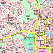
POHJAKARTAN AINEISTOS Tampere: Vesistö, liikenneverkko, nimistöä (järvien nimet, kaupunginosien nimet), rakennuksia, alueita Kuntarajan ulkopuoli: Vesistö, liikenneverkko, kuntarajat, kuntien nimet, taajama-alueita
-
Pohjakartat osa-alueille: Lielahti-Hiedanranta, Tesoma, Keskusta ja Alasjärven itäpuoli POHJAKARTTOJEN AINEISTOJA Vesistö, liikenneverkkoa, nimistöä (vesistöt, kaupunginosat, teiden nimiä), rakennuksia, alueita (mm. korttelialueet)
-
Osoiteaineisto on yhdistelmä rakennusten ja kiinteistöjen osoitteista ja koordinaateista. Aineisto luetaan kerran yössä FACTA-kuntarekisterin tiedoista. Aineistossa ei ole posti- eikä käyntiosoitteita. Aineistossa saattaa olla virheitä ja puutteita (mm. rakennusten koordinaatit eivät välttämättä ole oikean kiinteistön alueella). Päivitys ja ylläpito jatkuvaa. Aineisto päivittyy kartta- ja rajapintapalveluihin kerran vuorokaudessa aineiston ylläpitojärjestelmästä. Aineisto on katseltavissa julkisesta Hyvinkään karttapalvelusta sekä avoimesti käytettävissä WMS-katselupalvelun kautta. Tasokoordinaatisto: ETRS-GK-25 Korkeusjärjestelmä: N2000
-
Tampereen rakennukset, poistuneet, on Tampereen kattava tieto poistuneista rakennustunnuksista, sijaintikiinteistöistä, rakennusten sijainnista ja osoitteista ja omistajista. ......
-
Tampereen rakennukset on Tampereen kattava tieto pysyvistä rakennustunnuksista, sijaintikiinteistöistä, rakennusten sijainnista ja osoitteista ja omistajista. Sijaintikiinteistöjä, sijainteja ja osoitteita päivitetään jatkuvasti. Tunnukset määritetään ja alue/sijainti lasketaan lupaprosessissa suunnitellun pohjalta, päivitetään sijaintikatselmusmittauksista valmiiksi. Sijaintikiinteistöt päivittyvät Maanmittauslaitokselta saatujen lohkomistietojen ja Tampereen kaupungin tekemien tontinmittausten kautta. Omistajatiedot päivittyvät kiinteistön omistajuuden/haltijuuden tulkinnalla Maanmittauslaitokselta tehtyjen lainhuutoajojen pohjalta. Omistajuuksia korjataan mahdollisten poikkeusten osalta myös rakennuslupatietojen pohjalta. Osoitteet annetaan rakennustunnuksen perustamisen yhteydessä, päivitetään tonttijakojen ja rakennuslupien yhteydessä. Sijainti tallennetaan ETRS-GK24 tasokoordinaattijärjestelmässä. Rakennustunnukset ovat yksilöiviä tunnuksia. Aineisto on saatavissa ? Tietoaineiston geometria on piste.