dataset
Type of resources
Available actions
Topics
Keywords
Contact for the resource
Provided by
Years
Formats
Representation types
Update frequencies
status
Service types
Scale
Resolution
-

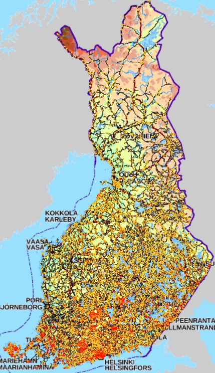
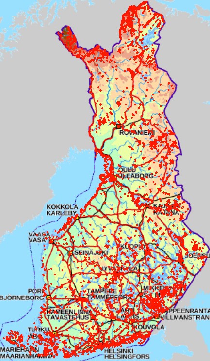
FIN Aineiston tarkoituksena on: -Identifioida tie- ja rata-alueet, joiden varrella esiintyy uhanalaisia ja silmälläpidettäviä lajeja -Identifioida tie- ja rata-alueet, joiden varrella esiintyy hyviä elinvoimaisia niittyindikaattorilajeja (hyönteisten mesi- ja ravintokasveja) -Identifioida tie- ja rata-alueet, joiden varrella esiintyy suojelualueita -Identifioida tie- ja rata-alueet, joiden varrella esiintyy komealupiinia tai kurtturuusua -Identifioida tie- ja rata-alueet, joiden varrella esiintyy komealupiinia tai kurtturuusua uhanalaisten lajien lisäksi -> Löytää herkät alueet ja paikallistaa vieraslajien uhka Tieto esitetään 1 kilometrin ruuduissa. Aineistosta on julkaistu kaksi erillistä versiota. -VaylanvarsienVieraslajitJaArvokkaatElinymparistot_avoin: Avoin versio, jonka lajitietoa on karkeistettu mahdollisista herkistä lajeista johtuen. Aineisto kuuluu SYKEn avoimiin aineistoihin (CC BY 4.0) ja sitä saa käyttää lisenssiehtojen mukaisesti -VaylanvarsienVieraslajitJaArvokkaatElinymparistot_kayttorajoitettu: Alkuperäinen karkeistamaton versio. Tämä versio on vain viranomaiskäyttöön eikä kyseistä aineistoa saa jakaa Aineistosta on tehty tarkempi menetelmäkuvaus https://geoportal.ymparisto.fi/meta/julkinen/dokumentit/VierasVayla_Menetelmakuvaus.pdf sekä muuttujaseloste https://geoportal.ymparisto.fi/meta/julkinen/dokumentit/VierasVayla_VariableDescription.xlsx ENG The purpose of the material is to: -Identify road and rail areas that have nearby observations of endangered and near threatened species -Identify road and rail areas with good meadow indicator plant species -Identify road and rail areas along which there are protected areas -Identify the road and rail areas along which there are observations of Lupinus polyphyllus or Rosa rugosa observations -Identify the road and rail areas along which there are Lupinus polyphyllus or Rosa rugosa observations in addition to sensitive species -> Finds sensitive areas and identify the overall threat of alien species The data is presented in 1-kilometer square grid cells. There are two separate versions of the data. -VaylanvarsienVieraslajitJaArvokkaatElinymparistot_avoin: Open access version, in which its species-related parts have been simplified due to data restriction issues. The material belongs to Syke's open materials (CC BY 4.0) and may be used in accordance with the license terms. -VaylanvarsienVieraslajitJaArvokkaatElinymparistot_kayttorajoitettu: Original version. This version is only for official use and the material in question may not be shared. A more precise description about the data procedures can be found from (In Finnish) https://geoportal.ymparisto.fi/meta/julkinen/dokumentit/VierasVayla_Menetelmakuvaus.pdf Furthermore, all the variables in the data are explained in this bilingual variable description https://geoportal.ymparisto.fi/meta/julkinen/dokumentit/VierasVayla_VariableDescription.xlsx This dataset was updated with the newest species observations on 10/2023 and 11/2024 Process code for this can be found from https://github.com/PossibleSolutions/VierasVayla_SpeciesUpdate
-
KUVAUS: Karttataso sisältää sekajätteen keräysalueet, jotka tulevat voimaan kuudessa vaiheessa 31.12.2029 mennessä, sekä nykyisen voimassa olevan sekajätteen keräysalueen. PÄIVITYS: Satunnainen (vain tarvittaessa). YLLÄPITOSOVELLUS: Tampereen kaupungin tiedostopalvelin ja PostGIS-tietokanta KOORDINAATTIJÄRJESTELMÄ: Aineisto tallennetaan ETRS-GK24FIN (EPSG:3878) tasokoordinaattijärjestelmässä GEOMETRIA: vektori (alue) SAATAVUUS: Aineisto on tallennettu Postgis-tietokantaan. JULKISUUS: Aineisto on nähtävillä julkisesti kaikille käyttäjille Oskari-karttapalvelussa. TIETOSUOJA: Aineistoon ei liity tietosuojakysymyksiä. AINEISTOSTA VASTAAVA TAHO: Tampereen kaupunki, Alueellinen jätehuoltolautakunta, jatehuoltolautakunta@tampere.fi
-
The EMODnet (European Marine Observation and Data network) Geology project collects and harmonizes marine geological data from the European sea areas to support decision making and sustainable marine spatial planning. The partnership includes 39 marine organizations from 30 countries. The partners, mainly from the marine departments of the geological surveys of Europe (through the Association of European Geological Surveys-EuroGeoSurveys), have assembled marine geological information at various scales from all European sea areas (e.g. the White Sea, Baltic Sea, Barents Sea, the Iberian Coast, and the Mediterranean Sea within EU waters). This dataset includes EMODnet seabed substrate maps at a scale of 1:10 000 from the European marine areas. Traditionally, European countries have conducted their marine geological surveys according to their own national standards and classified substrates on the grounds of their national classification schemes. These national classifications are harmonised into a shared EMODnet schema using Folk's sediment triangle with a hierarchy of 16, 7 and 5 substrate classes. The data describes the seabed substrate from the uppermost 30 cm of the sediment column. Further information about the EMODnet Geology project is available on the portal (http://www.emodnet-geology.eu/).
-

Production and Industrial Facilities contain the data set on establishments based on Statistics Finland's Business Register as follows: Data: location coordinates of the establishment, industry according to the Standard Industrial Classification TOL 2008 at the 2-digit level Industries according to D2.8.III.8 INSPIRE in TOL 2008 industries: B Mining and quarrying C Manufacturing D Electricity, gas steam and air conditioning supply E Water supply, sewerage, waste management and remediation activities F Construction H Transport and storage (excl. 53 Postal and courier activities) Coverage of the data set: establishments with over ten employees Statistical reference year: 2019 The data set is also suitable for viewing the location of industrial establishments. The coverage of the spatial data is about 90 % of the statistical data. The general Terms of Use must be observed when using the data: http://tilastokeskus.fi/org/lainsaadanto/copyright_en.html. In addition to the national version, an INSPIRE information product is also available from the data.
-
-
KUVAUS: Tampereen rakennelmien 2D-seinälinjat aluemuotoisena geometriana korkeudeltaan nollattuna. Mukana vain valmiit ja julkisesti näytettävät rakennelmat. Virkistys aamuisin klo 6.35. KATTAVUUS: Tampereen kaupunkiseutu PÄIVITYS: Aineistoa päivitetään jatkuvasti uusien rakennelmien valmistuessa. YLLÄPITOSOVELLUS: StellaMap (DGN-tiedostot) ja FME KOORDINAATTIJÄRJESTELMÄ: Aineisto tallennetaan ETRS-GK24FIN (EPSG:3878) tasokoordinaattijärjestelmässä. GEOMETRIA: vektori (alue) SAATAVUUS: Aineisto on saatavilla WFS-rajapinnalta Tampereen kaupungin sisäiseen käyttöön sekä konsulteille sopimuksella/käyttöehdolla. Aineiston primäärilähde on Oracle-tietokanta. JULKISUUS: Aineisto on julkisesti katsottavissa Oskari-karttapalvelussa. TIETOSUOJA: Aineistoon ei liity tietosuojakysymyksiä. KENTÄT: -TYYPPI: Rakennelma, Muu rakennelma, Portaat tai esteettömyysluiska, Laituri, Piippu tai Allas -ALALUOKKA: Varastotila, Katos, Muu rakennelma, Maastoportaat, Autokatos, Joukkoliikenteen pysäkkikatos, Muu laituri, Venelaituri, Mainosrakennelma, Jätekatos, Muistomerkki, Savupiippu, Huvipuistolaite, Raunio, Katsomo, Muu piippu, Maatalousallas, Maauima-allas, Esteettömyysluiska, Hyppyrimäki, Keittokatos, Suihkulähde tai suihkukaivo -RAKENNELMALUOKKA_FACTA: Tulee rakennelmalle i_pyraknro perusteella Factasta (huom. ei löydy kaikilta rakennelmilta). -PYSYVA_RAK_NRO_FACTA: Rakennelman pysyvä rakennusnumero Factasta. AINEISTOSTA VASTAAVA TAHO: Tampereen kaupunki, Paikkatietoyksikkö, paikkatieto_tuki@tampere.fi
-

FIN Suomen hiekkarantoja ja niiden taustatekijöitä kuvaava aineisto. Datan taustalla olevan hankkeen pääasiallisena tarkoituksena on hiekkarantojen identifioiminen parhaasta käytettävissä olevasta tiedosta, näiden rantojen ominaispiirteiden kuvaaminen, ympäristöllisen arvon arvioiminen sekä hoitotarpeessa olevien rantojen löytäminen. Aineistosta on julkaistu kaksi erillistä versiota. -HiekkarantojenOminaisuudet_avoin: Avoin versio, jonka lajitietoa on karkeistettu mahdollisista herkistä lajeista johtuen. Aineisto kuuluu SYKEn avoimiin aineistoihin (CC BY 4.0) ja sitä saa käyttää lisenssiehtojen mukaisesti -HiekkarantojenOminaisuudet_kayttorajoitettu: Alkuperäinen karkeistamaton versio. Tämä versio on vain viranomaiskäyttöön eikä kyseistä aineistoa saa jakaa” Aineistosta on tehty tarkempi menetelmäkuvaus https://geoportal.ymparisto.fi/meta/julkinen/dokumentit/RantaPutte_Menetelmakuvaus.pdf sekä muuttujaseloste https://geoportal.ymparisto.fi/meta/julkinen/dokumentit/RantaPutte_VariableDescription.xlsx ENG This data describes Finnish sandy beaches and their background factors. The main purpose of the project underlying the data is to identify sandy beaches from the best available information, to describe the characteristics of these beaches, to assess their environmental value and to find beaches in need of conservation There are two separate versions of the data. -HiekkarantojenOminaisuudet_avoin: Open access version, in which its species-related parts have been simplified due to data restriction issues. The material belongs to Syke's open materials (CC BY 4.0) and may be used in accordance with the license terms. -HiekkarantojenOminaisuudet_kayttorajoitettu: Original version. This version is only for official use and the material in question may not be shared. A more precise description about the data procedures can be found from (In Finnish) https://geoportal.ymparisto.fi/meta/julkinen/dokumentit/RantaPutte_Menetelmakuvaus.pdf All the variables in the data are explained in this bilingual variable description https://geoportal.ymparisto.fi/meta/julkinen/dokumentit/RantaPutte_VariableDescription.xlsx
-
FIN Järvien vesikasvillisuusvyöhykettä kuvaava aineisto 1971 suomalaisesta järvivesimuodostumasta. Aineisto on polygonivektorimuodossa, jossa yksittäisen järven vesikasvivyöhyke esitetään moniosaisena polygonina. Vesikasvillisuusvyöhyke koostuu ilmakuvilta erottuvasta vedenpinnan yläpuolisesta (ilmaversoinen ja kelluslehtinen) ja aivan vedenpinnan tasolle yltävästä uposlehtisestä kasvillisuudesta. Vesikasvillisuusvyöhykkeen ja järven 0–3 metrin syvyysvyöhykkeen perusteella järville on laskettu kasvittumisaste-niminen tunnusluku, jota käytetään järvien ekologisen tilan arvioinnissa kuvaamaan rehevöitymisen aiheuttamaa kasvillisuuden runsastumista. Vesikasvillisuusvyöhyke on analysoitu Picterra-yrityksen koneoppimismalleilla Maanmittauslaitoksen hallinnoimista väri-infra- eli vääräväriortokuvista vuosilta 2012-2023. Vyöhykkeen analysointi on rajattu 1.7.–10.9. otettuihin ortokuviin. Lisäksi analysointi on rajattu seuraaviin vesienhoidon suunnittelun 3. suunnittelukaudella määritettyihin järvityyppeihin: • Pienet humusjärvet • Keskikokoiset humusjärvet • Runsashumuksiset järvet • Matalat humusjärvet • Matalat runsashumuksiset järvet Aineisto sisältää 698 järvivesimuodostumalta ilmakuvatulkinnan useammalta vuodelta. Havaittu kasvittumisaste on laskettu niille 977 järvivesimuodostumalle, joilta oli saatavissa tieto 0–3 metrin syvyysvyöhykkeestä. Aineistoon on jätetty järviä ilman syvyysaineistoa ja siten kasvittumisasteen laskentaa siinä tarkoituksessa, jotta aineistoa voidaan tarvittaessa hyödyntää muuhunkin kuin kasvittumisaste-muuttujaan perustuvaan tila-arviointiin. Aineistolle on tehty silmämääräinen tarkastus virheellisten havaintojen poistamiseksi. Aineisto voi silti sisältää väärintulkintoja. Kasvittumisasteen luontaisen vaihtelun mallintamisesta saadut tunnusluvut, kuten odotetut kasvittumisasteet ja kasvittumisasteeseen perustuva ekologinen tilaluokka, ovat ympäristöhallinnon asiantuntijoiden katseltavissa Pisara-järjestelmässä. Käyttötarkoitus: Ympäristöhallinnon tehtävien tueksi vesien tilan arviointiin. Järvien ekologisen tilan arviointia tekevät asiantuntijat käyttävät paikkatietoaineistoa ilmakuvatulkinnan laadun arvioimiseen yksittäisellä järvellä. Asiasanat: kaukokartoitus, ilmakuvat, vesikasvillisuus, seuranta, ekologinen tila Lisätietoja: https://geoportal.ymparisto.fi/meta/julkinen/dokumentit/Jarvien_vesikasvillisuusvyohykkeet.pdf https://vesi.fi/aineistopankki/koneoppimispohjaiseen-ilmakuvatulkintaan-perustuva-jarvien-vesikasvillisuuden-tilanarviointi/ ENG This data describes lake macrophyte zone on 1971 Finnish lake waterbodies. The spatial features are represented as multi-part polygons. The attributes are in Finnish. The zone represents emergent and floating-leaved vegetation plus submerged vegetation just above the surface of water. Together with lake bathymetric data, the percentage of vegetated littoral (PVL) was calculated. The PVL is applied in ecological status assessment. Lake macrophyte zone was detected from color-infrared aerial orthophotos administered by the National Land Survey of Finland. The detections were performed with the help of a custom machine learning model trained using Picterra. The detections were applied to orthophotos in 2012-2013 which were filmed between 1st of July and 10th of September. The detections were limited to humic and humic-rich lake waterbodies. There are detections from multiple years for 698 lake waterbodies. Observed PVL were calculated on 977 lake waterbodies which have bathymetric data to identify the 0 to 3 meters deep littoral zone. To potentially utilize the data for more than just the PVL-based approach, the data also have detections on waterbodies without bathymetric data and therefore observed PVL. A visual inspection of the data has been performed to remove erroneous detections. The data may still contain misinterpretations. Purpose of use: Support of environmental administration in ecological status assessment. More information: https://geoportal.ymparisto.fi/meta/julkinen/dokumentit/Jarvien_vesikasvillisuusvyohykkeet.pdf https://vesi.fi/aineistopankki/koneoppimispohjaiseen-ilmakuvatulkintaan-perustuva-jarvien-vesikasvillisuuden-tilanarviointi/
-
Maanmittauslaitoksen KM2-korkeusmallin kanssa yhteensopiva korkeusmalli, jossa alkuperäisiä korkeusarvoja on alennettu erityisesti virtavesikohteiden (viivamaiset sekä aluemaiset) ja tieverkoston risteyskohdissa. Alennetut korkeusarvot pyrkivät kuvaamaan virtausreittejä, kuten tierumpuja ja putkia, joita alkuperäisessä KM2:ssa ei ole. Aineisto on tuotettu yhdistämällä useita eri valtakunnan kattavia lähtöaineistoja, joita ovat - korkeusmalli KM2 (Maanmittauslaitos) - Siltojen kansien korkeudet (Syke) - Maastotietokanta (Maanmittauslaitos) - DIGIROAD-tieverkosto (Väylävirasto) - Rumpurekisteri (Väylävirasto) Lisäksi jotkin kunnat ja kaupungit ovat digitoineet Maastotietokannasta puuttuvia virtausreittejä. Korkeusarvot ovat ilmoitettu N2000-korkeusjärjestelmässä. Aineisto on avoin (lisenssi CC BY 4.0). Käyttötarkoitus: Korvaamalla KM2:n korkeusarvot uomakorjausaineiston arvoilla saadaan korkeusmalli, joka soveltuu mm. pintaveden virtauksen mallinnukseen alkuperäistä korkeusmallia paremmin. Tämä mahdollistaa esim. hulevesitulvariskien luotettavamman arvioinnin. Aineisto kuuluu SYKEn avoimiin aineistoihin (CC BY 4.0). Lähde: Syke, Maanmittauslaitos (perustuu Syken, MML:n ja Väyläviraston aineistoihin).
-
This dataset represents the density of all IMO registered ships operating in the Baltic Sea. Density is defined as the number of ships crossing a 1 x 1km grid cell. It is based on HELCOM AIS (Automatic Identification System) data. The HELCOM AIS network hosts all the AIS signals received by the Baltic Sea States since 2005. The AIS Explorer allows to compare density maps of different ship types per month: http://maps.helcom.fi/website/AISexplorer/ The data was processed to produce density maps and traffic statistics. All scripts are available in GitHub: https://github.com/helcomsecretariat. The production of these maps have been carried out 2016-2017 through the HELCOM project on the assessment of maritime activities in the Baltic Sea. The underlying AIS data processing work has been co-financed by EU projects Baltic Scope (2015-2017 EASME/EMFF/2014/1.2.1.5) and Baltic Lines (2016-2019, Interreg Baltic Sea Region). In addition, the Ministry of the Environment of Finland supported the work with a special contribution in view of the use of the results in the HOLAS II process.
 Paikkatietohakemisto