notPlanned
Type of resources
Available actions
Topics
Keywords
Contact for the resource
Provided by
Years
Formats
Representation types
Update frequencies
status
Service types
Scale
Resolution
-
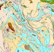
Bedrock of Finland 1:200 000 is a unified bedrock map dataset covering the whole Finland. It has been compiled by generalising the scale-free bedrock map feature dataset. The dataset consists of a lithological/stratigraphic geological unit polygon layer and linear layers, in which faults, diverse overprinting lines and dykes are represented. The dataset also includes an origin of the data and a quality estimation of the data polygon layers. The stratigraphic geological unit polygon layer includes lithological coding, geological time period and hierarchical lithostratigraphical or lithodemic classification as attributes in accordance with the Finnish database for stratigrafic geological units (Finstrati). The line layers have their own hierarchical classification. The data are at 1:200 000 scale, which indicates that the main part of the scale-free data have been generalised to correspond to a product at a scale of 1:200 000. Those areas where the source data is coarser than 1:200 000 have not been generalised. Coordinate reference system of the dataset was transformed in March 2013. The transformation from Finnish National Grid Coordinate System (Kartastokoordinaattijärjestelmä, KKJ) Uniform Coordinate Frame to ETRS-TM35FIN projection was done by using the three-dimensional transformation in accordance with the recommendations for the public administration JHS154.
-
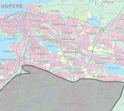
Geologisen tutkimuskeskuksen määrittämä arseeniriskialue 1995. Kattavuus koko kaupunki, kertaluonteinen selvitys. Tuote on avointa aineistoa, lisätietoja: https://www.tampere.fi/viestinta/rajapinnat-avoin-data-ja-mobiilipalvelut
-
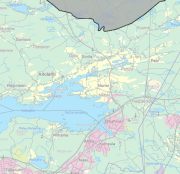
Geologisen tutkimuskeskuksen määrittämät fluoridiriskialueet 1995. Kattaa koko kaupungin, kertaluonteinen selvitys. Vastaava yksikkö Tampereen kaupunki/Ympäristöterveys/Terveydensuojelu, yhdyshenkilö Tuula Sillanpää. Tuote on avointa aineistoa. http://teto.tampere.fi/lisenssit/tre_avoimen_datan_lisenssi.pdf
-

Turun maakuntamuseossa maisemahistoriaa tutkitaan vanhojen karttojen, pääasiassa 1700-luvun lopun isojakokarttojen, avulla. Niistä voidaan tutkia mm. vanhojen kylien, peltojen, niittyjen ja teiden sijaintia. Alkuperäiset kartat kuvataan digitaalisesti ja kuvat viedään paikkatietoohjelmaan, jossa ne kiinnitetään vastinpisteiden avulla nykyisten peruskarttojen päälle. Karttojen sisältö piirretään puhtaaksi ja niihin liittyvät asiakirjatiedot kirjataan taulukkoon. Piirretty kartta voidaan avata päällekkäin nykyisen peruskartan kanssa ja siten paikallistaa historiallinen maisemarakenne suhteessa nykyiseen. Rajapintapalvelu sisältää seuraavat karttatasot (tekninen nimi soluissa): - Varsinais-Suomen maisemahistoriakartat: Maankäyttö (maisemahistoria_alue_kooste) - Varsinais-Suomen maisemahistoriakartat: Rajat, reitit ja aidat (maisemahistoria_viiva_kooste) - Varsinais-Suomen maisemahistoriakartat: Rakennukset ja kohteet (maisemahistoria_piste_kooste)
-
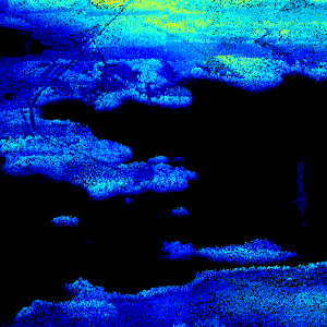
Laser scanning data refers to three-dimensional point-like data depicting the ground and objects on the ground. Each point is provided with x, y and z coordinate information. Laser scanning data is available from all of Finland. The product belongs to the open data of the National Land Survey of Finland. From 2020 onwards, laser scanning data according to the laser scanning programme will be produced. The product description of the 'Laser scanning data 5 p' according to the scanning programme is available: https://www.maanmittauslaitos.fi/en/maps-and-spatial-data/expert-users/product-descriptions/laser-scanning-data-5-p. A spaced-out open dataset will be created from the new Laser scanning data 5 p: https://www.maanmittauslaitos.fi/en/maps-and-spatial-data/expert-users/product-descriptions/laser-scanning-data-05-p. The characteristics of this dataset correspond to the Laser scanning data 2008–2019 dataset.
-
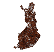
The Rock Geochemical Database of Finland data set describes the concentrations of major and trace elements in the bedrock of Finland. In all, 6544 samples were analysed for the total and partial concentrations of 57 elements using several different methods (XRF, ICP-MS, ICP-AES, GFAAS). The samples were taken during 1990-1995 with a mini-drill from rock that was as unaltered as possible. The sampling density varies between one sample per 30 km2 and one sample per 120 km2. The chemical analyses of the data were performed during 1992-2001. The reproducibility of the analytical results and the analytical drift were estimated using 375 duplicate sample pairs. The lowest reliable concentration was determined for each element and analytical method. In addition to the chemical concentrations, the database contains spatial data and several geological attributes for each sample. The data set and its manual were published in 2007 and they are available via the web site of the Geological Survey of Finland (GTK).
-
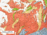
The 1:100 000 scale bedrock map data of the Geological Survey of Finland (GTK) include material produced during 1948-2007 for the needs of the mapping of mineral resources, for the sustainable exploitation of aggregate resources and for scientific research. These data include lithological information as polygons, bedrock observation points and drilling sites as well as essential tectonic observations, and information on lithological primary structures, ore minerals and metamorphic index minerals. Some 1:100 000 map sheets give both stratigraphical information as well as lithological data. An explanatory text accompanies most map sheets.
-

Lounaistiedon WMS-palvelu sisältää lukuisia avoimia alueellisia aineistoja. Lounaistiedon avoimen datan WMS-palvelun osoite on http://geoserver.lounaistieto.fi:80/geoserver/vsl/ows?SERVICE=WMS& Palvelun käyttö on maksutonta eikä vaadi autentikointia eli tunnistautumista käyttäjätunnuksen ja salasanan avulla.
-
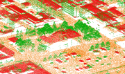
Kuopion laserkeilausaineisto on maanpintaa ja maanpinnalla olevia kohteita kuvaava kolmiulotteinen pistemäinen aineisto. Jokaisella pisteellä on x, y ja z koordinaattitieto. Laserkeilausaineisto on keilattu ilmalaserkeilauksena vuosina 2007-2017. Kuopion kaupungin toiminnoissa aineistoa hyödynnetään kantakartan ylläpidossa, kaavoituksessa, eri vastuu alueiden suunnittelutehtävissä sekä erilaisten kolmiulotteisten havainnemallien sekä kaupunkimallin laadinnassa. Tuote on maksullista aineistoa. Laserkeilausaineistoa myydään esimerkiksi rakennusluvan asemapiirrusten laadintaan(pintamalli) tai muuhun suunnitteluun yksityisille henkilöille tai yrityksille. Laserkeilausaineiston hinta määräytyy Kuopion kaupungin paikkatietoaineistojen hinnaston mukaisesti.
 Paikkatietohakemisto