2016
Type of resources
Available actions
Topics
Keywords
Contact for the resource
Provided by
Years
Formats
Representation types
Update frequencies
status
Service types
Scale
Resolution
-
NLS-FI INSPIRE Download Service (WFS) for Buildings/Polygon is an INSPIRE compliant direct access Web Feature Service. It contains the following INSPIRE feature types: Building The service is based on the NLS-FI INSPIRE Buildings Theme Dataset. The dataset is administrated by the National Land Survey of Finland. The service contains all features from the dataset that are modelled as polygons.
-
NLS-FI INSPIRE Download Service (WFS) for Hydrography Theme is an INSPIRE compliant direct access Web Feature Service. It contains the following INSPIRE feature types: Dam Or Weir, Land-water Boundary, Rapids, Shoreline Construction, Standing Water, Watercourse. The service is based on the NLS-FI INSPIRE Hydrography Physical Waters dataset. The dataset is administrated by the National Land Survey of Finland.
-
NLS-FI INSPIRE Download Service (WFS) for Geographical Names Theme is an INSPIRE compliant direct access Web Feature Service. It contains the following INSPIRE feature types: NamedPlace. The service is based on the Geographic Names Register of the National Land Survey of Finland. The dataset is administrated by the National Land Survey of Finland.
-

Lack of spatial soil data in digital form has been a primary obstacle in establishing European policies on land use and environmental protection. Abundant data on soil characteristics exist in Finland but have been scattered among various sources, making it difficult for authorities to make country-wide presentations and predictions.The objective of the project was to create georeferenced soil map and database according to the instructions of the European Soil Bureau using data from existing databases and collecting some new data. The basis of the work was a geological map of quaternary deposits, which describes the soil at a depth of 1 metrem (parent material) according to the Finnish classification based on the concentration of organic matter and the texture of mineral material. Primary research topics included generalization methodology of soil polygons with GIS technology, calculation of soil characteristics needed in the database and computerizing the existing non-digital soil information. It was proved that aerial geophysics can be used for separation of shallow peats from deep peat soils and muddy soils and other wet areas can be identified. Soil names according to the FAO/Unesco system and the World Reference Base for Soil Resources (WRB-2014) were derived from the soil names of the Finnish soil classification system and geophysical data. Soilscape (Soil Mapping Units) of Finland with WRB-2014 soil classification, intented to be used in European scale e.g to delineate risk areas mentioned in soil framework directive proposal.
-
NLS-FI INSPIRE Download Service (WFS) for Buildings/Point is an INSPIRE compliant direct access Web Feature Service. It contains the following INSPIRE feature types: Building The service is based on the NLS-FI INSPIRE Buildings Theme Dataset. The dataset is administrated by the National Land Survey of Finland. The service contains all features from the dataset that are modelled as points.
-
NLS-FI INSPIRE Download Service (WFS) for Administrative Units Theme is an INSPIRE compliant direct access Web Feature Service. It contains the following INSPIRE feature types: AdministrativeUnit, AdministrativeBoundary, Baseline, MaritimeZone, MaritimeBoundary. The service is based on the NLS-FI INSPIRE Administrative Units dataset. The dataset is administrated by the National Land Survey of Finland.
-
NLS-FI INSPIRE Download Service (WFS) for Cadastral Parcels Theme is an INSPIRE compliant direct access Web Feature Service. It contains the following INSPIRE feature types: BasicPropertyUnit, CadastralParcel, CadastralBoundary. The service is based on the NLS-FI INSPIRE Cadastral Parcels dataset. The dataset is administrated by the National Land Survey of Finland.
-
Metsävarantoaineisto kuvaa metsässä kasvavan puun määrää ja metsämaaluokkien yleisyyttä. Se perustuu Luken tuottamaan monilähteiseen valtakunnan metsien inventointiaineistoon (MVMI) vuodelta 2015. http://www.paikkatietohakemisto.fi/geonetwork/srv/fin/catalog.search;jsessionid=5xucstm4ryvlfxq6q2bwg49z#/metadata/c2ca1093-c111-4062-9c32-0bb9e3de159d MVMI:n alkuperäiset 16 m x 16 m rasterit on summattu Biomassa-atlasta varten 1 km x 1 km hilalle. Koska jako ei mene tasan (1 km:lle mahtuu 62,5 kertaa 16 m), jako tehtiin ensin 2 km x 2 km ruutuihin ja jaettiin niiden sisällä 16 m x 16 m hilat 1 km x 1 km hiloihin. Keskellä olevalle jakolinjalle osuvat 16 m x 16 m ruudut jaettiin siten, että kukin 1 km ruutujen väliin jäävä 16 m kaistale liitettiin yhteen viereisistä ruuduista siten, että jokaiseen 1 km x 1 km ruutuun tulee mukaan yksi tällainen reunakaistale.
-

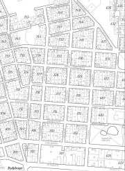
Osoitekartta käsittää Hangon, Tvärminnen ja Lappohjan taajama-alueet. Osoitekartta sisältää voimassa olevat kiinteistöjen osoitteet, kiinteistörajat, korttelinumerot ja tontin numerot.
-
Rantaviiva-aineistot digitoitiin vuonna 2016 osana Satakuntaliiton ”Satakunnan tiestö 100 vuotta sitten”-projektia. Projektissa asemoitiin 1800-luvun lopun ja 1900-luvun alun Senaatin kartaston karttalehdet Satakunnan alueelta sekä 1920- ja 1930 -lukujen lehtijakoinen pitäjänkartasto. Kartta-aineisto asemoitiin nykyiselle peruskartalle karttalehtikohtaisesti asemointipisteiden avulla, jonka jälkeen karttojen ja kirjallisten lähteiden tietojen perusteella luotiin vektoritaso piirtämällä vanhaa rantaviivaa kuvaava viiva kartan osoittamalle sijainnille. Aineiston suositeltava tarkastelumittakaava on 1:20 000 – 1:100 000.
 Paikkatietohakemisto