 Paikkatietohakemisto

Type of resources
Available actions
Topics
Keywords
Contact for the resource
Provided by
Years
Formats
Representation types
Update frequencies
status
Service types
Scale
Resolution
-
NLS-FI INSPIRE Download Service (WFS) for Hydrography Theme is an INSPIRE compliant direct access Web Feature Service. It contains the following INSPIRE feature types: Dam Or Weir, Land-water Boundary, Rapids, Shoreline Construction, Standing Water, Watercourse. The service is based on the NLS-FI INSPIRE Hydrography Physical Waters dataset. The dataset is administrated by the National Land Survey of Finland.
-
Please note that this dataset is deprecated from 30 May 2025 onwards. For more information, please check https://www.maanmittauslaitos.fi/en/service-messages/changes-inspire-services-concerning-buildings-and-addresses DVV INSPIRE Addresses Theme Dataset is a dataset depicting the Addresses of Buildings in Finland. It contains the following INSPIRE feature types: Address, AdminUnitName, PostalDescriptor, ThoroughfareName. The elements are updated weekly. The dataset is based on "Väestötietojärjestelmän rakennus- ja huoneistotiedot" by the Digital and Population Data Services Agency (Digi- ja väestötietovirasto). The dataset is available via the DVV INSPIRE Download Service (WFS) for Addresses Theme and it can be viewed via the DVV INSPIRE View Service (WMS) for Addresses.
-
Number of population by statistical units. The number of population on the last day of the reference year (31.12.). Statistical areas are municipalities, sub-regional units, regions, major regions, Regional State Administrative Agencies (AVI) and Centres for Economic Development, Transport and the Environment (ELY). The statistical variables in the data are: total population (vaesto), share of the total population (vaesto_p), number of men (miehet), men's share of the population in an area (miehet_p) and women (naiset), women's share (naiset_p), those aged under 15: number (ika_0_14), share (ika_0_14p), those aged 15 to 64: number (ika_15_64), share (ika_15_64p), and aged 65 or over: number (ika_65_), share (ika_65_p). The data is suitable for the examination of population distribution and making various regional analyses. The general Terms of Use must be observed when using the data: https://tilastokeskus.fi/org/lainsaadanto/copyright_en.html. In addition to the national version, an INSPIRE information product is also available from the data.
-

Lack of spatial soil data in digital form has been a primary obstacle in establishing European policies on land use and environmental protection. Abundant data on soil characteristics exist in Finland but have been scattered among various sources, making it difficult for authorities to make country-wide presentations and predictions.The objective of the project was to create georeferenced soil map and database according to the instructions of the European Soil Bureau using data from existing databases and collecting some new data. The basis of the work was a geological map of quaternary deposits, which describes the soil at a depth of 1 metrem (parent material) according to the Finnish classification based on the concentration of organic matter and the texture of mineral material. Primary research topics included generalization methodology of soil polygons with GIS technology, calculation of soil characteristics needed in the database and computerizing the existing non-digital soil information. It was proved that aerial geophysics can be used for separation of shallow peats from deep peat soils and muddy soils and other wet areas can be identified. Soil names according to the FAO/Unesco system and the World Reference Base for Soil Resources (WRB-2014) were derived from the soil names of the Finnish soil classification system and geophysical data. Soilscape (Soil Mapping Units) of Finland with WRB-2014 soil classification, intented to be used in European scale e.g to delineate risk areas mentioned in soil framework directive proposal.
-
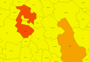
NLS-FI INSPIRE Administrative Units Theme Dataset is a dataset depicting Administrative Units covering the land area and Maritime Units covering the sea area of Finland. Administrative Units contain the following INSPIRE feature types: AdministrativeUnit, AdministrativeBoundary. Maritime Units contain the following INSPIRE feature types: Baseline, MaritimeZone, MaritimeBoundary. Administrative Units are updated once a year from the NLS Cadastral Index Map database. Maritime Units are quite stable and have no regular update cycle. The dataset is available via the NLS-FI INSPIRE Download Service (WFS) for Administrative Units Theme and it can be viewed via the NLS-FI INSPIRE View Service (WMS) for Administrative Units.
-
Statistics Finland's Web Service is a WMS interface service through which the following data required by INSPIRE and national legislation on geographic information are available: 1) Statistical units: Regional divisions (municipality, major region, region, sub-regional unit, Regional State Administrative Agency (AVI), Centre for Economic Development, Transport and the Environment (ELY), electoral district) and grid 1 km x 1 km. 2) Non-profit and public services: Educational institutions (comprehensive schools, upper secon-dary general schools) 3) Production and industrial facilities: Production and industrial facilities 4) Population distribution by the regional divisions used in statistics and by 1 km x 1 km grids. Other data published: - Open data by postal code area (Paavo) - Population distribution by 5 km x 5 km grids The data are administered by Statistics Finland. The service is free of charge and does not require authentication or identification with a user ID and password. The general Terms of Use must be observed when using the data: http://tilastokeskus.fi/org/lainsaadanto/copyright_en.html.
-
Location (x,y) and name of educational institutions. Statistical reference year 2022. Data includes a location and a name of every comprehensive and upper secondary level schools in Finland. The source of data is the yearly updated register of educational institutions (https://tilastokeskus.fi/tup/oppilaitosrekisteri/index_en.html) which is maintained by Statistics Finland. An educational institution is defined as an administrative unit as such not the school building or the operating place. Coordinates are mostly accurate based on the centroid of the building althought there exists some educational institutions with estimated coordinates. Estimations are based to the street address of the educational institutions. Validity (OLO): 0 = Valid 1 = Closed down during the statistical year 2 = Merged with another educational institution during the statistical year 3 = Educational institution removed from the educational institutions of the education system 6 = Educational institution had no activity during the statistical year 7 = Technical removal Type of educational institute (OLTYP): 11 = Comprehensive schools 12 = Comprehensive school level special education schools 15 = Upper secondary general schools 19 = Comprehensive and upper secondary level schools The general Terms of Use must be observed when using the data: http://tilastokeskus.fi/org/lainsaadanto/copyright_en.html. In addition to the national version, an INSPIRE information product is also available from the data.
-
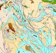
Bedrock of Finland 1:200 000 is a unified bedrock map dataset covering the whole Finland. It has been compiled by generalising the scale-free bedrock map feature dataset. The dataset consists of a lithological/stratigraphic geological unit polygon layer and linear layers, in which faults, diverse overprinting lines and dykes are represented. The dataset also includes an origin of the data and a quality estimation of the data polygon layers. The stratigraphic geological unit polygon layer includes lithological coding, geological time period and hierarchical lithostratigraphical or lithodemic classification as attributes in accordance with the Finnish database for stratigrafic geological units (Finstrati). The line layers have their own hierarchical classification. The data are at 1:200 000 scale, which indicates that the main part of the scale-free data have been generalised to correspond to a product at a scale of 1:200 000. Those areas where the source data is coarser than 1:200 000 have not been generalised. Coordinate reference system of the dataset was transformed in March 2013. The transformation from Finnish National Grid Coordinate System (Kartastokoordinaattijärjestelmä, KKJ) Uniform Coordinate Frame to ETRS-TM35FIN projection was done by using the three-dimensional transformation in accordance with the recommendations for the public administration JHS154.
-
The GTK’s Mineral Deposit database contains all mineral deposits, occurrences and prospects in Finland. Structure of the new database was created in 2012 and it is based on global geostan-dards (GeoSciML and EarthResourceML) and classifications related to them. The database is in Oracle, data products are extracted from the primary database. During 2013 GTK’s separate mineral deposit databases (Au, Zn, Ni, PGE, U, Cu, Industrial minerals, FODD, old ore deposit database) were combined into a single entity. New database contains extensive amount of information about mineral occurrence feature along with its associated commodities, exploration activities, holding history, mineral resource and re-serve estimates, mining activity, production and geology (genetic type, host and wall rocks, min-erals, metamorphism, alteration, age, texture, structure etc.) Database will be updated whenever new data (e.g. resource estimate) is available or new deposit is found. Entries contain references to all published literature and other primary sources of data. Also figures (maps, cross sections, photographs etc.) can be linked to mineral deposit data. Data is based on all public information on the deposits available including published literature, archive reports, press releases, companies’ web pages, and interviews of exploration geologists. Database contains 33 linked tables with 216 data fields. Detailed description of the tables and fields can be found in separate document. (http://tupa/metaviite/MDD_FieldDescription.pdf) The data products extracted from the database are available on Mineral Deposits and Exploration map service (http://gtkdata.gtk.fi/MDaE/index.html) and from Hakku -service (http://hakku.gtk.fi).
-
NLS-FI INSPIRE Hydrography Theme Dataset is a dataset depicting the Hydrography Physical Waters covering the whole of Finland. It contains the following INSPIRE feature types: Dam Or Weir, Land-water Boundary, Rapids, Shoreline Construction, Standing Water, Watercourse. The elements are updated approximately every 5–10 years. The dataset is based on the NLS Topographic database: https://www.paikkatietohakemisto.fi/geonetwork/srv/eng/catalog.search#/metadata/cfe54093-aa87-46e2-bfa2-a20def7b036f The dataset is available via the NLS-FI INSPIRE Download Service (WFS) for Hydrography Theme and it can be viewed via NLS-FI INSPIRE View Service (WMS) for Hydrography. http://paikkatiedot.fi/so/4dae5686-2a8c-40d8-837f-ce6f5547dba2