 Paikkatietohakemisto
25000
Type of resources
Available actions
Topics
Keywords
Contact for the resource
Provided by
Years
Formats
Representation types
Update frequencies
status
Scale
Resolution
-
The EMODnet (European Marine Observation and Data network) Geology project collects and harmonizes marine geological data from the European sea areas to support decision making and sustainable marine spatial planning. The partnership includes 39 marine organizations from 30 countries. The partners, mainly from the marine departments of the geological surveys of Europe (through the Association of European Geological Surveys-EuroGeoSurveys), have assembled marine geological information at various scales from all European sea areas (e.g. the White Sea, Baltic Sea, Barents Sea, the Iberian Coast, and the Mediterranean Sea within EU waters). This multiscale dataset includes EMODnet seabed substrate maps at a scale of 1:1 500, 1:5 000, 1:10 000, 1:15 000, 1:20 000, 1:25 000, 1:30 000, 1:45 000, 1: 50 000, 1:60 000, 1:70 000 from the European marine areas. Traditionally, European countries have conducted their marine geological surveys according to their own national standards and classified substrates on the grounds of their national classification schemes. These national classifications are harmonised into a shared EMODnet schema using Folk's sediment triangle with a hierarchy of 16, 7 and 5 substrate classes. The data describes the seabed substrate from the uppermost 30 cm of the sediment column. Further information about the EMODnet Geology project is available on the portal (http://www.emodnet-geology.eu/).
-
The EMODnet (European Marine Observation and Data network) Geology project collects and harmonizes marine geological data from the European sea areas to support decision making and sustainable marine spatial planning. The partnership includes 39 marine organizations from 30 countries. The partners, mainly from the marine departments of the geological surveys of Europe (through the Association of European Geological Surveys-EuroGeoSurveys), have assembled marine geological information at various scales from all European sea areas (e.g. the White Sea, Baltic Sea, Barents Sea, the Iberian Coast, and the Mediterranean Sea within EU waters). This dataset includes EMODnet seabed substrate maps at a scale of 1:25 000 from the European marine areas. Traditionally, European countries have conducted their marine geological surveys according to their own national standards and classified substrates on the grounds of their national classification schemes. These national classifications are harmonised into a shared EMODnet schema using Folk's sediment triangle with a hierarchy of 16, 7 and 5 substrate classes. The data describes the seabed substrate from the uppermost 30 cm of the sediment column. Further information about the EMODnet Geology project is available on the portal (http://www.emodnet-geology.eu/).
-

The map sheet division is a system created for printing maps, which covers map sheet codes, map scales and map sheet sizes. Today, map sheet division is also used for other purposes. It is also possible to download other NLS datasets in addition to maps in accordance with map sheet division. The map sheet division TM35, which is based on the projected coordinate reference system ETRS-TM35FIN is in use today. Before 2007, a map sheet division that was based on the KKS coordinate reference system was used. The TM35 map sheet division consists of 7 different grid sizes, the smallest scale is 1:200,000 and the largest is 1:5000. An explanation of how the grids are further split into more detailed grids and the principles of map sheet numbering is on the National Land Survey website (in Finnish) https://www.maanmittauslaitos.fi/kartat-ja-paikkatieto/kartat/osta-kartta/nain-loydat-oikean-karttalehden. The attribute data of the grids include map sheet number, the area of a square on the grid, perimeter and the coordinates of the centre of the square. The map sheet division is available as a file in vector format and through our contract-based WMTS service in raster format. In addition, you can view it in the geoportal Paikkatietoikkuna. The product is a part of the open data of the National Land Survey.
-
NLS-FI INSPIRE Geographical Names Theme Dataset is a dataset depicting the Named Places and Geographical Names covering the whole of Finland. It contains the following INSPIRE feature types: NamedPlace The elements are updated weekly. The dataset is based on the Geographic Names Register of the National Land Survey of Finland: http://www.paikkatietohakemisto.fi/geonetwork/srv/fin/catalog.search#/metadata/eec8a276-a406-4b0a-8896-741cd716ade6 The dataset is available via the NLS-FI INSPIRE Download Service (WFS) for Geographical Names Theme and it can be viewed via the NLS-FI INSPIRE View Service (WMS) for Geographical Names.
-
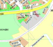
Opaskartta on yleistetty karttatuote, jonka ylläpitomittakaava on 1:25000. Aineisto käsittää koko kunnan alueen sisältäen peltoalueet, metsäalueet, vesialueet, asuinalueet, teollisuusalueet, yleiset alueet, tiestön, nimistön sekä hakuruuduston. Opaskarttaa ollaan luomassa uudelleen Trimble Locus sovellukseen Oracle tietokantaan. Työ on toistataiseksi kesken, ja kartta on ajankohdalta 2016. Tasokoordinaatistona on ETRS-GK24 (EPSG:3878)
-
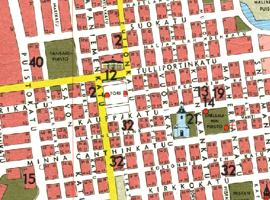
Aineisto sisältää opaskarttoja Kuopiosta eri vuosikymmeniltä. Vanhin kartta on vuodelta 1967. Aineistot jakautuvat taajama-aluetta kuvaavaksi sekä haja-asutusalueen osoitteita kuvaaviksi opaskarttatuotteiksi. Opaskartoilla näkyvät osoitetiedot eivät ole ajantasaisia vaan kuvaavat ajanhetken tilannetta.
-
Satakunnan maakunnallisesti arvokkaat maisema-alueet
-
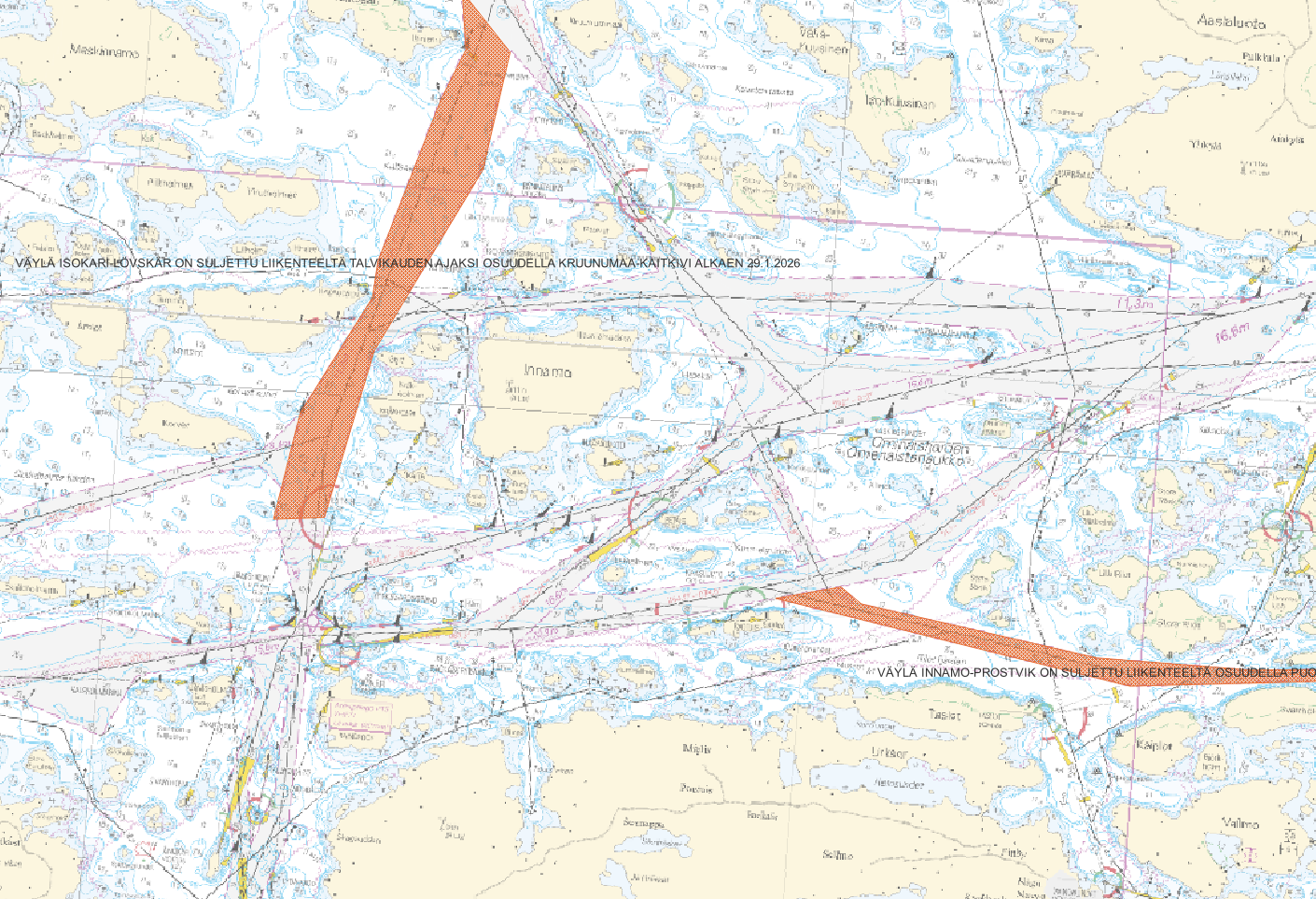
Sisältää seuraavat karttatasot: Voimassa olevat merivaroitukset, pistemäiset kohteet (tason tekninen nimi: navigational_warnings_p) Voimassa olevat merivaroitukset, viivamaiset kohteet (tason tekninen nimi: navigational_warnings_l) Voimassa olevat merivaroitukset, aluemaiset kohteet (tason tekninen nimi: navigational_warnings_a) Aineisto sisältää Traficomin julkaisemat, aineiston hakuhetkellä voimassa olevat merivaroitukset perustuen Traficomin julkaisemaan merivaroitusohjeeseen. Muodostaakseen kokonaisuuden voimassa olevista merivaroituksista, on kaikki kolme karttatasoa huomioitava. Huom! Verkkopalvelussa olevat tiedot saattavat päivittyä viivästyneesti. Merivaroitusten saatavuus tämän palvelun kautta ei vapauta alusten päälliköitä vaatimuksesta vastaanottaa merivaroituksia IMO:n/IHO:n hyväksymien lähetysjärjestelmien kautta.
-
Satakunnan maakuntakaavan 2050 laadintaa varten käynnistetyssä inventoinnissa tarkistettiin maakunnallisesti merkittävien rakennettujen kulttuuriympäristöjen tiedot ja aluerajaukset sekä täydennettiin kohdeluetteloa modernin rakennusperinnön osalta.
-
Digitaalisista ilmakuvista orto-oikaistu kuva-aineisto. Aineiston maastoresoluutio on 50 senttimetriä. Aineisto on saatavilla sekä väri- että vääräväriortokuvina Aineisto on tallennettu sekä ETRS-GK24 (EPSG: 3878) että TM35FIN (EPSG: 3067) tasokoordinaattijärjestelmissä. Aineisto on saatavilla WMS2-rajapinnalta, verkkolevyltä sekä Tampereen "Avoin data" sivuilta. Lisätietoja aineistoista saa osoitteesta tampereenpalvelupiste@tampere.fi