 Paikkatietohakemisto
1000000
Type of resources
Available actions
Topics
Keywords
Contact for the resource
Provided by
Years
Formats
Representation types
Update frequencies
status
Scale
-
The EMODnet (European Marine Observation and Data network) Geology project (http://www.emodnet-geology.eu/) collects and harmonizes marine geological data from the European sea areas to support decisionmaking and sustainable marine spatial planning. The partnership includes 39 marine organizations from 30 countries. The partners, mainly from the marine departments of the geological surveys of Europe (through the Association of European Geological Surveys- EuroGeoSurveys), have assembled marine geological information at a scale of 1:1 000 000 from all European sea areas (e.g. the White Sea, Baltic Sea, Barents Sea, the Iberian Coast, and the Mediterranean Sea within EU waters). This data includes the EMODnet seabed substrate map at a scale of 1:1 000 000 from the European marine areas. Traditionally, European countries have conducted their marine geological surveys according to their own national standards and classified substrates on the grounds of their national classification schemes. These national classifications are harmonized into a shared EMODnet schema using Folk's sediment triangle with a hierarchy of 16, 7 and 5 substrate classes. The data describes the seabed substrate from the uppermost 30 cm of the sediment column. In cases, the data has been generalized into a target scale (1:1 000 000). The smallest cartographic unit within the data is 4 km2. Further information about the EMODnetGeology project is available on the portal (http://www.emodnet-geology.eu/).
-
Seabed substrate 1:1 000 000 is one of the products produced in the EMODnet (European Marine Observation and Data network) Geology EU project. Project provided seabed geological material from the European maritime areas. The EMODnet Geology project (http://www.emodnet-geology.eu/) collects and harmonizes geological data from the European sea areas to support decision-making and sustainable marine spatial planning. The EMODnet Geology partnership has included 36 marine organizations from 30 countries. This data includes the EMODnet seabed substrate map at a scale of 1:1 000 000 from the Finnish marine areas. It is based on the data produced on a scale of 1:20 000 by the Geological Survey of Finland (GTK). The data has been harmonized and reclassified into five Folk substrate classes (clay + silt (mud), sandy clays, clayey sands, coarse sediments, mixed sediments) and bedrock. The data describes the seabed substrate from the uppermost 30 cm of the sediment column. The data have been generalized into a target scale (1:1 000 000). The smallest cartographic unit within the data is 4 km2. Further information about the EMODnet-Geology project is available on the portal (http://www.emodnet-geology.eu/).
-
National Land Survey's Topographic map in vector format is a dataset depicting the terrain of all of Finland. The most important elements are the road network, administrative borders, preservation areas, population centres, geographic names, waterways, land use and elevation. The largest scale level (1:100,000) of the Topographic map in vector format is produced by generalising from the Topographic database. Topographic map 1:250,000 is produced by generalising the dataset 1:100,000. Topographic map 1:1,000,000 is produced by generalising the dataset 1:250,000. Topographic map 1:4,500,000 is produced by generalising the dataset 1:1,000,000. The geographic names have been generalised from the geographic names in the Geographic Names Register to map names suited to the scale in question. The administrative borders in the Municipal Division of each scale are used as administrative borders. The product belongs to the open data of the National Land Survey of Finland.
-

Division into administrative areas (vector) is a dataset depicting the municipalities, regions, Economic development centres and the national border of Finland. The Division into administrative areas products in vector format contain the number codes of the municipalities, the names of the municipalities in both Finnish and Swedish as well as municipal boundaries and municipal geographical areas. In addition, the products include the corresponding information about the regions, the Economic development centres and the nation as well as a specification of the municipality's area into land and water area. The municipality's area is not included in the XML/GML and GeoPackage format. The dataset Municipal Division is produced in scales 1:10,000, 1:100,000, 1:250,000, 1:1,000,000 and 1:4,500,000. The data included in the dataset in scale 1:10,000 are taken from the Cadastre. Regarding other scales, municipal boundaries have been generalised to suit the scale in question. The product is a part of the open data of the National Land Survey.
-
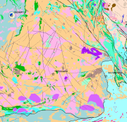
The Superficial deposits of Finland 1:1 000 000 is based on 'Quaternary Deposits of Finland and Northwestern Part of Russian Federation and their Resources (Sheet 1, Western part)' mapping data. This data is also based on the 1984 map 'Quaternary Deposits of Finland' (1:1 000 000) in the “Geologia” (Geology) folio of the Atlas of Finland, 5th edition (123-126, 1990). Joint scientific and technical planning for the map of the 'Quaternary Deposits of Finland and Northwestern Part of Russian Federation and their Resources' was begun in 1987 while work on the map started in 1988. No field mapping was done for the map, rather the 1:1 000 000 Quaternary map printed in 1984 was supplemented with new data partly obtained from rock aggregate studies and partly from information on superficial deposits gathered in other superficial mapping projects. The map 'Quaternary Deposits of Finland and Northwestern Part of Russian Federation and their Resources' was printed in 1993. The map shows the superficial deposits with colours and symbols and these are classed according to their mode of geological development. The deposit classes are as follows: pre-Quaternary bedrock exposures (no Quaternary layers); boulder field, physically weathered bedrock; gravelly and sandy till; silty till; clayey till; hummocky moraine ; moraine complex; esker, delta, sandur, sorted marginal formation; interlobate formation (esker); till-covered esker / other till-covered gravel and sand deposit; gravel and sand deposit peripheral to eskers; littoral gravel and sand deposit; fluvial deposit; homogeneous clay and silt deposit; layered (varved) clay and silt deposit; peat deposit. Additionally, drumlins, end moraines, aeolian deposits, and sites of gravel, sand, clay and peat extraction as well as gold panning areas have been indicated with symbols. The data set was converted to a digital format to meet the needs of the OneGeology-Europe Project for a printed map in 2009. This data did not include drumlins, end moraines, aeolian deposits, and more important sites for the exploitation of superficial deposits (sites of gravel, sand, clay and peat extraction as well as gold panning areas). In accordance with the 1984 Quaternary map (1:1 000 000) the minimum size of the deposit polygon is generally one square kilometre. In nature the size of superficial sedimentary deposits is usually smaller than one square kilometre and therefore the most common deposit type in the area is shown in the polygon. In places, deposits smaller than a square kilometre that are significant from a superficial perspective have been noted. As a rule, the narrowest point of the deposit polygon was 0.5 km and in important cases, for example on eskers, 0.3 km. As an exception, the size of small eskers has been exaggerated. Coordinate reference system of the Superficial deposits of Finland 1:1 000 000 was transformed in October 2013. The transformation from Finnish National Grid Coordinate System (Kartastokoordinaattijärjestelmä, KKJ) Uniform Coordinate Frame to ETRS-TM35FIN projection was done by using the three-dimensional transformation in accordance with the recommendations for the public administration JHS154. The water layer which were used in the OneGeology-Europe project was replaced in 2015 with the more accurate water layer of the Topographic database 1:55 0000-1:500 000 (DVE3) from ICT Agency HALTIK.
-

Municipality-based statistical units are municipalities, sub-regional units, regions, major regions, economic development centres, wellbeing services counties and electoral districts. Maintenance of working areas was discontinued on 31 December 2023 and Regional State Administrative Agencies (AVI) and Centres for Economic Development, Transport and the Environment (ELY) on 31 December 2025. Municipality-based statistical units correspond to the regional divisions used in the statistics of the statistical reference year concerned. Annual versions and the latest regionally divided data (excluding the year attribute in the name of the data) are published from the data. Data used without the year attribute are updated automatically. The general Terms of Use must be observed when using the data: https://stat.fi/en/about-us/get-to-know-statistics-finland/legislation/terms-of-use In addition to the national version, an INSPIRE information product is also available from the data.
-
The Topographic map is a dataset depicting the terrain of all of Finland. The key elements in it are the road network, buildings and constructions, geographic names, waterways, land use and elevation. The more precise levels of the Topographic map consist of the same map objects and map symbols depicted in the same way as in the familiar Basic map. Basic map raster is applicable to be used, for instance, as a base map for planning land use or for excursion and outdoor recreational purposes in mobile devices and in various Internet services associated with nature. When going over to the more general datasets in the Topographic map, the number and visualisation of objects and map symbols changes. The generalised small-scale Topographic maps raster are applicable to be used as approach maps in e.g. mobile devices and Internet services. The product belongs to the open data of the National Land Survey of Finland.
-

Division into administrative areas (raster) is a dataset depicting the municipal Division of Finland. The dataset Municipal Division is produced in scales 1:10,000, 1:100,000, 1:250,000, 1:1,000,000 and 1:4,500,000. The data included in the dataset in scale 1:10,000 are taken from the Cadastre. Regarding other scales, municipal boundaries have been generalised to suit the scale in question. Division into administrative areas products in raster format include municipal boundaries only. The product is a part of the open data of the National Land Survey.
-
Laittomat öljypäästöt havaittuna ilmakuvilta vuosina 1998-2006 Itämerellä. Aineisto on irroitettu Helcomin Baltic GIS -karttapalveluista. Helcomin vuosittaisista tiedoista on yhdistetty yksi kartta-aineisto.
-
Kallioperä 1:1 000 000 aineisto valmistui vuonna 1997 tarkoituksena koota viimeisin kallioperätieto yhteen ja tuottaa siitä painettava kartta. Kallioperä – Berggrund – Bedrock of Finland 1 : 1 000 000 kuvaa Suomen kallioperän kivilajit ikäryhmissä, tektonisina yksikköinä ja jaettuna seuraaviin pääalueisiin: Lapin Granuliittivyöhyke ja Inari kompleksi, Karjalainen Pääalue, Svekofennialainen Pääalue ja Kaledonialainen pääalue. Näitä nuoremmat kivet, Mesoproterotsooiset, Neoproterotsooiset ja Paleotsooiset, esitetään ikäryhmittäin. Kartta-aineisto sisältää myös alkalikivet, karbonatiitit ja kimberliitit, sekä meteoriitti-iskemät. Erillisinä tiedostoina ovat geologiset rakenteet, metamorfiset ominaisuudet sekä juonet. Kartta-aineisto koottiin ja muokattiin aiemmin valmistuneista kallioperäaineistoista yhtenäiseksi paikkatietoaineistoksi. Kartta-aineistoa tarkennettiin ja täydennettiin puuttuvilta osin lentogeofysiikan aineistojen avulla. Maastotarkastuksia tehtiin erityisesti pääaluerajoilla. Kallioperä – Berggrund – Bedrock of Finland 1 : 1 000 000 aineisto sisältää kivilajialueet, granuliittialueet ja pääalueet alueina, juonet, tektoniset rakenteet, litologiset suuntaukset, kimberliittiprovinssit ja pääalueiden rajat viivoina sekä meteoriitti-iskemät pisteinä.