 Paikkatietohakemisto
TIFF
Type of resources
Available actions
Topics
Keywords
Contact for the resource
Provided by
Years
Formats
Representation types
Update frequencies
status
Scale
Resolution
-
Potential cumulative impacts on benthic habitats is based on the same method than <a href="http://metadata.helcom.fi/geonetwork/srv/eng/catalog.search#/metadata/9477be37-94a9-4201-824a-f079bc27d097" target="_blank">Baltic Sea Impact Index</a>, but is focused on physical pressures and benthic habitats. The dataset was created based on separate analysis for potential cumulative impacts on only the benthic habitats, as these are particularly affected by physical pressures. In this case the evaluation was based on pressure layers representing <a href="http://metadata.helcom.fi/geonetwork/srv/eng/catalog.search#/metadata/ea0ef0fa-0517-40a9-866a-ce22b8948c88" target="_blank">physical loss</a> and <a href="http://metadata.helcom.fi/geonetwork/srv/eng/catalog.search#/metadata/05e325f3-bc30-44a0-8f0b-995464011c82" target="_blank">physical disturbance</a>, combined with information on the distribution of eight broad benthic habitat types and five habitat-forming species (<a href="http://metadata.helcom.fi/geonetwork/srv/eng/catalog.search#/metadata/363cb353-46da-43f4-9906-7324738fe2c3" target="_blank">Furcellaria lumbricalis</a>, <a href="http://metadata.helcom.fi/geonetwork/srv/eng/catalog.search#/metadata/f9cc7b2c-4080-4b19-8c38-cac87955cb91" target="_blank">Mytilus edulis</a>, <a href="http://metadata.helcom.fi/geonetwork/srv/eng/catalog.search#/metadata/264ed572-403c-43bd-9707-345de8b9503c" target="_blank"> Fucus sp.</a>, <a href="http://metadata.helcom.fi/geonetwork/srv/eng/catalog.search#/metadata/822ddece-d96a-4036-9ad8-c4b599776eca" target="_blank">Charophytes</a> and <a href="http://metadata.helcom.fi/geonetwork/srv/eng/catalog.search#/metadata/ca327bb1-d3cb-46c2-8316-f5f62f889090" target="_blank">Zostera marina</a>). The potential cumulative impacts has been estimated based on currently best available data, but spatial and temporal gaps may occur in underlying datasets. Please scroll down to "Lineage" and visit <a href="http://stateofthebalticsea.helcom.fi/cumulative-impacts/" target="_blank">State of the Baltic Sea website</a> for more info.
-
The Baltic Sea Impact Index is an assessment component that describes the potential cumulative burden on the environment in different parts of the Baltic Sea. The BSII is based on georeferenced datasets of human activities (36 datasets), pressures (18 datasets) and ecosystem components (36 datasets), and on sensitivity estimates of ecosystem components (so-called sensitivity scores) that combine the pressure and ecosystem component layers, created in <a href="http://www.helcom.fi/helcom-at-work/projects/holas-ii" target="_blank">HOLAS II</a> project. Cumulative impacts are calculated for each assessment unit (1 km2 grid cells) by summing all pressures occurring in the unit for each ecosystem component. Highest impacts are found from the cells where both are abundant, but high impacts can be caused also by a single pressure if there are diverse and sensitive habitats in the grid cell. All data sets and methodologies used in the index calculations are approved by all HELCOM Contracting Parties in review and acceptance processes. This data set covers the time period 2011-2016. Please scroll down to "Lineage" and visit <a href="http://stateofthebalticsea.helcom.fi/cumulative-impacts/" target="_blank">State of the Baltic Sea website</a> for more info.
-
The Baltic Sea Pressure Index is a calculation of quantity and spatial distribution of potential cumulative impacts on the Baltic Sea. The BSII is based on georeferenced datasets of human activities (36 datasets), pressures (18 datasets) and ecosystem components (36 datasets), and on sensitivity estimates of ecosystem components (so-called sensitivity scores) that combine the pressure and ecosystem component layers, created in <a href="http://www.helcom.fi/helcom-at-work/projects/holas-ii" target="_blank">HOLAS II</a> project. The assessment can be applied with a focus on pressures only by using the Baltic Sea Pressure Index (BSPI) which shows the anthropogenic pressures/human activities in the defined assessment units without including ecosystem components. The BSPI however includes a weighting component in order to grade the effect of the pressures on the ecosystem in a generalized perspective. Cumulative impacts are calculated for each assessment unit (1 km2 grid cells) by summing all impacts occurring in the unit. All datasets and methodologies used in the index calculations are approved by all HELCOM Contracting Parties in review and acceptance processes. This dataset covers the time period 2011-2016. Please scroll down to "Lineage" and visit <a href="http://stateofthebalticsea.helcom.fi/cumulative-impacts/" target="_blank">State of the Baltic Sea website</a> for more info.
-
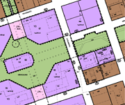
Iisalmen ajantasa-asemakaava on koostekartta hyväksytyistä ja lainvoiman saaneista asemakaavoista. Aineisto on tuotettu lainvoimaisten asemakaavojen pohjalta ja sitä ylläpidetään Oracle- tietokannassa Trimble Locus- järjestelmässä. Kuvaustekniikan mittakaava 1:1000. Päivitys ja ylläpito jatkuvaa.
-
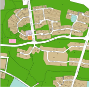
Taipalsaaren opaskartta on esitystavaltaan yleistetty opastava karttatuote. Kartan alue kattaa koko Taipalsaaren kunnan maa-alueen ja vesialueet. Kartta sisältää mm. seuraavat tiedot: nimistö, kadut, tiet, julkiset rakennukset, pientaloalueet, teollisuusalueet, metsä- ja pelto-alueet sekä kunnan rajat. Lisäksi kartassa on esitetty joitakin nähtävyyksiä. Aineistoa päivitetään jatkuvasti ja sitä ylläpidetään sähköisesti. Aineisto on saatavilla Taipalsaaren karttapalvelusta ja wms-rajapintapalvelusta.
-
Rasterimuotoinen kartta Hetan ympäristön ranta-alueiden osayleiskaavasta
-
Aineisto perustuu Maanmittauslaitoksen korkeusmalliin (pelastuskarttalehdet 19M, 19N, 20M ja 20N), joka on poimittu Paikkatietolainaamosta. Alkuperäinen malli on laskettu peruskartan korkeuskäyristä ja rantaviiva-elementeistä kolmioverkkointerpoloinnilla ruutumalliksi, jossa ruudun koko on 25 m x 25 m.
-
Enontekiön asemakaavayhdistelmä on koostekartta hyväksytyistä ja lainvoiman saaneista asemakaavoista. Aineisto on tuotettu lainvoimaisten asemakaavojen pohjalta ja sitä ylläpidetään rasterimuodossa. Päivitys ja ylläpito jatkuvaa.
-
Senaatin kartastoksi kutsutaan Venäjän armeijan 1800-luvun lopussa ja 1900-luvun alussa suorittamien kartoitusten tuloksena syntynyttä kartastoa. Satakunnan alueen karttalehdet asemoitiin vuonna 2016 osana Satakuntaliiton ”Satakunnan tiestö 100 vuotta sitten”-projektia. Aineisto jakautuu 1:21 000 mittakaavan ja 1:42 000 mittakaavan karttalehtiin. Varsinkin 1:42 000 mittakaavan lehtien osalta aineisto on sijainniltaan paikoitellen epätarkka. Alkuperäinen Senaatin karttojen aineisto on peräisin Kansallisarkiston kartta-arkistosta.
-
Hangon ajantasa-asemakaava on koostekartta hyväksytyistä ja lainvoiman saaneista asemakaavoista. Aineisto on tuotettu lainvoimaisten asemakaavojen pohjalta ja sitä ylläpidetään vektorimuodossa. Päivitys ja ylläpito jatkuvaa.