 Paikkatietohakemisto
20000
Type of resources
Available actions
Topics
Keywords
Contact for the resource
Provided by
Years
Formats
Representation types
Update frequencies
status
Scale
Resolution
-
KUVAUS Herkät vesistöt, joiden rajaus on luotu Viherkertoimen käyttöä varten. Viherkerroinmenetelmä on ekologinen suunnittelutyökalu tonttien viherpinta-alan arviointiin, minkä avulla etsitään vaihtoehtoisia ratkaisutapoja kaupunkivihreän lisäämiseen sekä hulevesien hallintaan. Määritellyillä alueilla huleveden laadulliseen hallintaan on kiinnitettävä erityistä huomiota. Aineisto perustuu hulevesiohjelmassa määritettyihin osavaluma-alueisiin, joiden avulla aineisto on rajattu. Aineisto on päivitetty 12/2023 vastaamaan uuden hulevesiohjelman valuma-alueita. Hulevesiohjelmaan liittyvän aineiston lisäksi rajausta on arvioitu asiantuntijoiden toimesta. KATTAVUUS Koko kaupunki PÄIVITYS Aineisto on laadittu viherkertoimen käyttöön ja päivittyy tiedon tarkentuessa. YLLÄPITOSOVELLUS Aineisto on tallennettu PostgreSQL-tietokantaan ja ylläpidetään QGIS-ympäristössä. KOORDINAATISTOJÄRJESTELMÄ Aineisto tallennetaan ETRS-GK24 (EPSG:3878) tasokoordinaattijärjestelmässä. GEOMETRIA Aluemainen SAATAVUUS Aineisto on saatavilla WFS- ja WMS2-rajapinnoilta. JULKISUUS, TIETOSUOJA. Avoin aineisto. VASTUUTAHO Ympäristönsuojeluyksikkö (ymparistonsuojelu@tampere.fi) KENTÄT vesisto: vesistöalueen nimi
-
The Bio-geographical provinces are internally homogeneous biogeographical regions of Finland. The number of regions is 21. The regions were spatially defined by an expert committee in 1930 as collections of municipalities. Consequently, the province boundaries follow the delineation of of municipalities in the 1930's including some enclaves, exclaves, and narrow stripes as the province boundaries have not been changed or updated since then excluding the cession of territory after the Second World War. All regions have names and abbreviations in Finnish, Swedish, and Latin. No other attribute data is available.
-
The EMODnet (European Marine Observation and Data network) Geology project collects and harmonizes marine geological data from the European sea areas to support decision making and sustainable marine spatial planning. The partnership includes 39 marine organizations from 30 countries. The partners, mainly from the marine departments of the geological surveys of Europe (through the Association of European Geological Surveys-EuroGeoSurveys), have assembled marine geological information at various scales from all European sea areas (e.g. the White Sea, Baltic Sea, Barents Sea, the Iberian Coast, and the Mediterranean Sea within EU waters). This multiscale dataset includes EMODnet seabed substrate maps at a scale of 1:1 500, 1:5 000, 1:10 000, 1:15 000, 1:20 000, 1:25 000, 1:30 000, 1:45 000, 1: 50 000, 1:60 000, 1:70 000 from the European marine areas. Traditionally, European countries have conducted their marine geological surveys according to their own national standards and classified substrates on the grounds of their national classification schemes. These national classifications are harmonised into a shared EMODnet schema using Folk's sediment triangle with a hierarchy of 16, 7 and 5 substrate classes. The data describes the seabed substrate from the uppermost 30 cm of the sediment column. Further information about the EMODnet Geology project is available on the portal (http://www.emodnet-geology.eu/).
-
The themes of the Topographic database and Topographic map raster series (scale 1:10,000) have been compiled into seven theme entities, theme rasters, required by the Inspire directive: hydrography, elevation, traffic network, land use, land cover, place names and buildings. In addition to the above, the theme rasters also include the municipal division, road names and map sheet division as separate themes. The theme rasters have not been implemented according to the imaging technology defined in the Inspire directive. They will be produced later. The product belongs to the open data of the National Land Survey of Finland.
-
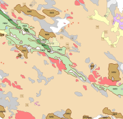
The Superficial deposits 1:20 000 / 1:50 000 data include material produced during the period 1972-2007 for land use planning, for the mapping and inventory of the natural resources as well as for environmental management and for scientific research. The main mapping scale has been 1:10 000. The data contains a sediment as a basal deposit at a depth of one metre. The minimum size of the basal deposit polygon is two hectares, with islands, mire and field enclosures, as well as geologically significant sites as an exception. The 0.4-0.9 m thick layers are described as overlying the basal deposit and, in geologically or economically significant cases, such layers could be even thicker. The minimum polygon size of the overlying deposit is usually four hectares. Thin covering layers under 0.4 m in thickness, which are difficult to delimit but effect an area of at least four hectares, are displayed as point data. Besides the deposits Quaternary geological formations formed in different ways, such as eskers and hummocky moraines, are described in the data. Other mapping sites such as small rock exposures, dunes and raised beaches are shown as point or line data. Coordinate reference system of the Superficial deposits 1:20 000 / 1:50 000 was transformed in March 2013. The transformation from Finnish National Grid Coordinate System (Kartastokoordinaattijärjestelmä, KKJ) Uniform Coordinate Frame to ETRS-TM35FIN projection was done by using the three-dimensional transformation in accordance with the recommendations for the public administration JHS154.
-

The Background map is a dataset product series in raster format that depicts the whole of Finland and that is meant for web use as a background material for thematic data. Its key objects are road names, roads and railways, buildings and constructions, administrative borders, geographical names, waterways, land use and addresses of buildings (from Ryhti/Finnish Environment Institute). The product belongs to the open data of the National Land Survey of Finland.
-
The EMODnet (European Marine Observation and Data network) Geology project collects and harmonizes marine geological data from the European sea areas to support decision making and sustainable marine spatial planning. The partnership includes 39 marine organizations from 30 countries. The partners, mainly from the marine departments of the geological surveys of Europe (through the Association of European Geological Surveys-EuroGeoSurveys), have assembled marine geological information at various scales from all European sea areas (e.g. the White Sea, Baltic Sea, Barents Sea, the Iberian Coast, and the Mediterranean Sea within EU waters). This dataset includes EMODnet seabed substrate maps at a scale of 1:20 000 from the European marine areas. Traditionally, European countries have conducted their marine geological surveys according to their own national standards and classified substrates on the grounds of their national classification schemes. These national classifications are harmonised into a shared EMODnet schema using Folk's sediment triangle with a hierarchy of 16, 7 and 5 substrate classes. The data describes the seabed substrate from the uppermost 30 cm of the sediment column. Further information about the EMODnet Geology project is available on the portal (http://www.emodnet-geology.eu/).
-
Med kommunalt avfall avses avfall från permanentboende, fritidsboende, sovsalar och andra bostäder samt avfall från administrativa, servicemässiga och ekonomiska verksamheter av jämförbar kvalitet med det. Utöver hushållen genereras kommunalt avfall till exempel inom social- och hälsovård och utbildningsverksamhet. Biologiskt nedbrytbart avfall från föreningar omfattar till exempel köks- och trädgårdsavfall, pappers- och kartongavfall, träavfall och septiktankslam. Mer än hälften av det blandade kommunala avfallet är biologiskt nedbrytbart avfall. För Biomassa-atlas har biologiskt nedbrytbart kommunalt avfall mängden beräknats med hjälp av Statistikcentralens nationella kommunala avfallsstatistik. Uppgifterna visar separat mängderna för separat insamlat kommunalt avfall och annat biologiskt nedbrytbart kommunalt avfall. Separat insamlat kommunalt bioavfall inkluderar biologiskt nedbrytbart köks- och matsalsavfall samt trädgårds- och parkavfall. Deras mängd var cirka 66 kg 2015, cirka 71 kg 2016-2017, cirka 77 kg 2018 och cirka 89 kg per invånare 2020. Mängden övrigt biologiskt nedbrytbart kommunalt avfall var 262 kg (2015) och 266 kg (2016), 263 kg (2017), 288 kg (2018) respektive 320 kg (2020) per invånare. Mängder biologiskt nedbrytbart kommunalt avfall har beräknats för 1 km x 1 km kvadrater baserat på befolkningen i området och de ovannämnda genereringstakten för biologiskt nedbrytbart kommunalt avfall.
-
EU stadgade i sitt direktiv 97/62/EG (habitatdirektivet) 1997, att varje medlemsland måste skydda vissa hotade arter och biotoper. Natura 2000, bildar ett nätverk av skyddsområden för dessa arter och biotoper. Åland gjorde ett eget förslag till områden som skulle ingå i det åländska Natura 2000 programmet, och kommissionen godkände förslaget med sitt beslut 2005. Åland är nu skyldigt att skydda dessa områden så att särskilt de arter och biotoper, som nämns i habitatdirektivet, bevaras inom områdena. De flesta områden har skyddats som naturreservat, några enbart med ett avtal med markägaren. För alla områden gäller dock bestämmelserna i bland annat naturvårdslagens 24 a § och 24 b §. I dessa paragrafer konstateras, att för alla sådana planer och projekt som kan negativt påverka Natura 2000 områden ska göras en bedömning av konsekvenserna. Man avser även sådana åtgärder som sker utanför själva Natura 2000 området, men kan påverka det. Om bedömningen visar att projektet kan påverka naturvärden negativt får myndigheter inte bevilja tillstånd för verksamheten. Detta gäller alla myndigheter. Områdenas gränser har levererats till EU och det är papperskartorna som har lagkraft och är bindande, det digitala materialet har det inte. Gränserna i lagret har inte uppdaterats för att motsvara nyare grundkartor och de har inte heller uppdaterats för att överensstämma mot fastighetsgränser. Skala 1:20 000
-