2018
Type of resources
Available actions
Topics
Provided by
Years
Formats
Representation types
Update frequencies
status
Service types
Scale
Resolution
-
Aineisto koostuu keskusta-alue ja kaupan alue rajauksista. Rajaukset perustuvat 250 m x 250 m tilastoruutuihin. Molemmat aluerajaukset ovat valtakunnallisesti yhdenmukaisia. Keskusta-alueet ovat alueita, joissa sijaitsee ympäröivää aluetta selkeästi tiiviimmin palveluiden työpaikkoja, vähittäiskaupan työpaikkoja sekä väestöä.Lisäksi keskusta-alueen tulee olla palveluiltaan monipuolinen, eli siellä tulee sijaita useita erityyppisiä julkisia ja yksityisiä palveluja. Keskusta-alueet myös luokitellaan sijainnin ja koon perusteella, jolloin voidaan erottaa ydinkeskustat alakeskuksista. Kaupan alueet on rajattu keskusta-alueiden ulkopuolelta. Kaupan alue on määritetty lähellä toisiaan sijaitsevien kauppojen muodostamaksi toiminnalliseksi alueeksi, jossa kauppojen asiakkailla voi olla mahdollisuus käyttää samaa pysäköintialuetta tai joukkoliikenneyhteyttä ja liikkua kaupasta toiseen jalkaisin. Alueet on luokiteltu sen mukaan, mikä on alueen koko ja sijainti suhteessa keskusta-alueisiin. Aineisto kuuluu SYKEn avoimiin aineistoihin (CC BY 4.0). Keskusta-alueista on saatavilla vuosien 2010 ja 2015 versiot. 2015 alkaen aineisto on saatavilla kahden vuoden välein. Tietyn vuoden aineiston valmistuu aina noin kahden vuoden viiveellä. Kaupan alueet ovat saatavilla vuosille 2012 ja 2017 ja 2017 alkaen aineisto on saatavilla kahden vuoden välein. Käyttötarkoitus: Maankäytön suunnittelun tueksi. Lisätietoja: https://geoportal.ymparisto.fi/meta/julkinen/dokumentit/KeskustaKaupanAlueet.pdf https://helda.helsinki.fi/handle/10138/44971
-
Field biomass sidestreams GIS data describes the maximum harvestable sidestream potential based on current tillage. Sidestreams has been calculated by crop statistics, cultivation area, solid content and harvest index. Harvest index describes the part of the plant that is utilized as a crop. Rest of the plant is considered sidestream. In many cases the maximum sidestream cannot be necessarily utilized as whole, because of technical and economical constraints for harvest. Part of the sidestream is also wise to plough in to field to maintain its fertility. Field crop data is conducted from Luke's crop production statistics. The crop statistics in ELY centre level is divided into the Biomass Atlas grid weighting by the crop area of that certain plant. Crop area is from IACS-register, used to manage subsidies in agriculture. Farmers report their cultivation plans there every spring. Crop area and amount are from same year, usually previous year.
-
Biomassa-atlaksen yritystoiminnan jätetiedot kuvaavat ympäristölupavelvollisten yritysten vuosittain tuottamien biohajoavien jätteiden määriä 1 km ruutuaineistona. Aineisto perustuu ympäristöhallinnon YLVA-tietojärjestelmään (ent. VAHTI)) kirjattuihin asiakaskohtaisiin jätetietoihin, joita on jatkokäsitelty Suomen ympäristökeskuksessa. Tiedot koskevat vuotta 2018. Jätemäärät (t/v) on ilmoitettu kansallisen jäteluokituksen mukaisiin kuusinumeroisiin EWC/LoW- jäteluokkiin. Luokitus perustuu valtioneuvoston asetukseen jätteistä (179/2012, liite 4). EWC/LoW-jäteluokkakoodi (EWC=European waste catalogue, LoW = List of Wastes) on muotoa xx.yy.zz, jossa neljä ensimmäistä numeroa kuvaavat jätteen alkuperätoimintaa ja sen alatoimialoja ja kaksi viimeistä numeroa jätteen laatua. Kansallisessa jäteluokituksessa on toimialaluokkia kaikkiaan 20. YLVAssa on lisäksi lietteille käytössä kirjaintarkenne A-G, joka ilmaisee lietteen käsittelytavan. YLVA-tietojärjestelmässä asiakaskohtaiset jätetiedot kirjataan kolmeen eri jätevirtaan: lähtevä ja tuleva jätevirta sekä varastotilanne. Biomassa-atlaksen yritystoiminnan jätemäärätiedot perustuvat YLVA-asiakkaiden lähtevään jätevirtaan kirjattuihin, biohajoavia jätejakeita koskeviin määrätietoihin (t/v), pois lukien jätteenkäsittelylaitoksilta lähtenyt jätevirta. YLVA-tietojärjestelmä ei mahdollista jätemäärien aukotonta tasetarkastelua, sillä se on pääasiallisesti kehitetty viranomaisten valvontatehtävää, ei tilastointia varten. Kaikkia jätteiden (esi)käsittelyketjuja koskevia määrätietoja ei tule kirjatuksi YLVAan. Koska jätteenkäsittelylaitoksetkin ovat yritystoimintaa, Biomassa-atlaksen tietojenkäsittelyprosessissa on poistettu yritysten jätemääristä jätteenkäsittelylaitoksilta lähtenyt jätevirta, jotta vältyttäisiin päällekkäiseltä yritysten jätemäärätiedolta. Aineistossa on näin ollen mukana yrityksiltä jätteenkäsittelyyn (esikäsittelyyn, hyödyntämiseen ja loppukäsittelyyn) lähteneet jätemäärät, mutta ei jätteenkäsittelylaitoksilta hyödyntämiseen/loppukäsittelyyn lähteneet jätemäärät. Käytännössä osa yritystoiminnan jätteistä kulkee jätteenkäsittelylaitosten, kuten kuljetus-, keräys- ja lajittelutoimintaa harjoittavien yritysten tai muiden esikäsittelylaitosten kautta varsinaiseen hyödyntämiseen. Osa yritysten jätteistä on YLVAssa kirjattu toimitetuksi suoraan varsinaisiin jätteen käsittely-/hyödyntämispaikkoihin ilman esikäsittelytoimintoja koskevia jätemääräkirjauksia. Myös nämä yritysten jätemäärät ovat aineistossa mukana. Biomassa-atlaksessa yritystoiminnan jätetiedot on YLVAn EWC-jäteluokkakoodien perusteella jaoteltu viiteen pääluokkaan: 1) eläin- ja kasvijäte, 2) liete, 3) paperi- ja pahvijäte, 4) puujäte ja 5) sekajäte. Pääluokkien lisäksi määrätiedot jakautuvat vielä tarkemmin 62 alaluokkaan. Jäteluokitus on esitetty Biomassa-atlaksen verkkosivulla. Tiedot päivitetään Biomassa-atlakseen kerran vuodessa. Viimeisin päivitys koskee vuotta 2020. Jätemäärätiedoista ei käy ilmi yksittäisen jätteentuottajan nimeä. Yritysten biohajoavien jätteiden ja laskennallisesti tuotettujen yhdyskuntien biohajoavien jätteiden määrätietoja ei pidä tarkastella kartalla samanaikaisesti, koska osa tiedoista on päällekkäistä. Laskennallisiin biohajoaviin yhdyskuntajätteisiin sisältyy myös yritysten yhdyskuntajätteen kaltainen biohajoava jäte, jota esimerkiksi on toimistoista peräisin oleva paperi- ja pahvijäte ja henkilöstöruokaloista peräisin oleva biojäte.
-
KUVAUS: Kemikaalionnettomuusvaaran aiheuttavat laitokset. Kartassa on esitetty vyöhyke, jossa maankäytön muutoksiin tarvitaan TUKES:n konsultaatio. Direktiivin 2012/18/EU mukaiset laitokset Suomessa. TUKESin julkaisemassa liitteessä luetellaan ne vaarallisia kemikaaleja käsittelevät laitokset (tehdas tai varasto), joihin sovelletaan ympäristöministeriön kirjeessä dnro YM4/501/2015 kuvattuja lausuntomenettelyitä kaavoitukseen ja rakentamisen lupiin liittyen. Konsultointivyöhykkeellä tapahtuvista kaavamuutoksista tai merkittävämmästä rakentamisesta on pyydettävä lausunto. Kaavoittajan täytyy pyytää lausunto Tukesilta ja pelastusviranomaiselta. Kaavan valmisteluvaiheessa järjestetään myös viranomaisneuvotteluja. Konsultoinnin tarkoitus on, ettei suuronnettomuusvaarallisen kohteen läheisyyteen kaavoiteta sinne soveltumatonta toimintaa, esimerkiksi sairaaloita, kouluja, hoitolaitoksia tai muita vaikeasti evakuoitavia kohteita. Tukes päättää konsultointivyöhykkeen laajuuden kunkin laitoksen suuronnettomuusvaarojen perusteella. Laajuus voi olla 500 m – 2 km. Taulukossa mainittu etäisyys (laitosta ympäröivän konsultointivyöhykkeen laajuus) mitataan tehdasalueen tai tontin rajalta. KATTAVUUS; PÄIVITYS; LUOTETTAVUUS: Koko kaupunki. Lähtöaineisto (=laitoslista) on TUKESin julkaisema, kohteet on laitettu kartalle suunnittelutyön helpottamiseksi. Aineisto päivitetään TUKESin netistä löytyvän laitoslistan mukaan. Aineisto päivitetään, kun laitoslistassa havaitaan muutos, noin kerran vuodessa. Kentät ID: Kemikaalilaitoksen yksilöllinen tunnus LAITOS: Kemikaalilaitoksen yrityksen nimi ja mahdollinen tarkenne OSOITE: Kemikaalilaitoksen postiosoite POSTINRO: Kemikaalilaitoksen sijainnin postinumero KUNTA: Kemikaalilaitoksen sijaintikunta TOIMINTA: Toiminnan laajuus. Seveso III -direktiivin mukaiset laitokset ovat laitoksia, joiden toiminnan laajuus on turvallisuusselvityslaitos tai toimintaperiaateasiakirjalaitos. Muita mahdollisia kentän arvoja ovat lupalaitos ja nestekaasulaitos. VYOHYKE_KM: Konsultointivyöhykkeen leveys, kilometriä SEVESO: Mikäli laitos on Seveso-laitos, tiedoissa lukee Seveso-laitos. Muiden kemikaalilaitosten kohdalla lukee Ei VIIMEKSI_MUOKATTU_PVM: Kohteen viimeisin päivitysajankohta Tampereen kaupungin tietokannassa Tarkista ajankohtaisin tilanne TUKES:lta: Kartan käyttäjän vastuulla on tarkistaa TUKES:lta kemikaalilaitosten konsultointivyöhykkeiden ajankohtainen tilanne, joten tässä kentässä on linkki TUKES:in sivuille. TUKES_KEMIKAALILAITOS_KONSULTOINTIVYOHYKKEET_DOKUMENTTI_PVM: Tampereen tietokantaan päivitykset on tehty TUKES:n laitostilistausdokumentin mukaan, joka on päivätty tämän kentän päivämäärällä.
-
Iisalmen kaupungin WMS- palvelu on WMS-rajapintapalvelu, jonka kautta on saatavilla seuraavat karttatasot: kantakartta, ajantasa-asemakaava, osayleiskaavojen rajaukset, rakennuskieltoalueet, kiinteistorekisterikartta ja rakennukset . Palvelu perustuu vastaaviin paikkatietoaineistohin. Aineistoja hallinnoi Iisalmen kaupunki. Palvelun käyttö on pääosin maksutonta, mutta osa aineistoista vaatii maksullisen käyttäjätunnuksen ja salasanan .
-

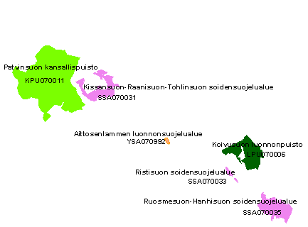
Luonnonsuojelu- ja erämaa-alueet -aineisto sisältää valtion alueille luonnonsuojelulain nojalla lailla tai asetuksella perustetut luonnonsuojelualueet ja erämaalailla perustetut erämaa-alueet. Lisäksi aineisto sisältää yksityisalueille luonnonsuojelulain nojalla elinkeino-, liikenne- ja ympäristökeskusten (aiemmin lääninhallitusten) perustamat yksityiset luonnonsuojelualueet (YSA), määräaikaiset rauhoitusalueet (MRA), suojellut luontotyypit (LTA) ja erityisesti suojeltavien lajien esiintymispaikat (ERA). 1.9.2014 alkaen aineisto on tuotettu kokonaisuudessaan Metsähallituksen SATJ-järjestelmässä. Muutokset päivittyvät aineistoon joka yö, myös latauspaketteihin ja rajapintapalveluihin. Luonnonsuojelualueaineistosta on olemassa myös erillinen INSPIRE-tietotuote, joka päivitetään kahdesti vuodessa. Aineisto kuuluu SYKEn avoimiin aineistoihin (CC BY 4.0). Aineistosta on julkaistu INSPIRE-tietotuote. Käyttötarkoitus: Luonnonsuojelualueiden tiedon hallintaan. Lisätietoja: https://geoportal.ymparisto.fi/meta/julkinen/dokumentit/Luonnonsuojelujaeramaaalueet.pdf The nature protected areas and wilderness reserves dataset includes nationally designated protected areas established on state owned land in accordance with the Nature Conservation Act or Nature Conservation decree, and areas established on private lands with a decision from the local Centres for Economic Development, Transport and the Environment (ELY-Centres). The dataset includes also extensive wilderness areas which are maintained in natural state and are at least partially naturally managed. The data on reserves on State-owned lands is produced by Metsähallitus. Protected sites established on private lands are digitized in ELY-Centres (by the responsibility area for Environment and natural resources). This Syke’s dataset can be used according to open data license (CC BY 4.0). INSPIRE compatible dataset has been published.
-

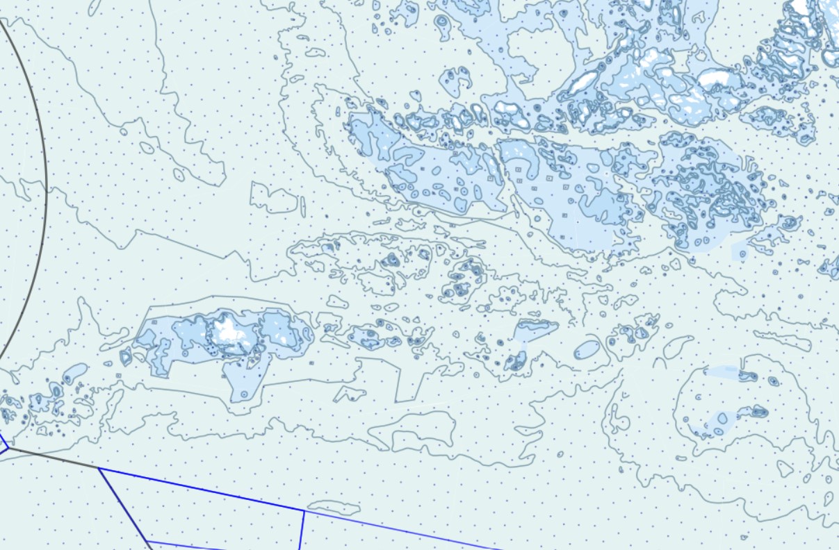
Liikenne- ja viestintävirasto Traficomin rajoitettu WFS on WFS-rajapintapalvelu, jonka kautta on saatavilla seuraavat karttatasot: Suluissa tason tekninen nimi Syvyysalueet (DepthArea_A) Syvyyskäyrät (DepthContour_L) Syvyyspisteet (Sounding_P) Mittaamaton alue (UnsurveyedArea_A) Ruoppausalue (DredgedArea_A) DW-reitti (DeepWaterRoutePart_A) Liikennejakovyöhyke (viiva) (TrafficSeaparationLine_L) Varoalue (PrecautionaryArea_A) Reittijakojärjestelmän liikennekaistan osa (TrafficSeparationSchemeLanePart_A) Liikennejakovyöhyke (alue) (TrafficSeparationZone_A) Kaksisuuntaisen reitin osa (TwoWayRoutePart_A) Reittijakojärjestelmän reunaviiva (TrafficSeparationSchemeBoundary_L)
-
Porin kaupungin WMS-palvelu on WMS-rajapintapalvelu, jonka kautta on saatavilla seuraavat karttatasot opaskartta, ajantasa-asemakaava ja ilmakuva. Aineistoja hallinnoi Porin kaupunki. Palvelun käyttö on maksutonta eikä autentikointia eli tunnistautumista käyttäjätunnuksen ja salasanan avulla.
-
Tampereen kantakaupungin ilmakuva vuodelta 2018. Aineisto on värillisistä digitaalisista ilmakuvista orto-oikaistu kuva-aineisto. Kuvaus kattaa Tampereen kantakaupungin alueen, sekä osittain ympäryskuntia Pirkkalaa ja Nokiaa. Ilmakuva on rasterikartta. Maastoresoluutio on 10.0 senttimetriä. Aineisto saatu Blom-karttapalvelujärjestelmästä (Copyright © 2018 BLOM) ja tallennettu kaupungin Geoserverille. Aineisto on saatavilla sekä ETRS-GK24 (EPSG:3878), että TM35FIN (EPSG:3067) tasokoordinaattijärjestelmissä. ETRS-GK24 on kuvauksen alkuperäinen koordinaatisto. Aineisto on julkisesti katseltavissa Tampereen karttapalvelussa (https://kartat.tampere.fi/oskari/ ) ja on käytettävissä WMS, sekä WMTS-rajapintapalveluista. AINEISTOSTA VASTAAVA TAHO: Tampereen kaupunki, Paikkatietoyksikkö
-

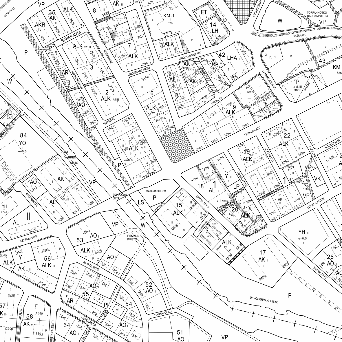
Jämsän kaupungin ylläpitämä ajantasa-asemakaava on koostekartta hyväksytyistä ja lainvoiman saaneista asemakaavoista. Aineisto on tuotettu lainvoimaisten asemakaavojen pohjalta ja sitä ylläpidetään vektorimuodossa. Päivitys ja ylläpito jatkuvaa. Aineisto on käytettävissä WMS-palvelun kautta.
 Paikkatietohakemisto