 Paikkatietohakemisto
1000
Type of resources
Available actions
Topics
Keywords
Contact for the resource
Provided by
Years
Formats
Representation types
Update frequencies
status
Scale
Resolution
-

Grid net for statistics 1 km x 1 km covers whole of Finland. The grid net includes all grid cells in Finland. The location reference of a grid cell is the coordinates of the bottom left corner of each grid cell. An identifier in accordance with national conventions (consecutive numbering) has also been produced for each grid cell. The Grid net for statistics 1 km x 1 km is the area division used in the production of statistics by 1 km x 1 km grid cells. For utilizing grid data auxiliary table of regional classifications are available: https://stat.fi/en/services/statistical-data-services/geographic-data/statistical-areas/grid-net-for-statistics-1-km The general Terms of Use must be observed when using the data: https://stat.fi/en/about-us/get-to-know-statistics-finland/legislation/terms-of-use In addition to the national version, an INSPIRE information product is also available from the data.
-
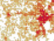
Number of population by 1 km x 1 km grids. The number of population on the last day of the reference year (31 December) by age group. Data includes only inhabited grids. The statistical variables of the data are: Total population (vaesto), number of men (miehet) and women (naiset), under 15 year olds (ika_0_14), 15-64 year olds (ika_15_64), and aged over 65 (ika_65_). Only the number of population is reported for grids of under 10 inhabitants. A grid identifier is expressed using a national identification code derived from the coordinates (idD_nro (num)) and INSPIRE's standard identification code (grd_id (char)). The data also contains the coordinates of the lower left-hand corner of a grid (xkoord, ykoord (num)). The data describes the population distribution independent of administrative areas (such as municipal borders). The data is suitable for examination of population distribution and making various spatial analysis. Data is available as polygons and as centroids of grid cells. The general Terms of Use must be observed when using the data: https://stat.fi/en/about-us/get-to-know-statistics-finland/legislation/terms-of-use. In addition to the national version, an INSPIRE information product is also available from the data.
-

Road traffic accidents involving personal injury known to the police in Finland and reported to Statistics Finland, which have co-ordinate data. The data cover the following information: vvonn = year of the accident kkonn = month of the accident kello = time of the accident vakav = seriousness of the accident: 1 = accident resulting in death, 2 = accident resulting in injury, 3 = accident resulting in serious injury onntyyppi = type of accident: 0 = same direction of travel (going straight), 1 = same direction of travel (turning), 2 = opposite direction of travel (going straight), 3 = opposite direction of travel (turning), 4 = intersecting direction of travel (going straight), 5 = intersecting direction of travel (turning), 6 = pedestrian accident (on pedestrian crossing), 7 = pedestrian accident (elsewhere), 8 = running off the road, 9 = other accident lkmhapa = number of passenger cars and vans in the accident lkmlaka = number of buses and lorries in the accident lkmjk = number of pedestrians in the accident lkmpp = number of bicycles and light electric vehicles in the accident lkmmo = number of mopeds in the accident lkmmp = number of motor cycles in the accident lkmmuukulk = number of other vehicles in the accident x = x co-ordinate of the accident y = y co-ordinate of the accident The general Terms of Use must be observed when using the data: https://stat.fi/en/about-us/get-to-know-statistics-finland/legislation/terms-of-use.
-
Number of population by 5 km x 5 km grids. The number of population on the last day of the reference year (31 December) by age group. Data includes only inhabited grids. The statistical variables of the data are: Total population (vaesto), number of men (miehet) and women (naiset), under 15 year olds (ika_0_14), 15–64 year olds (ika_15_64), and aged over 65 (ika_65_). Only the number of population is reported for grids of under 10 inhabitants. A grid identifier is expressed using a national identification code derived from the coordinates (idD_nro (num)) and INSPIRE's standard identification code (grd_id (char)). The data also contains the coordinates of the lower left-hand corner of a grid (xkoord, ykoord (num)). The data describes the population distribution independent of administrative areas (such as municipal borders). The data is suitable for examination of population distribution and making various spatial analysis. The general Terms of Use must be observed when using the data: https://stat.fi/en/about-us/get-to-know-statistics-finland/legislation/terms-of-use. In addition to the national version, an INSPIRE information product is also available from the data.
-

The map sheet division is a system created for printing maps, which covers map sheet codes, map scales and map sheet sizes. Today, map sheet division is also used for other purposes. It is also possible to download other NLS datasets in addition to maps in accordance with map sheet division. The map sheet division TM35, which is based on the projected coordinate reference system ETRS-TM35FIN is in use today. Before 2007, a map sheet division that was based on the KKS coordinate reference system was used. The TM35 map sheet division consists of 7 different grid sizes, the smallest scale is 1:200,000 and the largest is 1:5000. An explanation of how the grids are further split into more detailed grids and the principles of map sheet numbering is on the National Land Survey website (in Finnish) https://www.maanmittauslaitos.fi/kartat-ja-paikkatieto/kartat/osta-kartta/nain-loydat-oikean-karttalehden. The attribute data of the grids include map sheet number, the area of a square on the grid, perimeter and the coordinates of the centre of the square. The map sheet division is available as a file in vector format and through our contract-based WMTS service in raster format. In addition, you can view it in the geoportal Paikkatietoikkuna. The product is a part of the open data of the National Land Survey.
-
Materialet är sammanställt av Pargas stads gällande planer. Tilläggsinformation från Pargas stads mätningsbyrå. Uppdateras en gång i månaden.
-
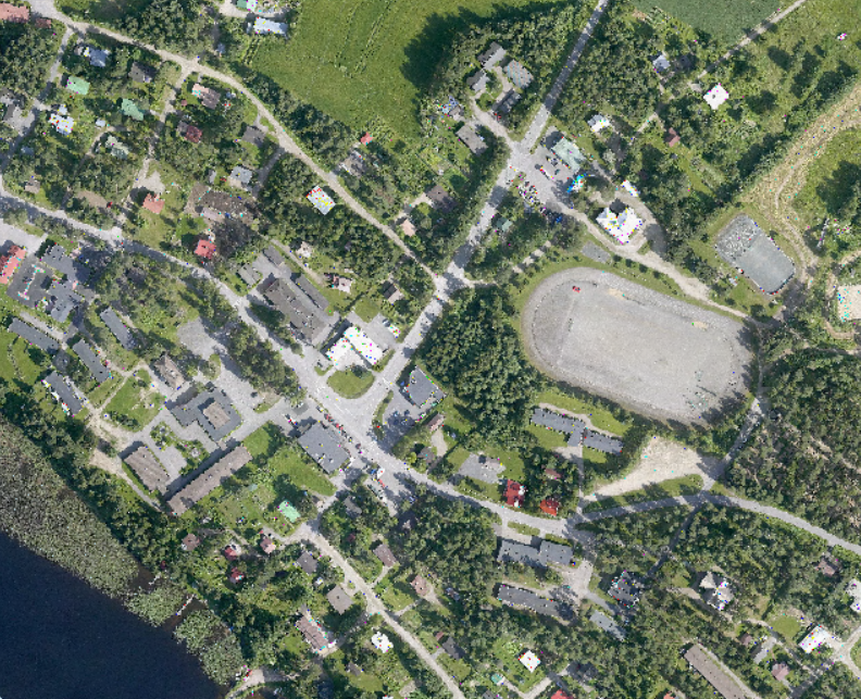
Ortokuva on lentokoneesta kohtisuoraan alaspäin otettu ilmakuva, josta on poistettu kameran kuvaprojektion ja maaston korkeusvaihteluiden aiheuttamat vääristymät. Ortokuvien yleinen maastopikselikoko eli maastoerottelukoko on 10 cm. Vanhimpien ilmakuvien maastoerottelokoko on välillä 10 cm ja 50 cm. Kuopion kaupungin tekemät ilmakuvaukset kattavat asemakaava-alueet. Vuoden 2004 ilmakuvaus on heinä-elokuussa 2004. Ortoilmakuvien maasterottelukyky on 10 cm. Ortokuva kattaa Vehmersalmen taajama-alueen. Aineisto saatavissa ETRS-GK27 koordinaatistossa.
-
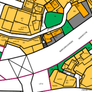
Espoon maankäyttökartta on koostekartta hyväksyttyjen ja lainvoiman saaneiden asemakaavojen mukaisista alueellisista maankäyttötarkoituksista. Aineisto on tuotettu lainvoimaisten asemakaavojen pohjalta ja sitä ylläpidetään vektorimuodossa. Päivitys ja ylläpito jatkuvaa.
-

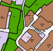
Kauhavan kaupungin ylläpitämä sijaintitarkka kaavan pohjakartta-aineisto, maastoa, rakennettua ympäristöä ja kiinteistöjaotusta kuvaavia tietoja. Aineistoa päivitetään kaavoituksen tarpeiden mukaan.
-
Ortokuva on lentokoneesta kohtisuoraan alaspäin otettu ilmakuva, josta on poistettu kameran kuvaprojektion ja maaston korkeusvaihteluiden aiheuttamat vääristymät. Ortokuvien yleinen maastopikselikoko eli maastoerottelukoko on 10 cm. Vanhimpien ilmakuvien maastoerottelokoko on välillä 10 cm ja 50 cm. Kuopion kaupungin tekemät ilmakuvaukset kattavat asemakaava-alueet. Vuoden 2010 ilmakuvaus on suoritettu päivien 11.7-12.7.2010 aikana. Ilmakuvauksen suoritti blomkartta Oy. Ortoilmakuvien maasterottelukyky on 10 cm. Ortokuva kattaa Kuopion keskustan alueen. Aineisto saatavissa ETRS-GK27 koordinaatistossa.