 Paikkatietohakemisto
Division into administrative areas (raster)
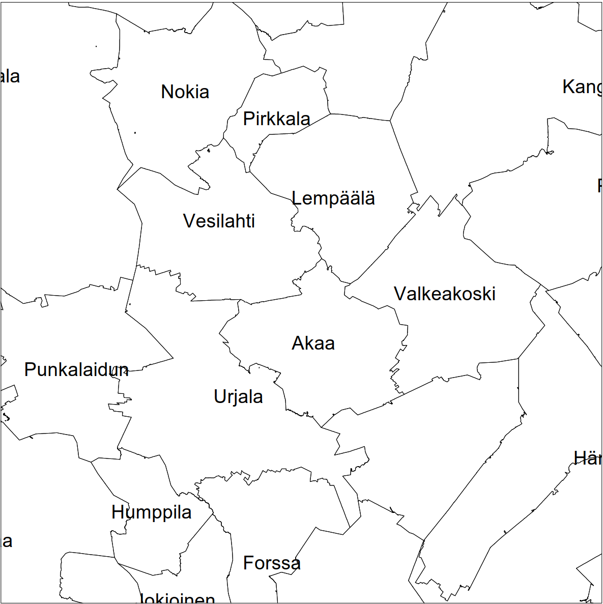
Division into administrative areas (raster) is a dataset depicting the municipal division of Finland. In addition, the boundaries of the regions and the state are shown with a thicker line. The product does not contain information about shorelines.
The dataset Municipal Division is produced in scales 1:10,000, 1:100,000, 1:250,000, 1:1,000,000, and 1:4,500,000.
• The dataset in scale 1:10,000 is based on the property boundaries in the Cadastre.
• Other scales are generalised versions of this dataset.
The dataset is updated yearly in January.
Central changes in 2026:
• The boundaries of the Regional State Administrative Agencies have been dismantled, the boundaries of economic development centres have replaced them (information available only in the vector product)
• Partial municipal merger between the city of Savonlinna and the municipality of Enonkoski
• Update 06/2026: The changes of the review of the state boundary between Finland and Norway in the dataset in scale 1:10,000.
The product belongs to the open data of the National Land Survey of Finland. Download the product from the MapSite's Download geospatial data section.
Simple
- Date (Creation)
- 2011-10-12
- Citation identifier
- FI / 1000314
- Purpose
-
Divison into administrative areas is suitable for use as background data for various analyses and as source data for map products.
- Point of contact
-
Organisation name Individual name Electronic mail address Role National Land Survey of Finland
Owner
- Maintenance and update frequency
- Annually
- Maintenance note
-
New annual versions are published at the beginning of the calendar year following the update of the municipal division dataset.
Annual versions of Division into administrative areas are available since 2012. The availability varies by format.
- Metadata author
-
Organisation name Individual name Electronic mail address Role National Land Survey of Finland
Owner
-
GEMET - INSPIRE themes, version 1.0
-
-
Administrative units
-
-
Paikkatietohakemiston asiasanasto
-
-
Not-Inspire
-
Administrative boundaries
-
avoindata.fi
-
- Access constraints
- Other restrictions
- Other constraints
- no limitations to public access
- Use constraints
- Other restrictions
- Other constraints
- Attribution 4.0 International (CC BY 4.0)
- Other constraints
-
Mention the name of the Licensor (the National Land Survey of Finland), the name of the dataset(s) and the time when the National Land Survey has delivered the dataset(s) (e.g.: contains data from the National Land Survey of Finland Topographic Database 06/2014).
- Spatial representation type
- Grid
- Denominator
- 10000
- Denominator
- 100000
- Denominator
- 250000
- Denominator
- 1000000
- Denominator
- 4500000
- Distance
- 1 m
- Distance
- 8 m
- Distance
- 32 m
- Distance
- 128 m
- Distance
- 512 m
- Language
- Finnish
- Language
- Swedish
- Character set
- 8859 Part 10
- Character set
- 8859 Part 15
- Topic category
-
- Boundaries
- Location
))
- Reference system identifier
- EPSG / ETRS89 / TM35FIN(E,N) (EPSG:3067) / 8.6
- Topology level
- Full surface graph
- Distribution format
-
Name Version PNG
- Distributor contact
-
Organisation name Individual name Electronic mail address Role National Land Survey of Finland
- OnLine resource
-
Protocol Linkage Name WWW:LINK-1.0-http--link
https://asiointi.maanmittauslaitos.fi/karttapaikka/tiedostopalvelu/hallinnolliset_aluejaot_rasteri MapSite Download geospatial data section
- OnLine resource
-
Protocol Linkage Name https://www.maanmittauslaitos.fi/paikkatiedon-tiedostopalvelu Paikkatiedon tiedostopalvelu (OGC API Processes) (in Finnish)
- OnLine resource
-
Protocol Linkage Name WWW:LINK-1.0-http--link
https://www.maanmittauslaitos.fi/asioi-verkossa/karttapaikka/liittyvat-palvelut Directory user interface
- Hierarchy level
- Dataset
Conformance result
- Title
-
Commission Regulation (EU) No 1089/2010 of 23 November 2010 implementing Directive 2007/2/EC of the European Parliament and of the Council as regards interoperability of spatial data sets and services
- Date (Publication)
- 2010-12-08
- Explanation
-
The data set is in accordance with the information product specification
- Pass
- No
- Statement
-
The Division into administrative areas (raster) product (formerly Municipal Division) has been produced since 2012.
Information product specifications for the 2025 version and older annual versions (in Finnish): http://xml.nls.fi/Kuntajako/Asiakasdokumentaatio/Tietotuoteselosteet/
- Included with dataset
- No
- Date (Revision)
- 2021-03-26
- Other citation details
-
Division into administrative areas (raster) is a dataset depicting the municipal boundaries of Finland. The property boundaries in the Cadastre that are kept up to date continuously serve as the source dataset for municipal boundaries. Municipal Division is updated yearly.
Generalisation and enclaves in different scales:
1:10,000:
• Based on Municipal Division in scale 1:10,000
• Ungeneralised
• Includes all enclaves (part of a municipality located within another municipality).
1:100,000:
• Generalised from the 1:10,000 dataset
• Includes all enclaves larger than 10 ha.
1:250,000:
• Generalised from the 1:100,000 dataset
• Includes all enclaves larger than 100 ha.
1:1,000,000 and 1:4,500,000:
• Generalised from the dataset in the previous scale
• Includes only the enclave of Hammarland.
The product does not contain information about shorelines.
- File identifier
- dfd1d7fb-0acb-433e-95fe-45be691a567a XML
- Metadata language
- Finnish
- Hierarchy level
- Series
- Hierarchy level name
-
Aineisto
- Date stamp
- 2026-09-02T09:11:50.55Z
- Metadata author
-
Organisation name Individual name Electronic mail address Role National Land Survey of Finland
Point of contact
- Other language
-
Language Character encoding English UTF8 Swedish UTF8 Finnish UTF8