 Paikkatietohakemisto
Elevation
Type of resources
Available actions
Topics
Keywords
Contact for the resource
Provided by
Years
Formats
Representation types
Update frequencies
Service types
Scale
-
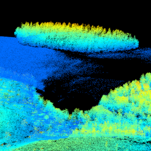
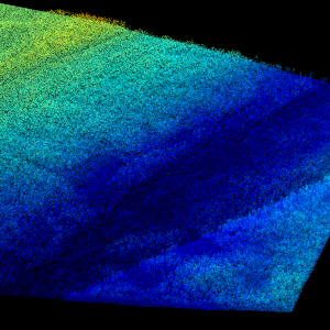
Laser scanning data refers to three-dimensional point-like data depicting the ground and objects on the ground. Each point is provided with x, y and z coordinate information. Laser scanning data is collected i.a. for updating elevation models, creating 3D geometries of buildings, mapping flood risks, and collecting information about forest resources. The terms of use must be approved to use laser scanning data.
-
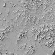
Hillshade (elevation model) is a raster dataset visualising the elevation of the terrain. There are five product versions available in which the pixel sizes are 2, 8, 32, 64, 128 and 512 metres. Pixel size 2 m has been produced of the dataset Elevation model 2 m. The other sizes have been produced of the dataset Elevation model 10 m. The material does not contain elevation values; it is a greyscale image that visualises the direction and steepness of hills. The product belongs to the open data of the National Land Survey of Finland.
-
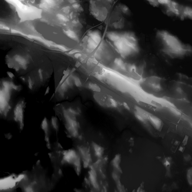
Elevation model 2 m is a model depicting the elevation of the ground surface in relation to sea level. Its grid size is 2 m x 2 m. The dataset is based on laser scanning data, the point density of which is at least 0.5 points per square metre. The product's coverage is based on nationwide laser scanning. In some parts of the outer archipelago or the eastern border, the elevation model is not available. Elevation model 2 m is produced in two quality classes: the elevation accuracy in class I is on average 0.3 metres and the elevation accuracy in class II varies between 0.3 metres and one metre. The product belongs to the open data of the National Land Survey of Finland.
-
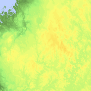
Elevation zones is a raster dataset that visualises elevation of the terrain. The product covers the whole of Finland. There are four product versions available in which the pixel sizes are 32, 64, 128 and 512 metres. The dataset does not contain elevation values; it is a colour image that visualises the height of the terrain above sea level as zones. The sea is shown in light blue in the elevation zone. The product Elevation zones is available as a version that covers the whole country and as versions that cover a certain area. The product belongs to the open data of the National Land Survey of Finland.
-
Laser scanning data refers to three-dimensional point-like data depicting the ground and objects on the ground. Each point is provided with x, y and z coordinate information. Laser scanning data 0.5 p has been spaced out from Laser scanning data 5 p's density of 5 p/m² to a density of 0.5 p/m². Laser scanning data 0.5 p is open data, and from 2020 onwards, it will be collected according to the national laser scanning programme (in Finnish): https://www.maanmittauslaitos.fi/laserkeilaus-ja-ilmakuvaus. For the time being, it is available only from certain parts of Finland. The product belongs to the open data of the National Land Survey of Finland. More information (in Finnish): https://www.maanmittauslaitos.fi/laserkeilausaineistot.
-
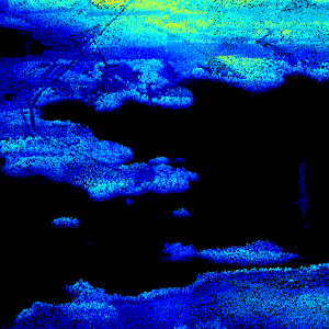
Laser scanning data refers to three-dimensional point-like data depicting the ground and objects on the ground. Each point is provided with x, y and z coordinate information. Laser scanning data is available from all of Finland. The product belongs to the open data of the National Land Survey of Finland. From 2020 onwards, laser scanning data according to the laser scanning programme will be produced. The product description of the 'Laser scanning data 5 p' according to the scanning programme is available: https://www.maanmittauslaitos.fi/en/maps-and-spatial-data/expert-users/product-descriptions/laser-scanning-data-5-p. A spaced-out open dataset will be created from the new Laser scanning data 5 p: https://www.maanmittauslaitos.fi/en/maps-and-spatial-data/expert-users/product-descriptions/laser-scanning-data-05-p. The characteristics of this dataset correspond to the Laser scanning data 2008–2019 dataset.
-
Control points and their coordinates and elevations define in practice the reference system for coordinates and elevations used in Finland. The NLS benchmark register contains information about nationwide control points and benchmarks. The marks are mainly horizontal and elevation control points in classes 1–3 measured by the National Land Survey of Finland. The product belongs to the open data of the National Land Survey of Finland.
-
Maanmittauslaitoksen KM2-korkeusmallin kanssa yhteensopiva korkeusmalli, jossa alkuperäisiä korkeusarvoja on alennettu erityisesti virtavesikohteiden (viivamaiset sekä aluemaiset) ja tieverkoston risteyskohdissa. Alennetut korkeusarvot pyrkivät kuvaamaan virtausreittejä, kuten tierumpuja ja putkia, joita alkuperäisessä KM2:ssa ei ole. Aineisto on tuotettu yhdistämällä useita eri valtakunnan kattavia lähtöaineistoja, joita ovat - korkeusmalli KM2 (Maanmittauslaitos) - Siltojen kansien korkeudet (Syke) - Maastotietokanta (Maanmittauslaitos) - DIGIROAD-tieverkosto (Väylävirasto) - Rumpurekisteri (Väylävirasto) Lisäksi jotkin kunnat ja kaupungit ovat digitoineet Maastotietokannasta puuttuvia virtausreittejä. Korkeusarvot ovat ilmoitettu N2000-korkeusjärjestelmässä. Aineisto on avoin (lisenssi CC BY 4.0). Käyttötarkoitus: Korvaamalla KM2:n korkeusarvot uomakorjausaineiston arvoilla saadaan korkeusmalli, joka soveltuu mm. pintaveden virtauksen mallinnukseen alkuperäistä korkeusmallia paremmin. Tämä mahdollistaa esim. hulevesitulvariskien luotettavamman arvioinnin. Aineisto kuuluu SYKEn avoimiin aineistoihin (CC BY 4.0). Lähde: Syke, Maanmittauslaitos (perustuu Syken, MML:n ja Väyläviraston aineistoihin).
-
Aineisto kattaa ympäristöhallinnon tekemien sisävesien (järvet, joet) luotauksien syvyystiedot. Tietoja käytetään järvien ja jokien syvyysaineiston (syvyyskäyrät ja -alueet sekä maksimisyvyyspiste) tuottamiseen. Luotauspisteisiin on yhdistetty luotauksen lähtötasotieto sekä järvien osalta järvien fysiografiatietoja SYKEn ylläpitämästä järvirekisteristä. Aineisto kuuluu SYKEn avoimiin aineistoihin (CC BY 4.0) Lisätietoja: https://geoportal.ymparisto.fi/meta/julkinen/dokumentit/Luotaus.pdf
-
Ortokuvien ja korkeusmallien kyselypalvelun (WCS) kautta voit hakea rasterimuotoisia ortokuvia ja korkeusmalleja. Palvelussa voit poimia haluttuja paloja aineistoista omalla aluerajauksellasi. Ortokuvien osalta palvelu sisältää Maanmittauslaitoksen väri-, vääräväri- ja mustavalkoisia ortokuvia eri vuosilta. Korkeusmalli on 2 m korkeusmallia, joka on tuotettu laserkeilausaineiston pohjalta. Korkeusmallia pystyy hakemaan palvelusta myös karkeammilla kuin 2m resoluutioilla. Tarjolla ovat seuraavat resoluutiot: 2 m, 4 m, 8 m, 16 m, 32 m, 64 m, 128 m, 256 m ja 512 m. Ortokuvat ovat saatavilla palvelusta GeoTIFF-formaatissa ja korkeusmalli GeoTIFF- tai ASCII Grid -formaatissa. Palvelun käyttäminen edellyttää perehtyneisyyttä paikkatietorajapintojen ohjelmalliseen hyödyntämiseen. Yksittäisten latausten tekeminen onnistuu myös selaimella. Ladatut tiedostot saat auki ja voit jatkokäsitellä paikkatieto-ohjelmalla. Toistaiseksi palvelua ei pysty käyttämään esimerkiksi QGIS -ohjelmalla. Aineistot ovat Maanmittauslaitoksen avoimen tietoaineiston Nimeä CC 4.0 -lisenssin alaisia. Palvelu tarjotaan avoimena rajapintana, jonka käyttö on maksutonta. Käyttäjä tunnistetaan API-avaimella. Lue lisää Maanmittauslaitoksen avoimen rajapinnan käyttöehdoista ja API-avaimen luomisesta ja käyttämisestä. https://www.maanmittauslaitos.fi/rajapinnat/api-avaimen-ohje https://www.maanmittauslaitos.fi/ortokuvien-ja-korkeusmallien-kyselypalvelu