 Paikkatietohakemisto
LAZ
Type of resources
Topics
Keywords
Contact for the resource
Provided by
Formats
Representation types
Update frequencies
-
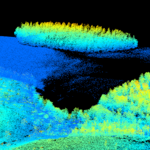
Laser scanning data refers to three-dimensional point-like data depicting the ground and objects on the ground. Each point is provided with x, y and z coordinate information. Laser scanning data is collected i.a. for updating elevation models, creating 3D geometries of buildings, mapping flood risks, and collecting information about forest resources. The terms of use must be approved to use laser scanning data.
-
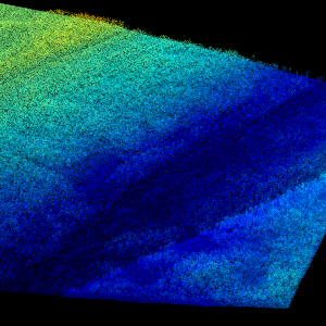
Laser scanning data refers to three-dimensional point-like data depicting the ground and objects on the ground. Each point is provided with x, y and z coordinate information. Laser scanning data 0.5 p has been spaced out from Laser scanning data 5 p's density of 5 p/m² to a density of 0.5 p/m². Laser scanning data 0.5 p is open data, and from 2020 onwards, it will be collected according to the national laser scanning programme (in Finnish): https://www.maanmittauslaitos.fi/laserkeilaus-ja-ilmakuvaus. For the time being, it is available only from certain parts of Finland. The product belongs to the open data of the National Land Survey of Finland. More information (in Finnish): https://www.maanmittauslaitos.fi/laserkeilausaineistot.
-
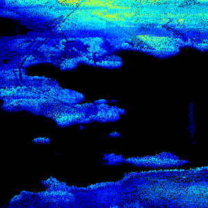
Laser scanning data refers to three-dimensional point-like data depicting the ground and objects on the ground. Each point is provided with x, y and z coordinate information. Laser scanning data is available from all of Finland. The product belongs to the open data of the National Land Survey of Finland. From 2020 onwards, laser scanning data according to the laser scanning programme will be produced. The product description of the 'Laser scanning data 5 p' according to the scanning programme is available: https://www.maanmittauslaitos.fi/en/maps-and-spatial-data/expert-users/product-descriptions/laser-scanning-data-5-p. A spaced-out open dataset will be created from the new Laser scanning data 5 p: https://www.maanmittauslaitos.fi/en/maps-and-spatial-data/expert-users/product-descriptions/laser-scanning-data-05-p. The characteristics of this dataset correspond to the Laser scanning data 2008–2019 dataset.