 Paikkatietohakemisto
National Land Survey of Finland
Type of resources
Available actions
Topics
Keywords
Contact for the resource
Provided by
Years
Formats
Representation types
Update frequencies
Service types
Scale
-

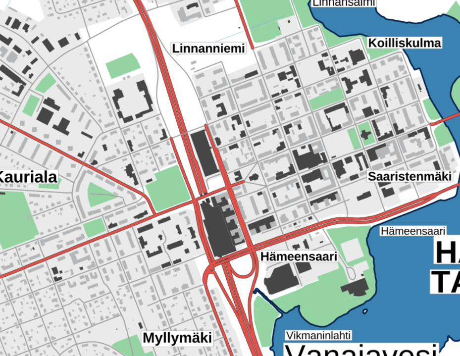
The Topographic database is a dataset depicting the terrain of all of Finland. The key objects in the Topographic database are the road network, buildings and constructions, administrative borders, geographic names, land use, waterways and elevation. Aerial photographs, scanning data and data provided by other data providers are utilised in updating the Topographic database. The updating is done in close cooperation with the municipalities. Field checks in the terrain are also needed to some extent, mostly as regards the classification of features. The topographic database is used in the production of other map products and in various optimisation tasks. The product belongs to the open data of the National Land Survey of Finland.
-
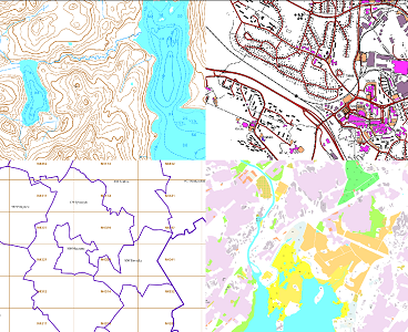
The themes of the Topographic database and Topographic map raster series (scale 1:10,000) have been compiled into seven theme entities, theme rasters, required by the Inspire directive: hydrography, elevation, traffic network, land use, land cover, place names and buildings. In addition to the above, the theme rasters also include the municipal division, road names and map sheet division as separate themes. The theme rasters have not been implemented according to the imaging technology defined in the Inspire directive. They will be produced later. The product belongs to the open data of the National Land Survey of Finland.
-
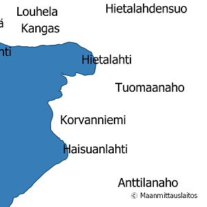
National Land Survey's geographic names are available as interfaces and files. Interfaces and file products comprise of place name products and map name products. The place name products include data about approximately 800,000 named places and their names in different languages. Data about place are among others place type, plane location and height above sea level, and data about names are among others the spelling that has been checked by the Institute for the Languages of Finland and language (Finnish, Swedish, Northern Sami, Inari Sami or Skolt Sami. In the place name products, every place and its name or names appear only once. The map name products contain the place names that have been selected for the National Land Survey's nine standard map products and information about the cartographical presentation of them. The information includes the location of the name on the map, for instance the coordinates of the left lower corner of the map text, the direction and bending of the text as well as typographical information, such as font type, size and colour. The name of a particular place, such as a river, can appear several times in the same map product. The product is a part of the open data of the National Land Survey.
-

The map sheet division is a system created for printing maps, which covers map sheet codes, map scales and map sheet sizes. Today, map sheet division is also used for other purposes. It is also possible to download other NLS datasets in addition to maps in accordance with map sheet division. The map sheet division TM35, which is based on the projected coordinate reference system ETRS-TM35FIN is in use today. Before 2007, a map sheet division that was based on the KKS coordinate reference system was used. The TM35 map sheet division consists of 7 different grid sizes, the smallest scale is 1:200,000 and the largest is 1:5000. An explanation of how the grids are further split into more detailed grids and the principles of map sheet numbering is on the National Land Survey website (in Finnish) https://www.maanmittauslaitos.fi/kartat-ja-paikkatieto/kartat/osta-kartta/nain-loydat-oikean-karttalehden. The attribute data of the grids include map sheet number, the area of a square on the grid, perimeter and the coordinates of the centre of the square. The map sheet division is available as a file in vector format and through our contract-based WMTS service in raster format. In addition, you can view it in the geoportal Paikkatietoikkuna. The product is a part of the open data of the National Land Survey.
-

Control points and their coordinates and elevations define in practice the reference system for coordinates and elevations used in Finland. The NLS benchmark register contains information about nationwide control points and benchmarks. The marks are mainly horizontal and elevation control points in classes 1–3 measured by the National Land Survey of Finland. The product belongs to the open data of the National Land Survey of Finland.
-
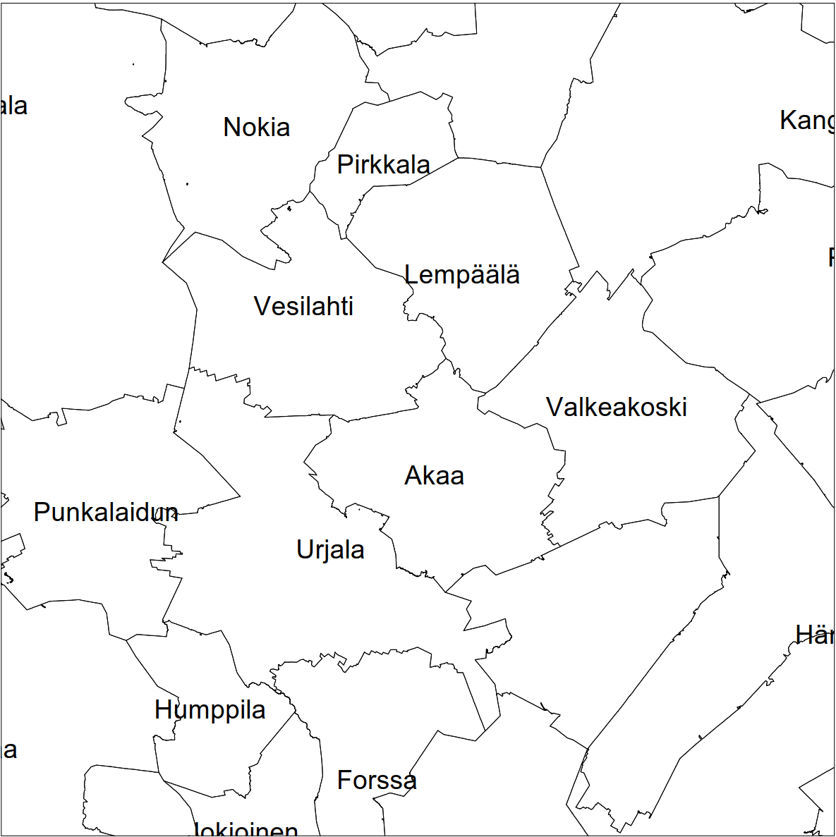
Division into administrative areas (vector) is a dataset depicting the municipalities, regions, Economic development centres and the national border of Finland. The Division into administrative areas products in vector format contain the number codes of the municipalities, the names of the municipalities in both Finnish and Swedish as well as municipal boundaries and municipal geographical areas. In addition, the products include the corresponding information about the regions, the Economic development centres and the nation as well as a specification of the municipality's area into land and water area. The municipality's area is not included in the XML/GML and GeoPackage format. The dataset Municipal Division is produced in scales 1:10,000, 1:100,000, 1:250,000, 1:1,000,000 and 1:4,500,000. The data included in the dataset in scale 1:10,000 are taken from the Cadastre. Regarding other scales, municipal boundaries have been generalised to suit the scale in question. The product is a part of the open data of the National Land Survey.
-
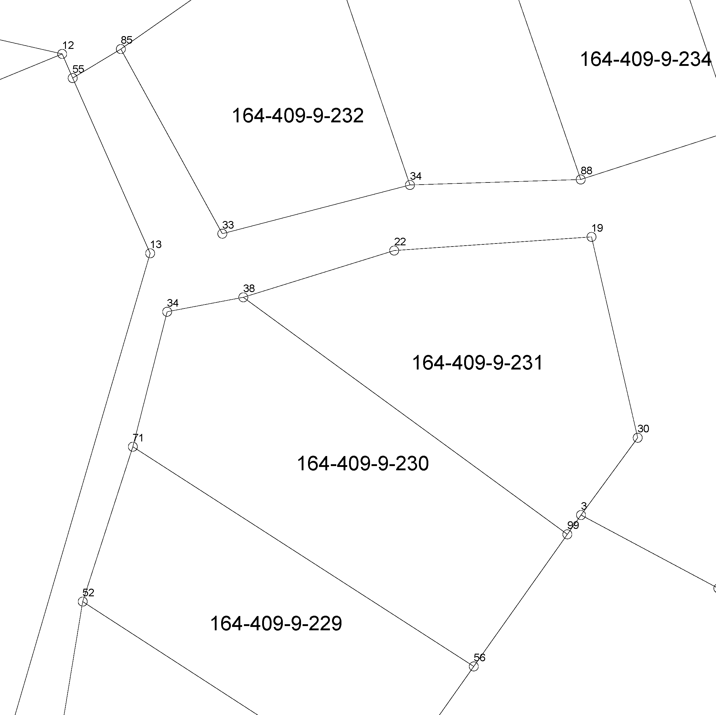
The location of the real property unit is shown on the cadastral index map. On the map, there are property and other register unit boundaries and property identifiers. The product is a part of the open data of the National Land Survey. Further information (in Finnish): http://www.maanmittauslaitos.fi/kiinteistot/asiantuntevalle-kayttajalle/kiinteistotiedot-ja-niiden-hankinta
-
The Plain map series is a simple, plain and readable dataset product series in raster format that depicts the whole of Finland. The product is meant to be used as a background map whose character changes to a guide map in large scales. Impaired vision has been taken into account when designing the product. The key objects presented on the map are roads and railways, road names, buildings and constructions, administrative borders, waterways and other geographical names. The road network, public buildings and texts have been especially emphasised. The most usual limitations of colour vision have been taken into account in the use of colours. The product belongs to the open data of the National Land Survey of Finland.
-

Laser scanning data refers to three-dimensional point-like data depicting the ground and objects on the ground. Each point is provided with x, y and z coordinate information. Laser scanning data is available from all of Finland. The product belongs to the open data of the National Land Survey of Finland. From 2020 onwards, laser scanning data according to the laser scanning programme will be produced. The product description of the 'Laser scanning data 5 p' according to the scanning programme is available: https://www.maanmittauslaitos.fi/en/maps-and-spatial-data/expert-users/product-descriptions/laser-scanning-data-5-p. A spaced-out open dataset will be created from the new Laser scanning data 5 p: https://www.maanmittauslaitos.fi/en/maps-and-spatial-data/expert-users/product-descriptions/laser-scanning-data-05-p. The characteristics of this dataset correspond to the Laser scanning data 2008–2019 dataset.
-

The Cadastral index map shows location data of real property units. They include boundaries, boundary markers, property identifiers, and unseparated parcels of real property units and other register units. The product is open data. You can take the product into use via the interface services or in file format in the Download geospatial data section on MapSite. You can read more about acquisition in the section Distribution and further information below. If you download the product with municipal boundaries on MapSite, it is good to know that parcels also include areas from the neighbouring municipality. You can make a more precise intersection in the client software, for instance with the Administrative areas product. The linear boundary data is, however, intersected according to municipal boundaries. Other attribute data related to properties are available in the Cadastre. More information (in Finnish and Swedish): http://www.maanmittauslaitos.fi/kiinteistot/asiantuntevalle-kayttajalle/kiinteistotiedot-ja-niiden-hankinta