infoFeatureAccessService
Type of resources
Available actions
Keywords
Contact for the resource
Provided by
Years
Formats
Update frequencies
Service types
-
GTKWFS on WFS-rajapintapalvelu, jonka kautta on saatavilla seuraavat karttatasot (suluissa tekninen nimi): Suomen metallogeeninen kartta (GTKWFS:Suomen_metallogeeninen_kartta), Maaperä 1:1 000 000 (GTKWFS:Maaperä_1_1_000_000), Suomen pintageologiakartta 1:1 000 000 OneGeology - Europe (GTKWFS:Suomen_pintageologia_1_1_000_000_OneGeology_-_Europe), Suuralueellinen geokemia; moreeni (GTKWFS:Suuralueellinen_geokemia__moreeni), Suuralueellinen geokemia; purovesi (GTKWFS:Suuralueellinen_geokemia__purovesi), Suuralueellinen geokemia; purosedimentti (GTKWFS:Suuralueellinen_geokemia__purosedimentti), Kallioperän isotooppiaineisto (GTKWFS:Kallioperän_isotooppiaineisto), Maaperä 1:200 000 (GTKWFS:Maaperä_1_200_000), Lohkarehavainnot (GTKWFS:Lohkarehavainnot), Kallioperäkairaukset (GTKWFS:Kallioperäkairaukset), Kallioperähavainnot (GTKWFS:Kallioperähavainnot), Kalliogeokemia (GTKWFS:Kalliogeokemia), Kallioperä :1 000 000 (GTKWFS:Kallioperä_1_1_000_000), Tutkitut_turvealueet (GTKWFS:Tutkitut_turvealueet), Maaperä 1:20 000/1:50 000 (GTKWFS:Maaperä_1_20_000__1_50_000), Kallioperä 1:200 000 (GTKWFS:Kallioperä_1_200_000). Palvelu perustuu kallioperätiedot sisältävään Suomen kallioperä 1:1 000 000 -aineistoon, maaperätiedot sisältävään Suomen maaperä 1:1 000 000 -aineistoon ja Suomen pintageologiakartta 1:1 000 000 -aineistoon. Aineistoja hallinnoi Geologian tutkimuskeskus. Palvelun käyttö on maksutonta eikä vaadi autentikointia eli tunnistautumista käyttäjätunnuksen ja salasanan avulla.
-
Statistics Finland's Web Service is a WFS interface service through which the following data required by INSPIRE and national legislation on geographic information are available: 1) Statistical units: Regional divisions (municipality, major region, region, sub-regional unit, Regional State Administrative Agency (AVI), Centre for Economic Development, Transport and the Environment (ELY), electoral district) and grid 1 km x 1 km 2) Non-profit and public services: Educational institutions (comprehensive schools, upper secondary general schools) 3) Production and industrial facilities: Production and industrial facilities 4) Population distribution by the regional divisions used in statistics and by 1 km x 1 km grids. Other data published: - Population distribution by 5 km x 5 km grids - Open data by postal code area (Paavo) The data are administered by Statistics Finland. The service is free of charge and does not require authentication or identification with a user ID and password. The general Terms of Use must be observed when using the data: http://tilastokeskus.fi/org/lainsaadanto/copyright_en.html.
-
Kouvolan kaupungin WFS-palvelu (Web Feature Service) on rajapintapalvelu, jonka avulla käyttäjät voivat hakea ja hyödyntää kaupungin tarjoamaa paikkatietoaineistoa rakenteisessa, koneluettavassa muodossa. Palvelu noudattaa OGC:n (Open Geospatial Consortium) määrittämää WFS-standardia, joka mahdollistaa paikkatietokohteiden haun, suodatuksen ja tarvittaessa muokkaamisen reaaliaikaisesti suoraan alkuperäisestä tietolähteestä. Palvelun kautta on saatavilla erilaisia vektorimuotoisia paikkatietokohteita, kuten rakennuksia, asemakaavoja, katuverkkoa, kiinteistöjä ja muita kaupungin hallinnoimia maankäyttöön, yleiseen infrastruktuuriin liittyviä aineistoja. Aineistot tarjotaan useimmiten GML-muodossa (Geography Markup Language), ja niitä voidaan hyödyntää esimerkiksi paikkatieto-ohjelmistoissa, selainpohjaisissa sovelluksissa ja automaattisissa tietojenkäsittelyprosesseissa. Palvelu tukee useita kyselyparametreja, kuten: BBOX (Bounding Box): alueellinen rajaus Filter: ominaisuustietojen perusteella suodattaminen SRS (Spatial Reference System): koordinaattijärjestelmän valinta Kaupungin WFS-palvelu on tarjolla avoimena osaksi ja osa aineistoista on erillisellä sopimuksella käytettävissa.
-
WFS download service for EMODnet Seabed substrate dataset: EMODnet Seabed substrate multiscale 1:1 000 000 –Europe (Seabed_substrate:multiscale_1m), EMODnet Seabed substrate multiscale 1:250 000 –Europe (Seabed_substrate:multiscale_250k), EMODnet Seabed substrate multiscale 1:100 000 –Europe (Seabed_substrate:multiscale_100k), EMODnet Seabed substrate multiscale 1:50 000 –Europe (Seabed_substrate:multiscale_50k), EMODnet Seabed substrate 1:100 000 –Europe (Seabed_substrate:seabed_substrate_100k), EMODnet Seabed substrate 1:250 000 –Europe (Seabed_substrate:seabed_substrate_250k), EMODnet Seabed substrate 1:1 000 000 –Europe (Seabed_substrate:seabed_substrate_1m), EMODnet Sedimention rates –Europe (Seabed_substrate:sedimentation_rates). The service is based on the EMODnet Geology dataset. The dataset is administrated by the Geological Survey of Finland. The service contains all features from the dataset that are modelled as polygons.
-
The Arctic SDI Gazetteer Service is a service that contains authoritative place names data from the arctic area. The service can be used for searching place names and performing reverse geocoding. The service contains about 2.87 million place name locations with about 3.15 million place names. It contains data from following sources: * Canada (Natural Resources Canada, updated: 02/2018) * Denmark (including Greenland) (SDFE, updated: 05/2017) * Finland (National Land Survey of Finland, updated: 04/2017) * GEBCO Undersea feature names gazetteer (updated: 04/2019) * Iceland (National Land Survey of Iceland, updated: 08/2017) * Norway (Norwegian Mapping Authority, updated: 08/2017) * Russia (Russian Mapping Agency, updated: 04/2019) * Sweden (Swedish National Mapping Agency, updated: 05/2017) * USA (US Geological Survey, updated: 05/2017)
-
OGC API Features-palvelu sisältää INSPIRE-direktiivin Liite I / Osoitteet-ryhmään kuuluvan seuraavan Syken aineiston: Osoitteet. Aineisto kuuluu SYKEn avoimiin aineistoihin (CC BY 4.0). Käytettävissä kaikilla mittakaavoilla.
-
OGC API Features-palvelu sisältää INSPIRE-direktiivin Liite III / Rakennukset-ryhmään kuuluvan seuraavan Syken aineiston: Rakennukset. Aineisto kuuluu SYKEn avoimiin aineistoihin (CC BY 4.0). Käytettävissä kaikilla mittakaavoilla.
-
Museoviraston kulttuuriympäristöaineistot, suojellut kohteet on Museoviraston WFS-rajapintapalvelu, jonka kautta on saatavilla seuraavat karttatasot (suluissa karttatason nimi): Kiinteät muinaisjäännökset ja muut kulttuuriperintökohteet (Muinaisjäännökset ja muut kulttuuperintökohteet, piste), Muinaisjäännösten aluerajaukset (Muinaisjäännökset, alue), Rakennusperintörekisterin suojellut rakennukset (Suojellut rakennukset, piste), Rakennusperintörekisterin suojeltujen rakennusten aluerajaukset (Suojellut rakennukset, alue), Valtakunnallisesti merkittävät rakennetut kulttuuriympäristöt alueet (RKY, alue), Valtakunnallisesti merkittävät rakennetut kulttuuriympäristöt pisteet (RKY, piste), Valtakunnallisesti merkittävät rakennetut kulttuuriympäristöt viivat (RKY, viiva), Maailmanperintökohteet (Maailmanperintö, alue), Maailmanperintökohteiden pistekohteet (Maailmanperintö, piste). Palvelu perustuu Museoviraston ylläpitämien rekisterien tietoihin. Aineistoja hallinnoi Museovirasto. Rakennusperintöaineistossa on myös kohteita, joita koskevia tietoja voi olla toisten viranomaisten rekistereissä. Palvelun käyttö on maksutonta eikä vaadi autentikointia eli tunnistautumista käyttäjätunnuksen ja salasanan avulla.
-
Museoviraston kulttuuriympäristöaineistot, kaikki kohteet on Museoviraston WFS-rajapintapalvelu, jonka kautta on saatavilla seuraavat karttatasot (suluissa karttatason nimi): Arkeologiset kohteet (Arkeologiset kohteet, piste), Arkeologisten kohteiden aluerajaukset (Arkeologiset kohteet, alue), Arkeologisten kohteiden alakohteet (Arkeologisten kohteiden alakohteet, piste), Rakennusperintörekisterin rakennukset (Rakennusperintö, piste), Rakennusperintörekisterin aluerajaukset (Rakennusperintö, alue), Valtakunnallisesti merkittävät rakennetut kulttuuriympäristöt alueet (RKY, alue), Valtakunnallisesti merkittävät rakennetut kulttuuriympäristöt pisteet (RKY, piste), Valtakunnallisesti merkittävät rakennetut kulttuuriympäristöt viivat (RKY, viiva), Maailmanperintökohteet alueet (Maailmanperintö, alue), Maailmanperintökohteet pisteet (Maailmanperintö, piste). Palvelu perustuu Museoviraston ylläpitämien rekisterien tietoihin. Aineistoja hallinnoi Museovirasto.Rakennusperintöaineistossa on myös kohteita, joita koskevia tietoja voi olla toisten viranomaisten rekistereissä (esimerkiksi ympäristöhallinto tai Kirkkohallitus). Palvelu on tarkoitettu viranomais- ja tutkimuskäyttöön. Palvelun käyttö on maksutonta, mutta vaatii erillisen käyttöluvan. Käyttöoikeutta voi hakea osoitteesta paikkatieto@nba.fi.
-

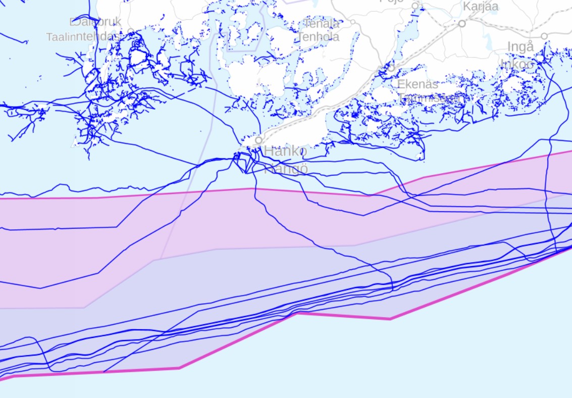
Liikenne- ja viestintävirasto Traficomin avoin WFS on WFS-rajapintapalvelu, jonka kautta on saatavilla seuraavat karttatasot (suluissa tekninen nimi): Johdot ja putkilinjat (johdot_ja_linjat_v) Rantarakenteet (rantarakenteet_v) Suomen valtakunnanraja merellä (Ahti_Limit_L) Talousvyöhyke (ExclusiveEconomicZone_A) Talousvyöhykkeen ulkoraja (ExclusiveEconomicZone_L) Sisäisten aluevesien ulkoraja (StraightTerritorialSeaBaseline_L) Aluemeren ulkoraja (TerritorialSeaArea_L) Aluemeri (TerritorialSeaArea_A) Sulut ja kanavat (alue) (sulut_a) Sulut ja kanavat (viiva) (sulut_v) Luotsinkohtauspaikka (PilotBoardingPlace_P) Radioilmoituspiste (Rdocal_P) Ilmoittautumislinja (Rdocal_L) VTS-alue (VTSArea_A) Palvelu perustuu Traficomin ylläpitämiin merikartta-aineistoihin. Palvelun käyttö on maksutonta eikä vaadi autentikointia eli tunnistautumista käyttäjätunnuksen ja salasanan avulla.
 Paikkatietohakemisto