 Paikkatietohakemisto
Administrative units
Type of resources
Available actions
Topics
Keywords
Contact for the resource
Provided by
Years
Formats
Representation types
Update frequencies
Service types
Scale
-
NLS-FI INSPIRE View Service for Administrative Units Theme is an INSPIRE compliant Web Map Service. It contains the following harmonized INSPIRE map layers: AdministrativeUnit, AdministrativeBoundary, Baseline, TerritorialSea, ExclusiveEconomicZone, MaritimeBoundary.InternalWaters, MaritimeBoundary.TerritorialSea ,MaritimeBoundary.ExclusiveEconomicZone. The service is based on the NLS-FI INSPIRE Administrative Units dataset. The dataset is administrated by the National Land Survey of Finland.
-
NLS-FI INSPIRE Administrative Units Theme Dataset is a dataset depicting Administrative Units covering the land area and Maritime Units covering the sea area of Finland. Administrative Units contain the following INSPIRE feature types: AdministrativeUnit, AdministrativeBoundary. Maritime Units contain the following INSPIRE feature types: Baseline, MaritimeZone, MaritimeBoundary. Administrative Units are updated once a year from the NLS Cadastral Index Map database. Maritime Units are quite stable and have no regular update cycle. The dataset is available via the NLS-FI INSPIRE Download Service (WFS) for Administrative Units Theme and it can be viewed via the NLS-FI INSPIRE View Service (WMS) for Administrative Units.
-

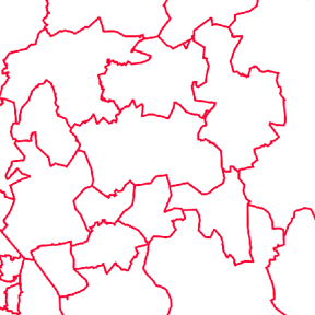
Division into administrative areas (vector) is a dataset depicting the municipalities, regions, Regional State Administrative Agencies, and the national border of Finland. The Division into administrative areas products in vector format contain the number codes of the municipalities, the names of the municipalities in both Finnish and Swedish as well as municipal boundaries and municipal geographical areas. In addition, the products include the corresponding information about the regions, the Regional State Administrative Agencies, and the nation as well as a specification of the municipality's area into land and water area. The municipality's area is not included in the XML/GML and GeoPackage format. The dataset Municipal Division is produced in scales 1:10,000, 1:100,000, 1:250,000, 1:1,000,000 and 1:4,500,000. The data included in the dataset in scale 1:10,000 are taken from the Cadastre. Regarding other scales, municipal boundaries have been generalised to suit the scale in question. The product is a part of the open data of the National Land Survey.
-
NLS-FI INSPIRE Download Service (WFS) for Administrative Units Theme is an INSPIRE compliant direct access Web Feature Service. It contains the following INSPIRE feature types: AdministrativeUnit, AdministrativeBoundary, Baseline, MaritimeZone, MaritimeBoundary. The service is based on the NLS-FI INSPIRE Administrative Units dataset. The dataset is administrated by the National Land Survey of Finland.
-

Division into administrative areas (raster) is a dataset depicting the municipal Division of Finland. The dataset Municipal Division is produced in scales 1:10,000, 1:100,000, 1:250,000, 1:1,000,000 and 1:4,500,000. The data included in the dataset in scale 1:10,000 are taken from the Cadastre. Regarding other scales, municipal boundaries have been generalised to suit the scale in question. Division into administrative areas products in raster format include municipal boundaries only. The product is a part of the open data of the National Land Survey.
-
Paikkatiedon tiedostopalvelu (OGC API Processes) tarjoaa kyselyrajapinnan, jonka kautta voi hakea Maanmittauslaitoksen avoimia paikkatietoaineistoja tiedostopaketteina. Aineistot ovat samat, joita voi hakea käyttöliittymän kautta Karttapaikka-palvelun Lataa paikkatietoaineistoja -osiosta. Aineistojen tarkemmat tiedot ovat luettavissa tuotekuvauksista https://www.maanmittauslaitos.fi/kartat-ja-paikkatieto/aineistot-ja-rajapinnat/tuotekuvaukset Palvelu sopii esimerkiksi käyttöön, jossa on tarvetta hakea paikkatietoaineistoja koordinaateilla eli suorakaiteella (Bounding Box) tai polygonirajauksella. Karttapaikan Lataa paikkatietoaineistoja-osiossa nämä valinnat piirretään kartalla, mutta OGC API Processes -palvelussa koordinaatit voi syöttää kyselyparametreina. Hakuparametrit vaihtelevat aineistosta riippuen. Osaa aineistoista voi hakea myös karttalehden, kunnan tai teeman perusteella, tai koko Suomen alueelta. Palvelusta saatavat aineistot ovat Maanmittauslaitoksen avoimen tietoaineiston Nimeä CC 4.0 -lisenssin alaisia. Palvelu tarjotaan avoimena rajapintana, jonka käyttö on maksutonta. Käyttäjä tunnistetaan API-avaimella. https://www.maanmittauslaitos.fi/rajapinnat/api-avaimen-ohje https://www.maanmittauslaitos.fi/paikkatiedon-tiedostopalvelu
-
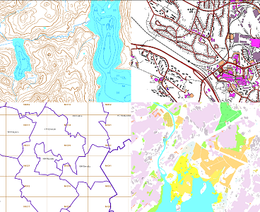
The themes of the Topographic database and Topographic map raster series (scale 1:10,000) have been compiled into seven theme entities, theme rasters, required by the Inspire directive: hydrography, elevation, traffic network, land use, land cover, place names and buildings. In addition to the above, the theme rasters also include the municipal division, road names and map sheet division as separate themes. The theme rasters have not been implemented according to the imaging technology defined in the Inspire directive. They will be produced later. The product belongs to the open data of the National Land Survey of Finland.
-
Palvelun kautta saa käyttöön ajantasaiset rasterimuotoiset perus-, maasto- ja yleiskartat sekä ilmakuvat. Palvelu on tarkoitettu WMTS-standardia tukevien sovellusten käyttöön. Lisätietoja: https://www.maanmittauslaitos.fi/karttakuvapalvelu https://www.maanmittauslaitos.fi/karttakuvapalvelu/tekninen-kuvaus-wmts Avointa palvelua voi käyttää API-avaimella. Sopimuspalvelun käyttö on maksullista ja vaatii käyttäjätunnuksen ja salasanan.
-

Paikkatietohakemisto is a national metadata discovery service.
-
Palvelu tarjoaa tietoja muun muassa liikenneverkoista, rakennuksista ja rakenteista, hallintorajoista, nimistöstä, maankäytöstä, vesistöistä ja korkeussuhteista. Aineistolähteenä on Maanmittauslaitoksen Maastotietokanta, jonka kohteita pidetään jatkuvasti ajan tasalla. Aineistot ovat Maanmittauslaitoksen avoimen tietoaineiston Nimeä CC 4.0 -lisenssin alaisia. Palvelu tarjotaan avoimena rajapintana, jonka käyttö on maksutonta. Käyttäjä tunnistetaan API-avaimella. Lue lisää Maanmittauslaitoksen avoimen rajapinnan käyttöehdoista ja API-avaimen luomisesta ja käyttämisestä. https://www.maanmittauslaitos.fi/rajapinnat/api-avaimen-ohje