Structure
Type of resources
Topics
Keywords
Contact for the resource
Provided by
Years
Formats
Representation types
Update frequencies
Scale
-
KUVAUS: Tampereen rakennelmien 2D-seinälinjat aluemuotoisena geometriana korkeudeltaan nollattuna. Mukana vain valmiit ja julkisesti näytettävät rakennelmat. Virkistys aamuisin klo 6.35. KATTAVUUS: Tampereen kaupunkiseutu PÄIVITYS: Aineistoa päivitetään jatkuvasti uusien rakennelmien valmistuessa. YLLÄPITOSOVELLUS: StellaMap (DGN-tiedostot) ja FME KOORDINAATTIJÄRJESTELMÄ: Aineisto tallennetaan ETRS-GK24FIN (EPSG:3878) tasokoordinaattijärjestelmässä. GEOMETRIA: vektori (alue) SAATAVUUS: Aineisto on saatavilla WFS-rajapinnalta Tampereen kaupungin sisäiseen käyttöön sekä konsulteille sopimuksella/käyttöehdolla. Aineiston primäärilähde on Oracle-tietokanta. JULKISUUS: Aineisto on julkisesti katsottavissa Oskari-karttapalvelussa. TIETOSUOJA: Aineistoon ei liity tietosuojakysymyksiä. KENTÄT: -TYYPPI: Rakennelma, Muu rakennelma, Portaat tai esteettömyysluiska, Laituri, Piippu tai Allas -ALALUOKKA: Varastotila, Katos, Muu rakennelma, Maastoportaat, Autokatos, Joukkoliikenteen pysäkkikatos, Muu laituri, Venelaituri, Mainosrakennelma, Jätekatos, Muistomerkki, Savupiippu, Huvipuistolaite, Raunio, Katsomo, Muu piippu, Maatalousallas, Maauima-allas, Esteettömyysluiska, Hyppyrimäki, Keittokatos, Suihkulähde tai suihkukaivo -RAKENNELMALUOKKA_FACTA: Tulee rakennelmalle i_pyraknro perusteella Factasta (huom. ei löydy kaikilta rakennelmilta). -PYSYVA_RAK_NRO_FACTA: Rakennelman pysyvä rakennusnumero Factasta. AINEISTOSTA VASTAAVA TAHO: Tampereen kaupunki, Paikkatietoyksikkö, paikkatieto_tuki@tampere.fi
-
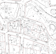
KUVAUS: Tampereen rakennusten 2D-seinälinjat aluemuotoisena geometriana korkeudeltaan nollattuna. Rakennusten ominaisuustiedot tulevat masterdatasta i_pyraknron perusteella. Jos tunnusvastaavuutta ei löydy, geometria ei tule mukaan näkymään. Virkistys aamuisin klo 6.15. KATTAVUUS: Tampereen kaupunkiseutu PÄIVITYS: Aineistoa päivitetään jatkuvasti uusien rakennusten valmistuessa. YLLÄPITOSOVELLUS: StellaMap (DGN-tiedostot) ja FME KOORDINAATTIJÄRJESTELMÄ: Aineisto tallennetaan ETRS-GK24FIN (EPSG:3878) tasokoordinaattijärjestelmässä. GEOMETRIA: vektori (alue) SAATAVUUS: Aineisto on saatavilla WFS-rajapinnalta. Aineiston primäärilähde on Oracle-tietokanta. JULKISUUS: Aineisto on katsottavissa Oskari-karttapalvelussa. KENTÄT: -PYSYVA_RAKENNUSTUNNUS: Tulee rakennuksen i_pyraknro perusteella Factasta. -SIJAINTIKIINTEISTO: Rakennuksen kiinteistötunnus -VALMISTUMISPVM -KERROSALA: Kerrosalaan luetaan kerrosten pinta-alat ja se ullakon tai kellarikerrosten ala, jossa on asuin- tai työhuoneita tai muita rakennuksen pääasiallisen käyttötarkoituksen mukaisia tiloja. Kerrosala on vaakasuora pinta-ala, jota rajoittavat kerrosten seinien ulkopinnat tai niiden ajateltu jatke ulkoseinien pinnassa olevien aukkojen ja koristeosien osalta (Tilastokeskus 2024). -KERROSTEN_LKM -HISSI -RAKENNUSTILAVUUS -POLTTOAINE -LAMMITYSTAPA: Vesikeskuslämmitys, Ilmakeskuslämmitys, Suora sähkölämmitys, Uunilämmitys, Ei kiinteää lämmityslaitetta, tuntematon. -PYSYVA_RAK_NRO_FACTA: Rakennelman pysyvä rakennusnumero Factasta. AINEISTOSTA VASTAAVA TAHO: Tampereen kaupunki, Paikkatietoyksikkö, paikkatieto_tuki@tampere.fi
-
KUVAUS: Aineisto sisältää raitiotien katusuunnitelmien reitit Tampereen alueelta sekä linkkejä suunnitelmapiirustuksiin. KATTAVUUS: Kaikille käyttäjille Oskari-karttapalvelussa. PÄIVITYS: Aineistoa päivitetään tarpeen mukaan (ylläpito jatkuvaa). YLLÄPITOSOVELLUS: PostgreSQL-tietokanta ja QGIS-ohjelmisto. KOORDINAATTIJÄRJESTELMÄ: Aineisto tallennetaan ETRS-GK24FIN (EPSG:3878) tasokoordinaattijärjestelmässä. GEOMETRIA: vektori (viiva) SAATAVUUS: Aineisto on saatavilla WFS-rajapinnalta Tampereen kaupungin sisäiseen käyttöön. JULKISUUS: Kaikille käyttäjille Oskari-karttapalvelussa. AINEISTOSTA VASTAAVA TAHO: Tampereen kaupunki, Kuntatekniikan suunnittelu
-
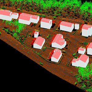
The 3D vectors for buildings are three-dimensional instances of the Building target category in the National Topographic Database (KMTK). The 3D vectors are produced with a high degree of automation from laser scanning data 5 p based on 2D vectors for buildings in KMTK. For the time being, data is available only from a few example areas, but the coverage will be extended to the whole of Finland as the laser scanning programme proceeds. The product belongs to the open data of the National Land Survey of Finland.
-
NLS-FI INSPIRE Buildings Theme Dataset is a dataset depicting the Buildings covering the whole of Finland. It contains the following INSPIRE feature types: Building The elements are updated weekly. The dataset is based on the NLS Topographic database: http://www.paikkatietohakemisto.fi/geonetwork/srv/en/main.home?uuid=cfe54093-aa87-46e2-bfa2-a20def7b036f. Id-attribute indicates the topographic database id for features (mtk-id). The dataset is available via the NLS-FI INSPIRE Download Service (WFS) for Buildings Theme and it can be viewed via the NLS-FI INSPIRE View Service (WMS) for Buildings.
-
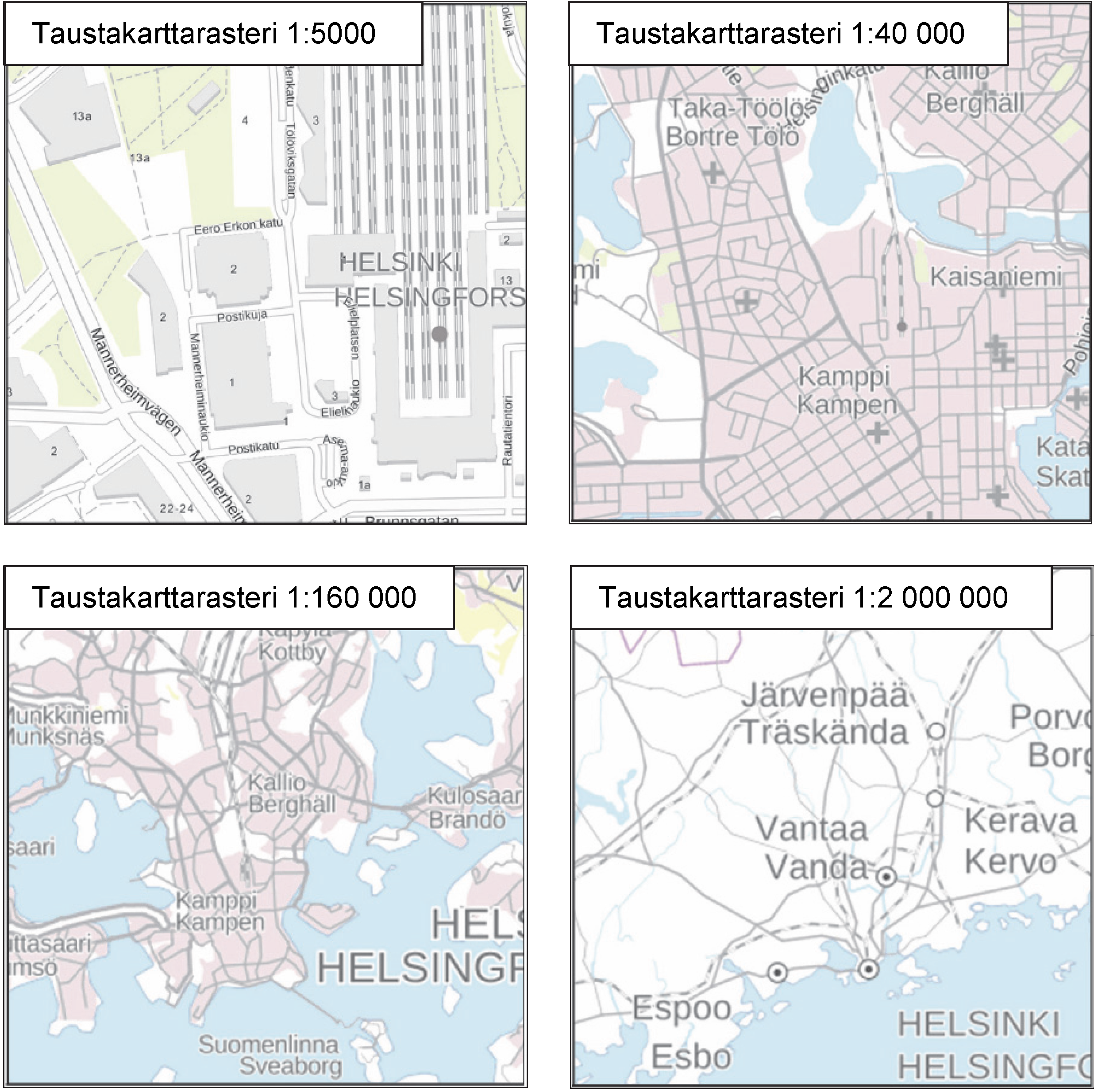
The Background map is a dataset product series in raster format that depicts the whole of Finland and that is meant for web use as a background material for thematic data. Its key objects are road names, roads and railways, buildings and constructions, administrative borders, geographical names, waterways, land use and addresses of buildings (from Ryhti/Finnish Environment Institute). The product belongs to the open data of the National Land Survey of Finland.
-
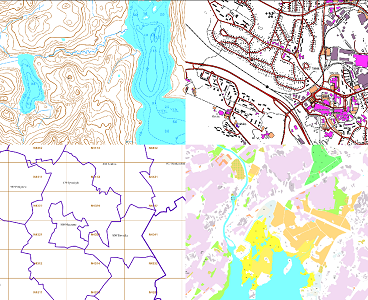
The themes of the Topographic database and Topographic map raster series (scale 1:10,000) have been compiled into seven theme entities, theme rasters, required by the Inspire directive: hydrography, elevation, traffic network, land use, land cover, place names and buildings. In addition to the above, the theme rasters also include the municipal division, road names and map sheet division as separate themes. The theme rasters have not been implemented according to the imaging technology defined in the Inspire directive. They will be produced later. The product belongs to the open data of the National Land Survey of Finland.
-
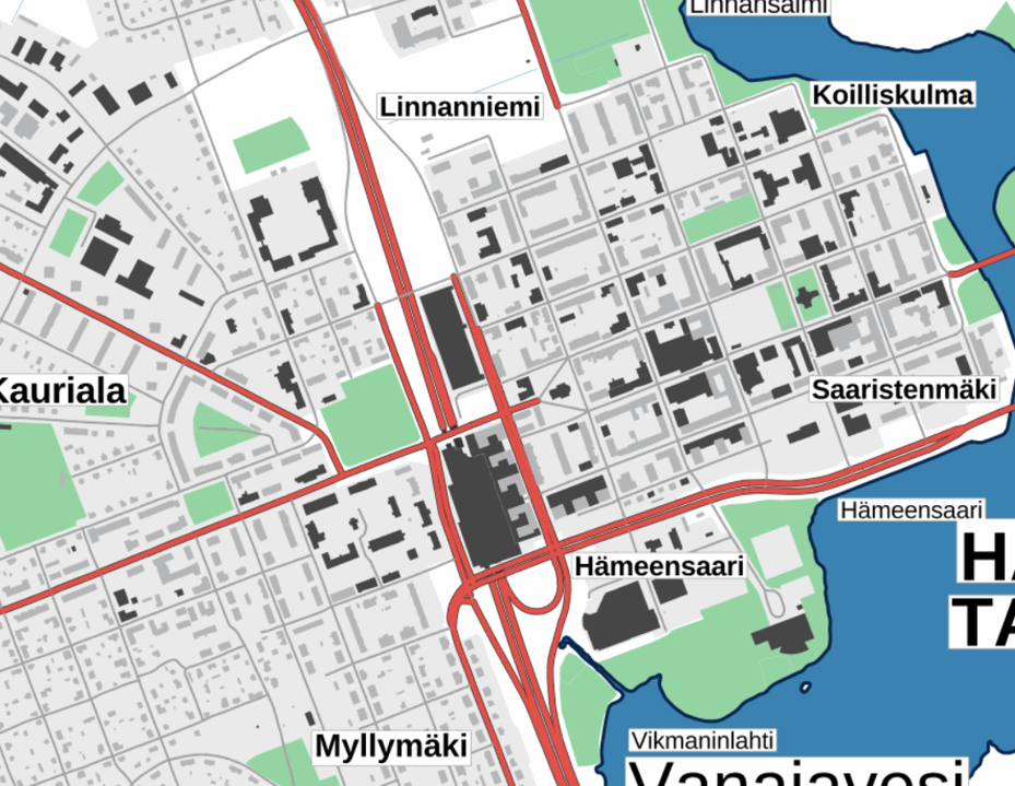
The Plain map series is a simple, plain and readable dataset product series in raster format that depicts the whole of Finland. The product is meant to be used as a background map whose character changes to a guide map in large scales. Impaired vision has been taken into account when designing the product. The key objects presented on the map are roads and railways, road names, buildings and constructions, administrative borders, waterways and other geographical names. The road network, public buildings and texts have been especially emphasised. The most usual limitations of colour vision have been taken into account in the use of colours. The product belongs to the open data of the National Land Survey of Finland.
-
-
 Paikkatietohakemisto