 Paikkatietohakemisto
vegetation
Type of resources
Available actions
Topics
Keywords
Contact for the resource
Provided by
Years
Formats
Representation types
Scale
-
Field biomass sidestreams GIS data describes the maximum harvestable sidestream potential based on current tillage. Sidestreams has been calculated by crop statistics, cultivation area, solid content and harvest index. Harvest index describes the part of the plant that is utilized as a crop. Rest of the plant is considered sidestream. In many cases the maximum sidestream cannot be necessarily utilized as whole, because of technical and economical constraints for harvest. Part of the sidestream is also wise to plough in to field to maintain its fertility. Field crop data is conducted from Luke's crop production statistics. The crop statistics in ELY centre level is divided into the Biomass Atlas grid weighting by the crop area of that certain plant. Crop area is from IACS-register, used to manage subsidies in agriculture. Farmers report their cultivation plans there every spring. Crop area and amount are from same year, usually previous year.
-
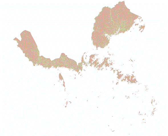
Tunturialueaineisto sisältää tunturikoivuvyöhykkeen ja paljakan eli yhtenäisen havumetsän pohjois- ja yläpuolella sijaitsevat alueet. Tunturialueen yhtenäinen ja yksiselitteinen määrittely hyödyttää esim. tuntureihin liittyviä kansallisia ja kansainvälisiä arviointeja sekä maankäyttö-, ilmasto- ja ekosysteemipalvelutarkasteluja. Aineisto on 20 m x 20 m rasteri, jonka lähtöaineistot on koottu usealta taholta. Lopputulos on laajan asiantuntijaryhmän hyväksymä. Tunturialue on luokitettu 3 luokkaan: 0 ei tunturialuetta 1 tunturikuvioiden alue 2 tunturikuvioihin mukaan luettava alue Tunturialueen kivennäismaa- ja kalliokuviot sisältyvät luokkaan 1 ja niihin liittyvät laajemmat suo- ja vesialueet luokkaan 2. Luokkaan 2 sisältyvät myös muut pienialaiset välialueet, joiden avulla tunturialue on rajattu eheämmäksi. Tunturialueaineistoon liittyy lähderasteri, joka kertoo mihin lähtöaineistoon kunkin pikselin arvo perustuu, sekä luokkia ja aineiston kokoamista kuvaava dokumentti. Aineisto kuuluu SYKEn avoimiin aineistoihin (CC BY 4.0). Käyttötarkoitus: Analyysit ja arvioinnit Lisätietoja: https://geoportal.ymparisto.fi/meta/julkinen/dokumentit/TunturialueaineistonLahdetiedot.pdf https://geoportal.ymparisto.fi/meta/julkinen/dokumentit/TunturialueaineistonTeko.pdf *** The fell area includes the mountain birch zone and sparsely vegetated / bare areas located above and north from the uniform coniferous forest. The data can be used in national and international assessments related to the fells, as well as land use, climate and ecosystem service reviews. The data is a 20 m x 20 m raster, the source data of which has been compiled from several parties. The result is approved by an extensive group of experts. The fell area is classified into 3 categories: 0 background 1 area of fell patterns 2 area to be included in the fell patterns The mineral soil and rock patterns of the fell area are included in category 1 and the associated wider bogs and water areas are included in category 2. Category 2 also includes other small sub-areas to make the fell area more intact. The fell area data is accompanied by a source raster, which tells which source data the value of each pixel is based, as well as a document describing the categories and compilation of the data (In Finnish). This SYKE’s dataset can be used according to open data license (CC BY 4.0).
-
Suokasvillisuuden aluejako perustuu suoyhdistymätyyppeihin. Jako on digitoitu teoksesta Suomen kartasto, vihko 141-143, Ruuhijärvi, R.1988: Suokasvillisuus. Merialueen vyöhykerajat on digitoitu R. Ruuhijärven erikseen määritteleminä v.2002. Aineisto kuuluu SYKEn avoimiin aineistoihin (CC BY 4.0). Aineistosta on julkaistu INSPIRE-tietotuote. Käyttötarkoitus: Aineistoa käytetään taustakarttojen tuottamiseen ja karkeisiin analyyseihin. The mire vegetation zones dataset includes information on vegetation zones based on combinations of different mire types. The distribution of zones has been digitized from the mire vegetation maps of the Finnish map book (Suomen kartasto, book 141-143, Ruuhijärvi, R 1998: Suokasvillisuus). The mire zones are extended to outer sea areas based on the identification made by R. Ruuhijärvi on 2002. The Finnish national borders are based on the Digital Chart of the World (DCW) dataset with coastline corrections done by Syke. The dataset has been fitted to match the outer borders of the national waters (digitized in Syke). This Syke’s dataset can be used according to open data license (CC BY 4.0). INSPIRE compatible dataset has been published.
-
Kaukokartoituksen ja paikkatiedon avulla tulkittiin inventointiluokkia Metsähallituksen Luontopalvelujen hallinnassa olevilla valtion suojelualueilla ja suojelutarkoituksiin varatuilla Ylä-Lapin alueilla. Inventointiluokka kuvaa kuviolla esiintyvää luontoa yleispiirteisesti. Se kuvaa pohja- ja kenttäkerroksen vallitsevaa kasvillisuutta ja soilla vedenpinnan tasoa eli mätäs-, väli- ja rimpipintoja. Aineisto on 10x10 m rasteri. Luokitukset erillisessä dokumentissa https://geoportal.ymparisto.fi/meta/julkinen/dokumentit/Ylalappi_luokitus.xls. Ylä-Lapin kaukokartoitushankkeen loppuraportti https://julkaisut.metsa.fi/julkaisu/yla-lapin-luonnon-kaukokartoitus-projektin-loppuraportti-osa-1-aineistot-ja-menetelmat/ Aineistoja on käytetty Ylä-Lapin biotooppitiedon päivitykseen. Aineistoja voi käyttää erilaissa selvityksissä ja ympäristöhallinnon tehtävien tukena. Aineisto kuuluu SYKEn avoimiin aineistoihin (CC BY 4.0) --- Northern Lapland: Inventory classes is produced by combining satellite-based remote sensing and field observations with GIS data. The data is a 10x10 m raster. The dataset will be available in the next Habitats Directive reporting and in the assessment of threatened habitats as well as in other surveys, assessments and studies, and they can be used in the implementation of the EU Biodiversity Strategy. More information: https://www.metsa.fi/en/project/remote-sensing-northern-lapland/ This SYKE’s dataset can be used according to open data license (CC BY 4.0)