 Paikkatietohakemisto
45000
Type of resources
Topics
Keywords
Contact for the resource
Provided by
Years
Formats
Representation types
status
Scale
-
The EMODnet (European Marine Observation and Data network) Geology project collects and harmonizes marine geological data from the European sea areas to support decision making and sustainable marine spatial planning. The partnership includes 39 marine organizations from 30 countries. The partners, mainly from the marine departments of the geological surveys of Europe (through the Association of European Geological Surveys-EuroGeoSurveys), have assembled marine geological information at various scales from all European sea areas (e.g. the White Sea, Baltic Sea, Barents Sea, the Iberian Coast, and the Mediterranean Sea within EU waters). This multiscale dataset includes EMODnet seabed substrate maps at a scale of 1:1 500, 1:5 000, 1:10 000, 1:15 000, 1:20 000, 1:25 000, 1:30 000, 1:45 000, 1: 50 000, 1:60 000, 1:70 000 from the European marine areas. Traditionally, European countries have conducted their marine geological surveys according to their own national standards and classified substrates on the grounds of their national classification schemes. These national classifications are harmonised into a shared EMODnet schema using Folk's sediment triangle with a hierarchy of 16, 7 and 5 substrate classes. The data describes the seabed substrate from the uppermost 30 cm of the sediment column. Further information about the EMODnet Geology project is available on the portal (http://www.emodnet-geology.eu/).
-
The EMODnet (European Marine Observation and Data network) Geology project collects and harmonizes marine geological data from the European sea areas to support decision making and sustainable marine spatial planning. The partnership includes 39 marine organizations from 30 countries. The partners, mainly from the marine departments of the geological surveys of Europe (through the Association of European Geological Surveys-EuroGeoSurveys), have assembled marine geological information at various scales from all European sea areas (e.g. the White Sea, Baltic Sea, Barents Sea, the Iberian Coast, and the Mediterranean Sea within EU waters). This dataset includes EMODnet seabed substrate maps at a scale of 1:45 000 from the European marine areas. Traditionally, European countries have conducted their marine geological surveys according to their own national standards and classified substrates on the grounds of their national classification schemes. These national classifications are harmonised into a shared EMODnet schema using Folk's sediment triangle with a hierarchy of 16, 7 and 5 substrate classes. The data describes the seabed substrate from the uppermost 30 cm of the sediment column. Further information about the EMODnet Geology project is available on the portal (http://www.emodnet-geology.eu/).
-
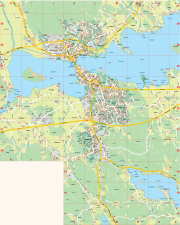
Opaskartta on yleistetty karttatuote, jonka ylläpitomittakaava koko kaupungin käsittävässä kartassa on 1:45000 ja taajamissa 1:10000. Opaskartan taajamat ovat Vammala, Keikyä, Kiikka, Karkku, Uotsola ja Häijää Opaskartalla on esitetty tiestö, nimistö, osoitenumeroita, maankäyttö sekä joitain palveluita Aineistoa ylläpidetään vektorimuodossa ja sitä päivitetään jatkuvasti.