 Paikkatietohakemisto
250000
Type of resources
Available actions
Topics
Keywords
Contact for the resource
Provided by
Years
Formats
Representation types
Update frequencies
status
Scale
-
National Land Survey's Topographic map in vector format is a dataset depicting the terrain of all of Finland. The most important elements are the road network, administrative borders, preservation areas, population centres, geographic names, waterways, land use and elevation. The largest scale level (1:100,000) of the Topographic map in vector format is produced by generalising from the Topographic database. Topographic map 1:250,000 is produced by generalising the dataset 1:100,000. Topographic map 1:1,000,000 is produced by generalising the dataset 1:250,000. Topographic map 1:4,500,000 is produced by generalising the dataset 1:1,000,000. The geographic names have been generalised from the geographic names in the Geographic Names Register to map names suited to the scale in question. The administrative borders in the Municipal Division of each scale are used as administrative borders. The product belongs to the open data of the National Land Survey of Finland.
-

Lack of spatial soil data in digital form has been a primary obstacle in establishing European policies on land use and environmental protection. Abundant data on soil characteristics exist in Finland but have been scattered among various sources, making it difficult for authorities to make country-wide presentations and predictions.The objective of the project was to create georeferenced soil map and database according to the instructions of the European Soil Bureau using data from existing databases and collecting some new data. The basis of the work was a geological map of quaternary deposits, which describes the soil at a depth of 1 metrem (parent material) according to the Finnish classification based on the concentration of organic matter and the texture of mineral material. Primary research topics included generalization methodology of soil polygons with GIS technology, calculation of soil characteristics needed in the database and computerizing the existing non-digital soil information. It was proved that aerial geophysics can be used for separation of shallow peats from deep peat soils and muddy soils and other wet areas can be identified. Soil names according to the FAO/Unesco system and the World Reference Base for Soil Resources (WRB-2014) were derived from the soil names of the Finnish soil classification system and geophysical data. Soilscape (Soil Mapping Units) of Finland with WRB-2014 soil classification, intented to be used in European scale e.g to delineate risk areas mentioned in soil framework directive proposal.
-
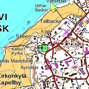
The Topographic map is a dataset depicting the terrain of all of Finland. The key elements in it are the road network, buildings and constructions, geographic names, waterways, land use and elevation. The more precise levels of the Topographic map consist of the same map objects and map symbols depicted in the same way as in the familiar Basic map. Basic map raster is applicable to be used, for instance, as a base map for planning land use or for excursion and outdoor recreational purposes in mobile devices and in various Internet services associated with nature. When going over to the more general datasets in the Topographic map, the number and visualisation of objects and map symbols changes. The generalised small-scale Topographic maps raster are applicable to be used as approach maps in e.g. mobile devices and Internet services. The product belongs to the open data of the National Land Survey of Finland.
-
The 1:250 000 data on the soft and hard areas of the seabed supplements the seabed substrate data produced by the Geological Survey of Finland (GTK) for areas for which actual survey data is unavailable. The data covers two categories; hard and soft seabed areas. The substrate types categorised as hard seabed areas cover types ranging from gravel to boulders and exposed rock, and the substrate types for soft seabed areas cover types from silt to sand. The model is based on the marine geological survey data of GTK, the substrate observations made by the Finnish Environment Institute (SYKE) and Metsähallitus, and on the environment variable data produced by the Finnish Inventory Programme for the Underwater Marine Environment, VELMU, particularly on depth and seabed openness models. The data has undergone statistical evaluation and the ultimate model is based on expert estimates and modelling. At its most precise, the data is at a scale of 1:250 000 and the areas with a size less than 0.3 square kilometres have been removed. The substrate type information pertaining to restricted areas has been removed from the final data. A permit (AK15246) for publishing data with a similar scale, i.e. the EMODnet data, was received from the Defence Command of the Finnish Defence Forces on 28 July 2014.
-

Division into administrative areas (raster) is a dataset depicting the municipal Division of Finland. The dataset Municipal Division is produced in scales 1:10,000, 1:100,000, 1:250,000, 1:1,000,000 and 1:4,500,000. The data included in the dataset in scale 1:10,000 are taken from the Cadastre. Regarding other scales, municipal boundaries have been generalised to suit the scale in question. Division into administrative areas products in raster format include municipal boundaries only. The product is a part of the open data of the National Land Survey.
-

Division into administrative areas (vector) is a dataset depicting the municipalities, regions, Regional State Administrative Agencies, and the national border of Finland. The Division into administrative areas products in vector format contain the number codes of the municipalities, the names of the municipalities in both Finnish and Swedish as well as municipal boundaries and municipal geographical areas. In addition, the products include the corresponding information about the regions, the Regional State Administrative Agencies, and the nation as well as a specification of the municipality's area into land and water area. The municipality's area is not included in the XML/GML and GeoPackage format. The dataset Municipal Division is produced in scales 1:10,000, 1:100,000, 1:250,000, 1:1,000,000 and 1:4,500,000. The data included in the dataset in scale 1:10,000 are taken from the Cadastre. Regarding other scales, municipal boundaries have been generalised to suit the scale in question. The product is a part of the open data of the National Land Survey.
-
The EMODnet (European Marine Observation and Data network) Geology project (http://www.emodnet-geology.eu/) collects and harmonizes marine geological data from the European sea areas to support decision- making and sustainable marine spatial planning. The partnership includes 36 marine organizations from 30 countries. The partners, mainly from the marine departments of the geological surveys of Europe (through the Association of European Geological Surveys-EuroGeoSurveys), have assembled marine geological information at a scale of 1:250 000 from all European sea areas (e.g. the White Sea, Baltic Sea, Barents Sea, the Iberian Coast, and the Mediterranean Sea within EU waters). This data includes the EMODnet seabed substrate map at a scale of 1:250 000 from the European marine areas. Traditionally, European countries have conducted their marine geological surveys according to their own national standards and classified substrates on the grounds of their national classification schemes. These national classifications are harmonized into a shared EMODnet schema using Folk's sediment triangle with a hierarchy of 16, 7 and 5 substrate classes. The data describes the seabed substrate from the uppermost 30 cm of the sediment column. The data has been generalized into a target scale (1:250 000). The smallest cartographic unit within the data is 0.3 km2 (30 hectares). Further information about the EMODnet-Geology project is available on the portal (http://www.emodnet-geology.eu/).
-
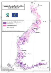
The data on acid sulfate soils in 1:250 000 scale contains material generated since 2009 on the existence and properties of sulfate soils on the Finnish coastal areas and their drainage basins roughly up to the highest shoreline of the ancient Litorina Sea. The data contains the following levels: - Acid sulfate soils, 1:250 000 maps o Probability of the existence of acid sulfate soils o Probability of the existence of coarse-grained acid sulfate soils - Acid sulfate soils, profile points on 1:250 000 maps - Acid sulfate soils, survey points on 1:250 000 maps - Acid sulfate soils, profile point fact sheets on 1:250 000 maps The data gives a general outlook on the properties and occurrence of acid sulfate soils. The regional existence of sulfate soils is presented as a regional map plane using a four-tiered probability classification: high, moderate, low and very low. These classifications are complemented with regional planar data on whether the acid sulfate soil is coarse-grained, since its properties are significantly different from typical fine-grained sulfate soils. The drilling point (profile points and survey points) observations and analysis data are presented as point-like data on the map and as profile point fact sheets linked to points The survey data can be utilised, for example, in the planning and execution of land use and water management as required by environmental protection and land use. The survey scale is 1:20 000 – 1:50 000. The observation point density is 1–2 / 2 km² on average, and the minimum area of the region-like pattern is usually 6 hectares. The surveys collected data on the lithostratigraphy, existence of sulfide and the depth where found, and the soil pH values. The survey depth is three metres. The laboratory analyses included the determination of elements with the ICP-OES method and pH incubation. The data is published in GTK’s Acid Sulfate Soils map service.
-
Seabed substrate 1:250 000 is one of the products produced in the EMODnet (European Marine Observation and Data network) Geology EU project. Project provided seabed geological material from the European maritime areas. The EMODnet Geology project (http://www.emodnet-geology.eu/) collects and harmonizes geological data from the European sea areas to support decision-making and sustainable marine spatial planning. The EMODnet Geology partnership has included 36 marine organizations from 30 countries. This data includes the EMODnet seabed substrate map at a scale of 1:250 000 from the Finnish marine areas. It is based on the data produced on a scale of 1:20 000 by the Geological Survey of Finland (GTK), which does not cover the whole Finnish marine area yet. The seabed substrate data will be updated with a new interpreted data on a yearly basis.The data has been harmonized and reclassified into five Folk substrate classes (mud, sandy clays, clayey sands, coarse sediments, mixed sediments) and bedrock. The data describes the seabed substrate from the uppermost 30 cm of the sediment column. The data have been generalized into a target scale (1:250 000). The smallest smallest cartographic unit within the data is 0.3 km2 (30 hectares). Further information about the EMODnet-Geology project is available on the portal (http://www.emodnet-geology.eu/). Permission (AK15246) to publish the material was obtained from the Finnish Defence Office 28.07.2014
-
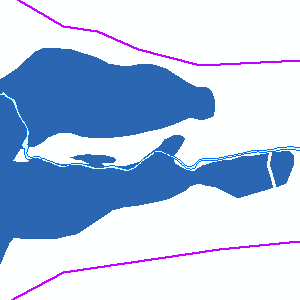
Havaittu tulva-alue on jonkun tietyn toteutuneen tulvan veden peittämä alue, joka on rajattu maastohavaintojen (tulva-alueen reunan merkitseminen tai kuvaaminen) tai kaukokartoitusaineiston (ilmakuvaus (stillkuvat/videointi) tai satelliittikuvat) perusteella. Tulkitulta tulvarajalta voidaan käydä mittaamassa myöhemmin tulvatilanteessa vallinneiden vedenkorkeuksien korkeusasemat. Satelliittikuvista voidaan tuottaa lähes reaaliaikaisia havaittuja tulva-alueita. Havaitut tulva-alueet on saatavilla tulva- ja tulkintakohtaisina karttatasoina. Samastakin tulvasta voi olla saatavilla useita eri karttatasoja, jos siitä on tulkittu tulva-alueet useista eri satelliitti- ja ilmakuvista. Toisaalta jostakin vanhemmasta tulvasta voi olla saatavilla tulvarajaus, josta on tiedossa vain pelkkä vuosi. Paikkatietoaineisto sisältää myös havainnoidun/tulkitun alueen rajauksen (esim. satelliitti- tai ilmakuvan rajaama alue). Lisäksi saatavilla on valtakunnallinen kooste kattaen kaikki aluerajaukset. Aineisto kuuluu SYKEn avoimiin aineistoihin (CC BY 4.0). Aineiston kuvaus: HavaittuTulva (havannoitu / tulkittu alue / detected area): HavTlv_id Kohteen numero / site number Nimi Kohteen nimi / site name Havaintovuosi Havaintovuosi / observation year HavaintoAika Havaintoaika (pvm ja aika / date and time) DigOrg Digitoinnin tehnyt organisaatio / organization where the digitization was done DigPohja Digitointimittakaava tai aineisto, jolta tulkinta tehty / scale MuutosPvm Pvm jolloin kohdetta tai siihen liittyviä tietoja on muokattu / date, when the data has been changed or updated Tietyn toteutuneen tulvan veden peittämä alue, esim. HavTlv_19660503_9999_Vantaa_Ortoilmakuva HavTlv_id Kohteen numero PeittavLuokka_id Peittävyysluokka Luokitus: 0 = kuiva maa (ei kaikissa) 1 = tulva-alue / flooded area 99 = vesistö/vesialue / water body -9 = tieto puuttuu / no data PeittavLuokka Peittävyysluokka DigOrg Digitoinnin tehnyt organisaatio DigPohja Digitointimittakaava tai aineisto, jolta tulkinta tehty MuutosPvm Pvm jolloin kohdetta tai siihen liittyviä tietoja on muokattu Lisätietoja: https://www.vesi.fi/tulvakartat https://www.vesi.fi/vesitieto/tulvakartoitus/ *** Brief in English The historic flood maps dataset (in Finnish Havaitut tulvat) includes data on detected (observed) floods indicating areas that have been covered by observed floods in some point of time. The historic flood maps can also be produced near real time using satellite images. The observed flood covered area has been outlined based on a field visits (marking or photographing the border area of the flood on site) or outlining has been done using remote sensing data (aerial photographs or satellite images). The border data can later be combined with information on water levels on marked water level measuring stations. Additional information and the flood map service: https://www.vesi.fi/en/water-topics/am-i-living-in-a-flood-risk-area/