Paikkatietohakemisto
Theme rasters
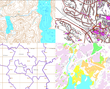
The themes of the Topographic database and Topographic map raster series (scale 1:10,000) have been compiled into seven theme entities, theme rasters, required by the Inspire directive: hydrography, elevation, traffic network, land use, land cover, place names and buildings. In addition to the above, the theme rasters also include the municipal division, road names and map sheet division as separate themes.
The theme rasters have not been implemented according to the imaging technology defined in the Inspire directive. They will be produced later.
The product belongs to the open data of the National Land Survey of Finland.
Simple
- Date (Publication)
- 2007-09-24
- Identifier
- FI / 1001108
- Purpose
-
The theme rasters are applicable to be used in base maps for planning land use or for excursion and outdoor recreational purposes in mobile devices and in various Internet services.
The background of the theme rasters is opaque so that they can be stacked one on the other and in this way desired map entities can be created.
- Maintenance and update frequency
- Continual
- Maintenance note
-
Continuous. The road network and geographic names are updated continuously, the administrative borders and the buildings yearly. The yearly updating data for the administrative borders are obtained from the material Municipal Division. Other features are updated one map sheet at a time in connection with the updating process of the Topographic database every 5–10 years.
Updating of the Topographic database (in Finnish): https://www.maanmittauslaitos.fi/peruspaikkatietojen-yllapito.
-
GEMET - INSPIRE themes, version 1.0
-
-
Administrative units
-
Elevation
-
Buildings
-
- Access constraints
- Other restrictions
- Other constraints
- no limitations to public access
- Use constraints
- Other restrictions
- Other constraints
- Attribution 4.0 International (CC BY 4.0)
- Other constraints
-
Mention the name of the Licensor (the National Land Survey of Finland), the name of the dataset(s) and the time when the National Land Survey has delivered the dataset(s) (e.g.: contains data from the National Land Survey of Finland Topographic Database 06/2014).
- Spatial representation type
- Grid
- Denominator
- 20000
- Distance
- 2 m
- Metadata language
-
fin
- Metadata language
-
swe
- Metadata language
- smn
- Metadata language
- sme
- Metadata language
- sms
- Character set
- 8859 Part 10
- Character set
- 8859 Part 15
- Topic category
-
- Imagery base maps earth cover
- Location
- Structure
- Transportation
- Elevation
- Boundaries
- Farming
- Inland waters
- Environment
))
- Supplemental Information
- Lämpar sig inte för navigering. Trafikverket har inte kontrollerat uppgifterna i denna produkt och ansvarar inte för att de är korrekta eller för ändringar som gjorts i efterhand. Not intended for navigational use. The Finnish Transport Agency has not checked the information in this product and is not responsible for its correctness or amendments made to the product.
- Reference system identifier
- EPSG / ETRS89 / TM35FIN(E,N) (EPSG:3067) / 8.6
- Reference system identifier
- EPSG / N60 height (EPSG:5717) N60 height (EPSG:5717) / 8.6
- Distribution format
-
-
PNG
(
)
-
PNG
(
)
- OnLine resource
-
Karttakuvapalvelu (WMTS)
(
WWW:LINK-1.0-http--link
)
Karttakuvapalvelu (WMTS)
- Hierarchy level
- Dataset
Conformance result
- Date (Publication)
- 2010-12-08
- Explanation
-
The product meets the specifications.
- Pass
- Yes
- Statement
-
The Topographic database is used as source data for the theme rasters.
The updating frequency varies depending on the feature (see Maintenance)
- Included with dataset
- No
- Date (Publication)
- 2020-01-01
- Other citation details
-
Hydrography
The theme Hydrography includes, for instance, the following features: standing water, watercourse, spring, water pit, rapids and shallows.
Elevation
Features in the theme Elevation are, for instance, contour line, altitude of water surface, escarpment, slope and declination line.
Traffic network
The theme Traffic networks describes, for instance, airfield runways, other airfield areas, roads and motor traffic areas, railways, ferries, small ferries, shipping channels and boating routes.
Land use
The theme Land use includes, for instance, the following features: cultivated land, park, forest land vegetation and other open space.
Land cover
The theme Land cover describes ground surface materials and extraction areas. Features are, for instance, mineral resources extraction area, rock, sand, rocky area, various swamps and boulders in water.
Place names
The theme Place names includes the names that have been chosen from the National Land Survey's index of geographical names to Basic map raster: terrain names, settlement names and names of individual features.
Buildings
The theme Buildings includes a large number of buildings that have been classified according to purpose and number of floors, e.g. industrial building, 1–2 floors; residential building, 3–n floors; and religious building.
Municipal division
Products in raster format include municipal boundaries only.
Road names
Road names is a raster product that covers the whole of Finland and includes the road and street names in the road network of the Topographic database.
Map sheet division
TM35 map-sheet division.
- File identifier
- a7889960-2d49-4129-bc6a-7f871710425e XML
- Metadata language
- Finnish
- Hierarchy level
- Dataset
- Hierarchy level name
-
Aineisto
- Date stamp
- 2025-06-06T13:44:49
Overviews
Spatial extent
Provided by