Paikkatietohakemisto
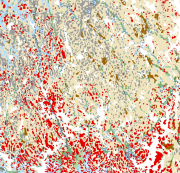
Maaperä 1:1 000 000
Superficial deposits of Finland 1:1 000 000
Maaperä 1:1 000 000 pohjautuu Suomen ja Venäjän Federaation luoteisosan maaperä ja sen raaka-ainevarat (Lehti 1- länsiosa) Suomen alueen 1:1 000 000 maaperäkartta-aineistoon. Aineisto pohjautuu Suomen Kartaston 5. laitoksen Geologia-vihkon (123-126, 1990) Suomen maaperä 1:1 000 000-aineistoon, joka painettiin vuonna 1984. Suomen ja Venäjän Federaation luoteisosan maaperän ja sen raaka-ainevarojen tieteellisteknillisen yhteistyökartan suunnittelu aloitettiin vuonna 1987 ja varsinaisen kartan työstö alkoi vuonna 1988. Karttaa varten ei tehty maastokartoitusta, vaan vuonna 1984 painettua 1:1 000 000 maaperäkarttaa täydennettiin osittain maa-ainestutkimusten ja muiden maaperäkartoitustöiden yhteydessä saaduilla uusilla maaperätiedoilla. Suomen ja Venäjän Federaation luoteisosan maaperä ja sen raaka-ainevarat -kartta painettiin vuonna 1993. Suomen ja Venäjän federaation luoteisosan maaperäkartta 1:1 000 000 esittää maaperää värein ja symbolein syntytavan mukaan luokiteltuina geologisina kerrostumina.
Kerrostumaluokkina kuvataan prekvartäärisen kallioperän paljastumia (kvartäärikerrostumat puuttuvat); rakka, kallioperän fysikaalinen rapauma; sora- ja hiekkamoreeni; silttimoreeni; savimoreeni; kumpumoreeni; moreenikompleksi; harju, delta, sanduri, lajittunut reunamuodostuma; saumaharju; moreenipeitteinen harju / muu moreenipeitteinen sora- ja hiekkakerrostuma; harjujen ulkopuolinen sora- ja hiekkakerrostuma; litoraalinen sora- ja hiekkakerrostuma; jokikerrostuma; homogeeninen savi- ja silttikerrostuma; kerrallinen savi- ja silttikerrostuma; turvekerrostuma. Symbolein on lisäksi kuvattu drumliinit; päätemoreenit; tuulikerrostumat; soran-, hiekan-, saven- ja turpeenottoalueita sekä kullanhuuhdonta-alueita.
Aineisto numeeristettiin OneGeology-Europe -projektin tarpeisiin painetusta kartasta vuonna 2009 lukuunottamatta drumliineja, päätemoreeneja ja tuulikerrostumia sekä tärkeimpiä kvartäärikerrostumien hyödyntämiskohteita (soran-, hiekan-, saven- ja turpeenottoalueita sekä kullanhuuhdonta-alueita).
Vuoden 1984 1:1 000 000 maaperäkartan mukaisesti maalajikuvion minimikoko on yleensä 1 km². Koska luonnossa maaperäkerrostumien koko on yleensä pienempi kuin 1 km², on kuviolla esitetty alueen yleisin kerrostumatyyppi. Paikoin on otettu huomioon maaperän kannalta merkittävät neliökilometriä pienemmätkin kerrostumat. Ohjeellinen kuvion kapein kohta oli 0,5 km ja tärkeissä tapauksissa esim. harjuilla 0,3 km. Poikkeuksena pienien harjujen kokoa on liioiteltu.
Maaperä 1:1 000 000-aineistolle on tehty koordinaatistomuunnos lokakuussa 2013. Muunnos kartastokoordinaattijärjestelmän yhtenäiskoordinaatistosta ETRS-TM35FIN -koordinaatistoon on tehty kolmioittaista affiinista muunnosta käyttäen.
OneGeology-Europe -projektissa käytetty vesistö on korvattu vuonna 2015 sijaintitarkkuudeltaan parempaan Hallinnon tietotekniikka keskuksen (HALTIK) -maastotietokannan 1:55 0000-1:500 000 (DVE3) vesistöön.
The Superficial deposits of Finland 1:1 000 000 is based on 'Quaternary Deposits of Finland and Northwestern Part of Russian Federation and their Resources (Sheet 1, Western part)' mapping data. This data is also based on the 1984 map 'Quaternary Deposits of Finland' (1:1 000 000) in the “Geologia” (Geology) folio of the Atlas of Finland, 5th edition (123-126, 1990). Joint scientific and technical planning for the map of the 'Quaternary Deposits of Finland and Northwestern Part of Russian Federation and their Resources' was begun in 1987 while work on the map started in 1988. No field mapping was done for the map, rather the 1:1 000 000 Quaternary map printed in 1984 was supplemented with new data partly obtained from rock aggregate studies and partly from information on superficial deposits gathered in other superficial mapping projects. The map 'Quaternary Deposits of Finland and Northwestern Part of Russian Federation and their Resources' was printed in 1993. The map shows the superficial deposits with colours and symbols and these are classed according to their mode of geological development.
The deposit classes are as follows: pre-Quaternary bedrock exposures (no Quaternary layers); boulder field, physically weathered bedrock; gravelly and sandy till; silty till; clayey till; hummocky moraine ; moraine complex; esker, delta, sandur, sorted marginal formation; interlobate formation (esker); till-covered esker / other till-covered gravel and sand deposit; gravel and sand deposit peripheral to eskers; littoral gravel and sand deposit; fluvial deposit; homogeneous clay and silt deposit; layered (varved) clay and silt deposit; peat deposit. Additionally, drumlins, end moraines, aeolian deposits, and sites of gravel, sand, clay and peat extraction as well as gold panning areas have been indicated with symbols.
The data set was converted to a digital format to meet the needs of the OneGeology-Europe Project for a printed map in 2009. This data did not include drumlins, end moraines, aeolian deposits, and more important sites for the exploitation of superficial deposits (sites of gravel, sand, clay and peat extraction as well as gold panning areas).
In accordance with the 1984 Quaternary map (1:1 000 000) the minimum size of the deposit polygon is generally one square kilometre. In nature the size of superficial sedimentary deposits is usually smaller than one square kilometre and therefore the most common deposit type in the area is shown in the polygon. In places, deposits smaller than a square kilometre that are significant from a superficial perspective have been noted. As a rule, the narrowest point of the deposit polygon was 0.5 km and in important cases, for example on eskers, 0.3 km. As an exception, the size of small eskers has been exaggerated.
Coordinate reference system of the Superficial deposits of Finland 1:1 000 000 was transformed in October 2013. The transformation from Finnish National Grid Coordinate System (Kartastokoordinaattijärjestelmä, KKJ) Uniform Coordinate Frame to ETRS-TM35FIN projection was done by using the three-dimensional transformation in accordance with the recommendations for the public administration JHS154.
The water layer which were used in the OneGeology-Europe project was replaced in 2015 with the more accurate water layer of the Topographic database 1:55 0000-1:500 000 (DVE3) from ICT Agency HALTIK.
Simple
-
Date (Publication)Päivämäärä (Julkaisu)
- 2010-11-22
- Point of contact
-
Organisation name Individual name Electronic mail address Role Geologian tutkimuskeskus
Geological Survey of Finland
OwnerOmistaja
-
Geosanasto
Geosanasto
-
-
Maaperä
Soils
-
Aluegeologia
Areal geology
-
Sedimentit
Sediments
-
Kallioperä
Bedrock
-
Louhikot
Block fields
-
Rakat
Physical weathering
-
Jäätikön kerrostama aines
Drift
-
Pohjamoreeni
Basal till
-
Kumpumoreenit
Hummocky moraines
-
Päätemoreenit
Terminal moraines
-
Drumliinit
Drumlins
-
Glasifluviaalinen sedimentaatio
Glaciofluvial sedimentation
-
Harjut
Eskers
-
Deltat
Deltas
-
Reunamuodostumat
Ice-marginal features
-
Sora
Gravel
-
Hiekka
Sand
-
Merisedimentit
Marine sediments
-
Järvisedimentit
Lake sediments
-
Siltti
Silt
-
Savi
Clay
-
Rantamuodostumat
Shore features
-
Dyynit
Eolian features
-
Fluviaaliset muodostumat
Fluvial features
-
Turve
Peat
-
-
PlacePaikka
-
-
Suomi
Finland
-
-
TemporalAikajakso
-
-
Kvartääri
Quaternary
-
-
DisciplineToimiala
-
-
Geologiset kartat
Geologic maps
-
Maaperäkartat
Surficial geology maps
-
-
GEMET - INSPIRE themes, version 1.0
-
-
Geologia
Geology
-
-
Alueellinen laajuus
-
-
Kansallinen
National
-
-
Access constraintsSaantirajoitteet
-
Other restrictionsMuut rajoitteet
-
Muut rajoitteetOther constraints
-
julkista saatavuutta ei ole rajoitettuno limitations to public access
-
Use constraintsKäyttörajoitteet
-
Other restrictionsMuut rajoitteet
-
Muut rajoitteetOther constraints
-
Nimeä 4.0 Kansainvälinen (CC BY 4.0)Attribution 4.0 International (CC BY 4.0)
-
Spatial representation typeSijaintitiedon esitystapa
-
VectorVektori
-
DenominatorMittakaavan nimittäjä
- 1000000
-
LanguageResurssin kieli
- Finnish
-
Topic categoryAiheluokka
-
-
Geoscientific informationGeotieteet
-
-
ProsessointiympäristöEnvironment description
-
Aineisto numeeristettiin OneGeology-Europe -projektin tarpeisiin painetusta kartasta vuonna 2009 lukuunottamatta drumliineja, päätemoreeneja ja tuulikerrostumia sekä tärkeimpiä kvartäärikerrostumien hyödyntämiskohteita (soran-, hiekan-, saven- ja turpeenottoalue sekä kullanhuuhdonta-alue). Skannattu ja georeferoitu kartta vektoroitiin TNTmips-ohjelmalla. Vektoriviivojen jatkoprosessointi tapahtui Fingis-ohjelmalla. Maaperäaineisto viimeisteltiin ja tarkistettiin ArcGIS-ohjelmistolla.
The data set was converted to digital format to meet the needs of the OneGeology-Europe Project for a printed map in 2009. This data did not include drumlins, end moraines, aeolian deposits, and more important sites for the exploitation of superficial deposits (sites of gravel, sand, clay and peat extraction as well as gold panning areas). The scanned and georeferenced map was converted to vector format with the TNTmips program. Further processing of the vector lines was carried out with the FINGIS program. The superficial data set was completed and checked using ArcGIS software
))
-
Unique resource identifier
-
EPSG:3067
-
Topology levelTopologian taso
-
Geometry onlyPelkkä geometria
- Distribution format
-
Name Version ESRI file gdb
ESRI file gdb
10.1
- OnLine resource
-
Protocol Linkage Name WWW:LINK-1.0-http--link
http://gtkdata.gtk.fi/Maankamara/index.html Maankamara
-
Hierarchy levelRaportoinnin laajuuden hierarkiataso
-
DatasetTietoaineisto
Conformance result
Vaatimuksenmukaisuus
- Title
-
KOMISSION ASETUS (EU) N:o 1089/2010, annettu 23 päivänä marraskuuta 2010, Euroopan parlamentin ja neuvoston direktiivin 2007/2/EY täytäntöönpanosta paikkatietoaineistojen ja -palvelujen yhteentoimivuuden osalta
-
Date (Publication)Päivämäärä (Julkaisu)
- 2010-12-08
-
Selitys
-
Tietotuotemäärittelyä ei ole vielä julkaistu.
-
PassSääntöjenmukaisuusaste
- No
-
Kuvaus aineiston historiastaStatement
-
Maaperä 1:1 000 000 -aineiston tausta-aineistona on käytetty vuonna 1984 painettua 1:1 000 000 maaperäkarttaa, jota täydennettiin osittain hiekka- ja soravarojen arviointityön ja eri mittakaavaisten muiden maaperäkartoitustöiden yhteydessä saaduilla uusilla maaperätiedoilla.
Maaperä 1:1 000 000 aineiston aikaansaamiseksi hyödynnettiin vuonna 1984 painettua 1:1 000 000 maaperäkarttaa sekä sen julkaisemisen jälkeen valmistuneita eri-ikäisiä ja mittakaavaisia maaperäkarttoja sekä maa-ainestutkimuksissa kertyneitä maaperätietoja. Suomen ja Venäjän Federaation luoteisosan maaperä ja sen raaka-ainevarat -kartta painettiin vuonna 1993.
Maaperä 1:1 000 000-aineistolle on tehty koordinaatistomuunnos lokakuussa 2013. Muunnos kartastokoordinaattijärjestelmän yhtenäiskoordinaatistosta ETRS-TM35FIN -koordinaatistoon on tehty kolmioittaista affiinista muunnosta käyttäen.
OneGeology-Europe-projektissa käytetty vesistö on korvattu vuonna 2015 sijaintitarkkuudeltaan parempaan Hallinnon tietotekniikka keskuksen (HALTIK) -maastotietokannan 1:55 0000-1:500 000 (DVE3) vesistöön.
A 1:1 000 000 Quaternary map printed in 1984 has been used as background material for the data set of the 1:1 000 000 map of 'Quaternary Deposits of Finland and the Northwestern Part of the Russian Federation'. The 1984 map has been supplemented with new superficial data in part from sand and gravel appraisal work and from other superficial mapping work.
The realisation of the 1:1 000 000 map of ‘Quaternary Deposits of Finland and the Northwestern Part of the Russian Federation’ data set benefited from a 1:1 000 000 Quaternary map printed in 1984 as well as superficial maps completed since at different time and scales and superficial data gathered in rock aggregate studies. The map 'Quaternary Deposits of Finland and Northwestern Part of Russian Federation and Their Resources' was printed in 1993.
Coordinate reference system of the Superficial deposits of Finland 1:1 000 000 was transformed in October 2013. The transformation from Finnish National Grid Coordinate System (Kartastokoordinaattijärjestelmä, KKJ) Uniform Coordinate Frame to ETRS-TM35FIN projection was done by using the three-dimensional transformation in accordance with the recommendations for the public administration JHS154.
The water layer which were used in the OneGeology-Europe project was replaced in 2015 with the more accurate water layer of the Topographic database 1:55 0000-1:500 000 (DVE3) from ICT Agency HALTIK.
-
DescriptionDescription
-
Maaperä 1:1 000 000 aineiston aikaansaamiseksi hyödynnettiin vuonna 1984 painettua 1:1 000 000 maaperäkarttaa sekä sen julkaisemisen jälkeen valmistuneita eri-ikäisiä ja mittakaavaisia maaperäkarttoja sekä maa-ainestutkimuksissa kertyneitä maaperätietoja. Suomen ja Venäjän Federaation luoteisosan maaperä ja sen raaka-ainevarat -kartta painettiin vuonna 1993.
Maaperä 1:1 000 000-aineistolle on tehty koordinaatistomuunnos lokakuussa 2013. Muunnos kartastokoordinaattijärjestelmän yhtenäiskoordinaatistosta ETRS-TM35FIN -koordinaatistoon on tehty kolmioittaista affiinista muunnosta käyttäen.
OneGeology-Europe-projektissa käytetty vesistö on korvattu vuonna 2015 sijaintitarkkuudeltaan parempaan Hallinnon tietotekniikka keskuksen (HALTIK) -maastotietokannan 1:55 0000-1:500 000 (DVE3) vesistöön.
Aineisto numeeristettiin OneGeology-Europe -projektin tarpeisiin painetusta kartasta vuonna 2009 lukuunottamatta drumliineja, päätemoreeneja ja tuulikerrostumia sekä tärkeimpiä kvartäärikerrostumien hyödyntämiskohteita (soran-, hiekan-, saven- ja turpeenottoalue sekä kullanhuuhdonta-alue). Skannattu ja georeferoitu kartta vektoroitiin TNTmips-ohjelmalla. Vektoriviivojen jatkoprosessointi tapahtui Fingis-ohjelmalla. Maaperäaineisto viimeisteltiin ja tarkistettiin ArcGIS-ohjelmistolla.
The realisation of the 1:1 000 000 map of ‘Quaternary Deposits of Finland and the Northwestern Part of the Russian Federation’ data set benefited from a 1:1 000 000 Quaternary map printed in 1984 as well as superficial maps completed since at different time and scales and superficial data gathered in rock aggregate studies. The map 'Quaternary Deposits of Finland and Northwestern Part of Russian Federation and Their Resources' was printed in 1993.
Coordinate reference system of the Superficial deposits of Finland 1:1 000 000 was transformed in October 2013. The transformation from Finnish National Grid Coordinate System (Kartastokoordinaattijärjestelmä, KKJ) Uniform Coordinate Frame to ETRS-TM35FIN projection was done by using the three-dimensional transformation in accordance with the recommendations for the public administration JHS154.
The water layer which were used in the OneGeology-Europe project was replaced in 2015 with the more accurate water layer of the Topographic database 1:55 0000-1:500 000 (DVE3) from ICT Agency HALTIK.
The data set was converted to digital format to meet the needs of the OneGeology-Europe Project for a printed map in 2009. This data did not include drumlins, end moraines, aeolian deposits, and more important sites for the exploitation of superficial deposits (sites of gravel, sand, clay and peat extraction as well as gold panning areas). The scanned and georeferenced map was converted to vector format with the TNTmips program. Further processing of the vector lines was carried out with the FINGIS program. The superficial data set was completed and checked using ArcGIS software.
-
File identifierTiedostotunniste
- 98dd3816-e223-4864-848b-f463796d0c29 XML
-
Metadata languageMetatiedon kieli
- Finnish
-
Hierarchy levelResurssin tyyppi
-
DatasetTietoaineisto
- Hierarchy level name
-
Aineisto
-
Date stampMetatiedon päiväys
- 2023-10-11T15:47:37
- Metadata author
-
Organisation name Individual name Electronic mail address Role Geologian tutkimuskeskus
Geological Survey of Finland
Point of contactYhteystaho
- Other language
-
Language Character encoding EnglishEnglish8859 Part 158859 Part 15FinnishFinnishUTF8UTF8