Paikkatietohakemisto
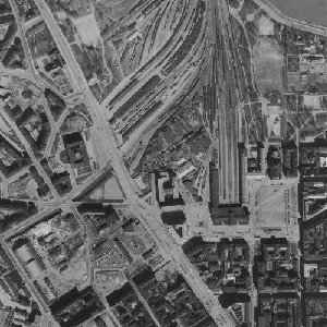
NLS Aerial photographs
An aerial photograph is a photograph of the terrain taken from an aeroplane. The images are vertical photographs applicable to be used in mapping. The aerial photographs are reprocessed into dimensionally accurate images called orthophotos.
Aerial photographs are available since the 1930s, depending on the area. Aerial photographs are available in black and white, colour and false colour. The size and accuracy of aerial photos depend on the camera, photography scale and altitude or ground sample distance (GSD).
The product belongs to the open data of the National Land Survey of Finland. Aerial photographs can be ordered by pieces that cover a certain area. The latest orthophotos based on the aerial photographs can be downloaded free of charge from the File service of open data.
Simple
- Date (Revision)
- 2010-04-01
- Identifier
- FI / 1000243
- Purpose
-
Aerial photos are used to make stereo models and orthophotos, which in turn are used for mapping. Aerial photos are used as such, for instance, for researching historical objects and analysing changes in the environment.
Oriented aerial photographs are used in stereoscopic photo interpretation for drawing up contour lines, for example. The oriented aerial photographs can be directly used in EspaCity software.
- Maintenance and update frequency
- As needed
- Maintenance note
-
New colour and false colour images are taken every three years, except for North Lapland, which is photographed approximately every 12 years. Aerial photography plans can be seen on the status map https://tilannekartta.maanmittauslaitos.fi/ilmakuva
Other product versions are not updated.
Information about areas photographed before 2020 is available on the National Land Survey's website: https://www.maanmittauslaitos.fi/laserkeilaus-ja-ilmakuvaus
Aerial photographs from different years are delivered as a separate delivery (see Distribution and further information).
-
GEMET - INSPIRE themes, version 1.0
-
-
Orthoimagery
-
-
Paikkatietohakemiston asiasanasto
-
-
Not-Inspire
-
- Access constraints
- Other restrictions
- Other constraints
- no limitations to public access
- Other constraints
-
Copyright and the other immaterial rights on the data set NLS Aerial photographs are owned by the National Land Survey of Finland. The data material is not confidential. Public access to the material is not restricted by the INSPIRE Directive. Areas defined by the Finnish Defence Forces may limit the access to aerial photographs in some regions.
- Use constraints
- Other restrictions
- Other constraints
- Attribution 4.0 International (CC BY 4.0)
- Other constraints
-
Mention the name of the Licensor (the National Land Survey of Finland), the name of the dataset(s) and the time when the National Land Survey has delivered the dataset(s) (e.g.: contains data from the National Land Survey of Finland Topographic Database 06/2014).
- Spatial representation type
- Grid
- Distance
- 0.25 m
- Distance
- 0.3 m
- Distance
- 0.4 m
- Distance
- 0.5 m
- Metadata language
- Finnish
- Character set
- 8859 Part 10
- Character set
- 8859 Part 15
- Topic category
-
- Imagery base maps earth cover
- Inland waters
- Environment
))
- Supplemental Information
-
Aerial photographs are available since the 1930s, depending on the area. Aerial photographs are available in black and white, colour and infrared.
The metadata of the aerial photographs is provided in connection with the delivery, if requested. Aerial photographs are available since the 1930s, depending on the area. Aerial photographs are available in black and white, colour and infrared.
The metadata of the aerial photographs is provided in connection with the delivery, if requested.
- Distribution format
-
-
Tiff
(
1.0
)
-
Tiff
(
1.0
)
- Transfer size
- 4000000
- OnLine resource
-
Separate delivery of material (chargeable)
(
WWW:LINK-1.0-http--link
)
Separate delivery of material (chargeable)
- OnLine resource
-
Copy of template Paikkatietopalvelun metatiedot (mallipohja) - monikielinen created at 2024-05-28T11:35:00Z
(
WWW:LINK-1.0-http--link
)
Copy of template Paikkatietopalvelun metatiedot (mallipohja) - monikielinen created at 2024-05-28T11:35:00Z
- Hierarchy level
- Dataset
Conformance result
- Date (Publication)
- 2010-11-23
- Explanation
-
The product does not meet the specifications.
- Pass
- No
- Statement
-
NLS aerial photographs function as the initial dataset in producing topographic data.
Aerial photographs are images that are taken from a plane with a sensor suitable for mapping purposes. The size of the area covered by the aerial photo depends on the photographing altitude. Until 2008, the NLS aerial photos were taken with a film camera, and since 2009, with a digital camera.
A digital aerial photo is produced of smaller pictures taken with eight cameras. The colour information is attached to the panchromatic high-resolution picture by a technique called pansharpening. The result is a picture that consists of four colour channels (red, blue, green and near-infrared).
The positional accuracy of an object depends on the structure and altitude of the camera. The images are affected by geometric defect due to central projection and altitude differences in the terrain. The defect is greatest near the edges of the image and smallest in the middle.
- Included with dataset
- No
- Date (Revision)
- 2010-03-31
- Other citation details
-
Film, 1:16 000 black-and-white
A black-and-white aerial photograph consists of a maximum of 256 different greyscale values.
Film, 1:31 000 black-and-white
A black-and-white aerial photograph consists of a maximum of 256 different greyscale values.
Film, 1:31 000 colour-infrared
In addition to visible light, the heat radiation (infrared radiation) reflected by the photographed objects is shown on the photo, consists of three colour channels (near-IR, red, green) each colour channel contains a maximum of 256 different shade values.
Film, 1:20 000 black-and-white
A black-and-white aerial photograph consists of a maximum of 256 different greyscale values.
Film, 1:20 000 colour-infrared
In addition to visible light, the heat radiation (infrared radiation) reflected by the photographed objects is shown on the photo, consists of three colour channels (near-IR, red, green), each colour channel contains 256 different shade values.
Digital pixel size 0.5 m all colour channels
Consists of four colour channels (red, green, blue and near-IR).
Digital pixel size 0.4 m all colour channels
Consists of four colour channels (red, green, blue and near-IR).
Digital pixel size 0.3 m all colour channels
Consists of four colour channels (red, green, blue and near-IR).
Digital pixel size 0.25 m all colour channels
Consists of four colour channels (red, green, blue and near-IR).
- File identifier
- 5b512e40-2c4c-43ff-819f-749c385811b4 XML
- Metadata language
- Finnish
- Character set
- 8859 Part 10
- Hierarchy level
- Dataset
- Hierarchy level name
-
Aineisto
- Date stamp
- 2024-05-28T14:39:38
- Metadata standard name
-
ISO 19115:2003/19139
- Metadata standard version
-
1.0
Overviews
Spatial extent
Provided by