 Paikkatietohakemisto
Elevation zones (raster)
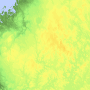
Elevation zones is a raster dataset that visualises elevation of the terrain. The product covers the whole of Finland. There are four product versions available in which the pixel sizes are 32, 64, 128 and 512 metres. The dataset does not contain elevation values; it is a colour image that visualises the height of the terrain above sea level as zones. The sea is shown in light blue in the elevation zone. The product Elevation zones is available as a version that covers the whole country and as versions that cover a certain area.
The product belongs to the open data of the National Land Survey of Finland.
Simple
- Date (Creation)
- 2011-11-07
- Citation identifier
- FI / 1000376
- Purpose
-
The dataset Elevation zones can be used as a background map material to visualise the topography of the terrain (height above sea level).
- Point of contact
-
Organisation name Individual name Electronic mail address Role National Land Survey of Finland
Owner
- Maintenance and update frequency
- As needed
- Maintenance note
-
All rasters have been updated in October 2015.
The Elevation zones (raster) product is based on the Elevation model 10 m product, which in turn consists of the data in Elevation model 2 m. If there are changes in the source data, the Elevation zones product is updated in the services once a month (see Distribution and further information).
-
GEMET - INSPIRE themes, version 1.0
-
-
Elevation
-
-
Paikkatietohakemiston asiasanasto
-
-
Not-Inspire
-
avoindata.fi
-
Elevation models
-
- Access constraints
- Other restrictions
- Other constraints
- no limitations to public access
- Other constraints
-
Copyright and other immaterial rights on the dataset Elevation zones are owned by the National Land Survey of Finland. The data material is not confidential. Public access to the material is not restricted by the INSPIRE Directive.
- Use constraints
- Other restrictions
- Other constraints
- Attribution 4.0 International (CC BY 4.0)
- Other constraints
-
Mention the name of the Licensor (the National Land Survey of Finland), the name of the dataset(s) and the time when the National Land Survey has delivered the dataset(s) (e.g.: contains data from the National Land Survey of Finland Topographic Database 06/2014).
- Spatial representation type
- Grid
- Distance
- 32 m
- Distance
- 64 m
- Distance
- 128 m
- Distance
- 512 m
- Language
- Finnish
- Language
- Swedish
- Topic category
-
- Location
- Elevation
))
- Supplemental Information
-
The 512 m pixel version can be downloaded as an image covering the whole of Finland. Other versions can be downloaded by map sheet.
- Distribution format
-
Name Version GeoTIFF
1.0
- Distributor contact
-
Organisation name Individual name Electronic mail address Role National Land Survey of Finland
Owner
- OnLine resource
-
Protocol Linkage Name WWW:LINK-1.0-http--link
https://asiointi.maanmittauslaitos.fi/karttapaikka/tiedostopalvelu/korkeusvyohykkeet MapSite Download geospatial data section
- OnLine resource
-
Protocol Linkage Name WWW:LINK-1.0-http--link
https://www.maanmittauslaitos.fi/asioi-verkossa/paikkatietoikkuna Geodata Portal Paikkatietoikkuna
- OnLine resource
-
Protocol Linkage Name WWW:LINK-1.0-http--link
https://www.maanmittauslaitos.fi/paikkatiedon-tiedostopalvelu Paikkatiedon tiedostopalvelu (OGC API Processes) (in Finnish)
- Hierarchy level
- Dataset
Conformance result
- Title
-
Commission Regulation (EU) No 1089/2010 of 23 November 2010 implementing Directive 2007/2/EC of the European Parliament and of the Council as regards interoperability of spatial data sets and services
- Date (Publication)
- 2010-11-23
- Pass
- No
- Statement
-
Elevation zones is produced from Elevation model 10 m.
- File identifier
- 66619eca-42bb-47b2-9d8d-364fc839e0d7 XML
- Metadata language
- Finnish
- Hierarchy level
- Dataset
- Hierarchy level name
-
Aineisto
- Date stamp
- 2023-06-15T13:24:46
- Metadata author
-
Organisation name Individual name Electronic mail address Role National Land Survey of Finland
Point of contact
- Other language
-
Language Character encoding Swedish UTF8 English UTF8 Finnish UTF8