 Paikkatietohakemisto
Rock geochemical data of Finland
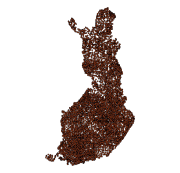
The Rock Geochemical Database of Finland data set describes the concentrations of major and trace elements in the bedrock of Finland. In all, 6544 samples were analysed for the total and partial concentrations of 57 elements using several different methods (XRF, ICP-MS, ICP-AES, GFAAS). The samples were taken during 1990-1995 with a mini-drill from rock that was as unaltered as possible. The sampling density varies between one sample per 30 km2 and one sample per 120 km2. The chemical analyses of the data were performed during 1992-2001. The reproducibility of the analytical results and the analytical drift were estimated using 375 duplicate sample pairs. The lowest reliable concentration was determined for each element and analytical method. In addition to the chemical concentrations, the database contains spatial data and several geological attributes for each sample. The data set and its manual were published in 2007 and they are available via the web site of the Geological Survey of Finland (GTK).
Simple
- Alternate title
-
Litogeokemian tietokanta
- Date (Publication)
- 2014-01-29
- Edition
-
1.0
- Unique resource identifier
- http://paikkatiedot.fi/so/1000164
- Presentation form
- digitalGeographicInfo
- Purpose
-
The data is suitable for site specific - regional geological studies: for example in the genetic and tectonic classification of rocks, in determining metallogenic provinces, in studying crustal origin and development and in interpreting regional till geochemical data. The data can also be used outside the field of geological research, for example in the medical sciences and in environmental research.
Because of the low density of the sample point grid, the material is not suitable for the study of areas with a small surface area.
- Status
- Completed
0295032901
- Maintenance and update frequency
- Not planned
-
Geosanasto
-
-
Geochemistry
-
Bedrock
-
Data bases
-
- Place
-
-
Finland
-
- Temporal
-
-
Archaean
-
Proterozoic
-
Paleozoic
-
-
GEMET - INSPIRE themes, version 1.0
-
-
Geology
-
-
Paikkatietohakemiston asiasanasto
-
-
Not-Inspire
-
avoindata.fi
-
- Access constraints
- Other restrictions
- Other constraints
- no limitations to public access
- Use constraints
- Other restrictions
- Other constraints
- Attribution 4.0 International (CC BY 4.0)
- Spatial representation type
- Vector
- Metadata language
- Finnish
- Character set
- 8859 Part 15
- Topic category
-
- Geoscientific information
- Environment description
-
The rock samples were taken with a mini-drill and were processed and analysed using standard methods in the geochemical laboratory of Geological Survey of Finland (GTK). Crushing was carried out with an iron-manganese jaw crusher. The crushed samples were divided using a riffle splitter and then pulverised in a ring mill in tungsten carbide and carbon steel bowls. Chemical analyses were performed with XRF, ICP-AES, GFAAS and ICP-MS equipment as well as with a carbon analyser. Statistical processing of the data for the determination of reproducibility and the lowest reliable concentration was performed with SYSTAT statistical software.
))
- Reference system identifier
- EPSG / ETRS89 / ETRS-TM35FIN (EPSG:3067) / 7.4
- Topology level
- Geometry only
- Distribution format
-
-
ESRI file gdb
(
10.1
)
-
MS_excel
(
Microsoft Office Excel 97-2003
)
-
ESRI file gdb
(
10.1
)
- OnLine resource
- http://hakku.gtk.fi/fi/locations/search?location_id=4 ( WWW:LINK-1.0-http--link )
- Hierarchy level
- Dataset
Conformance result
- Date (Publication)
- 2010-12-08
- Explanation
-
Aineisto ei ole INSPIRE-tietotuotemäärittelyn mukainen
- Pass
- No
- Statement
-
In sampling the Finnish rock geochemical data, maps at a scale of 1:50 000 were used in establishing location. Coordinates stored in the data set have been measured for sample points marked on field maps. Other information is based on geological field observations and on chemical analyses performed on samples.
Sampling and chemical analysis methods have been described in detail in the Geological Survey of Finland Report of Investigation 164.
The sampling was performed during 1990-1995. In planning sampling, the lithological variation displayed on geological maps was taken into account such that the amount of sample points in an area depended on the number of lithological units in an area. The sampling density varies between one sample per 30 km2 and one sample per 120 km2. Geologists chose the preliminary sampling sites on the basis of geological maps at a scale of 1:100 000. If a map at a scale of 1:100 000 was not available, a map at a scale of 1:400 000 was used. Sampling was performed by 16 two-person teams, each consisting of a geological student and a field assistant. The most representative sampling site was sought from a pre-selected area. Often it was necessary to clear moss to expose the best sampling and observation site. The recommended outcrop size was 10 m2 but it was necessary to take 40 % of the samples from smaller outcrops. The median size of the outcrops sampled was 10 m2 and the interquartile range (25%-75%) was 6-30 m2. A distinct and homogeneous lithological unit was chosen as a sampling site. A duplicate sample was taken from approximately every 17th locality in addition to a normal sample.
The samples were taken with a portable mini-drill. Drill core samples were 15-25 cm long and 2.5 cm in diameter. Visibly weathered parts of the samples were removed. To avoid contamination, new drill bits were first drilled into pure quartz vein.
Each sample consists of four to six subsamples, depending on the heterogeneity and grain size of the unit in question. In layered or banded rocks in which such features were over 5 cm in thickness, samples were taken from a single band or layer. In other cases, samples were taken from several bands or layers. In addition to the samples taken for chemical analysis, one orientated drill core was collected from each sampling point as reference material.
The sampling team leader filled in a field observation form for each sampling site. Lithologies and their age relationships, petrographic, textural and structural features, deformation, migmatisation and alteration were recorded on the form. A geological map of the outcrop with the subsample points marked was sketched on the reverse side of the observation form. Some of the sampling sites were photographed. The geologists in charge of the project carried out field visits to synchronise the observations made by different sampling teams.
Sample pre-processing and chemical analyses were performed at the geochemical laboratory of the Geological Survey of Finland (GTK) between 1992 and 2001. The samples were crushed to a grain size less than five millimetres using an iron-manganese jaw crusher. The crushed sample was split into three portions with a riffle splitter and one of these was stored. About 200 g was separated, again using a riffle splitter, from each of the remaining portions for pulverisation to a grain size of < 60 µm with a ring mill. One 200 g portion was pulverised in a carbon steel bowl and the other in a tungsten carbide bowl. The powders were stored in plastic vials. In the laboratory a duplicate sample was also prepared for those sites from which a field duplicate sample had been taken.
The samples were analysed with several different methods (XRF, ICP-MS, ICP-AES, GFAAS). Total carbon was measured with a carbon analyser and total fluorine was determined potentiometrically. The sample material that had been pulverised in a tungsten carbide bowl was used in XRF, carbon and fluorine analyses and the material powdered in a carbon steel bowl was used in the other determinations.
Reproducibility and the lowest reliable concentration were calculated for each of the analytical results using 375 laboratory duplicate samples. Reproducibility at a confidence level of 95 % was determined using paired normal and laboratory duplicate samples. The lowest reliable concentration was determined with the same sample pairs.
- Description
-
Sampling and chemical analysis methods have been described in detail in the Geological Survey of Finland Report of Investigation 164.
The sampling was performed during 1990-1995. In planning sampling, the lithological variation displayed on geological maps was taken into account such that the amount of sample points in an area depended on the number of lithological units in an area. The sampling density varies between one sample per 30 km2 and one sample per 120 km2. Geologists chose the preliminary sampling sites on the basis of geological maps at a scale of 1:100 000. If a map at a scale of 1:100 000 was not available, a map at a scale of 1:400 000 was used. Sampling was performed by 16 two-person teams, each consisting of a geological student and a field assistant. The most representative sampling site was sought from a pre-selected area. Often it was necessary to clear moss to expose the best sampling and observation site. The recommended outcrop size was 10 m2 but it was necessary to take 40 % of the samples from smaller outcrops. The median size of the outcrops sampled was 10 m2 and the interquartile range (25%-75%) was 6-30 m2. A distinct and homogeneous lithological unit was chosen as a sampling site. A duplicate sample was taken from approximately every 17th locality in addition to a normal sample.
The samples were taken with a portable mini-drill. Drill core samples were 15-25 cm long and 2.5 cm in diameter. Visibly weathered parts of the samples were removed. To avoid contamination, new drill bits were first drilled into pure quartz vein.
Each sample consists of four to six subsamples, depending on the heterogeneity and grain size of the unit in question. In layered or banded rocks in which such features were over 5 cm in thickness, samples were taken from a single band or layer. In other cases, samples were taken from several bands or layers. In addition to the samples taken for chemical analysis, one orientated drill core was collected from each sampling point as reference material.
The sampling team leader filled in a field observation form for each sampling site. Lithologies and their age relationships, petrographic, textural and structural features, deformation, migmatisation and alteration were recorded on the form. A geological map of the outcrop with the subsample points marked was sketched on the reverse side of the observation form. Some of the sampling sites were photographed. The geologists in charge of the project carried out field visits to synchronise the observations made by different sampling teams.
Sample pre-processing and chemical analyses were performed at the geochemical laboratory of the Geological Survey of Finland (GTK) between 1992 and 2001. The samples were crushed to a grain size less than five millimetres using an iron-manganese jaw crusher. The crushed sample was split into three portions with a riffle splitter and one of these was stored. About 200 g was separated, again using a riffle splitter, from each of the remaining portions for pulverisation to a grain size of < 60 µm with a ring mill. One 200 g portion was pulverised in a carbon steel bowl and the other in a tungsten carbide bowl. The powders were stored in plastic vials. In the laboratory a duplicate sample was also prepared for those sites from which a field duplicate sample had been taken.
The samples were analysed with several different methods (XRF, ICP-MS, ICP-AES, GFAAS). Total carbon was measured with a carbon analyser and total fluorine was determined potentiometrically. The sample material that had been pulverised in a tungsten carbide bowl was used in XRF, carbon and fluorine analyses and the material powdered in a carbon steel bowl was used in the other determinations.
Reproducibility and the lowest reliable concentration were calculated for each of the analytical results using 375 laboratory duplicate samples. Reproducibility at a confidence level of 95 % was determined using paired normal and laboratory duplicate samples. The lowest reliable concentration was determined with the same sample pairs.
The rock samples were taken with a mini-drill and were processed and analysed using standard methods in the geochemical laboratory of Geological Survey of Finland (GTK). Crushing was carried out with an iron-manganese jaw crusher. The crushed samples were divided using a riffle splitter and then pulverised in a ring mill in tungsten carbide and carbon steel bowls. Chemical analyses were performed with XRF, ICP-AES, GFAAS and ICP-MS equipment as well as with a carbon analyser. Statistical processing of the data for the determination of reproducibility and the lowest reliable concentration was performed with SYSTAT statistical software.
- Description
-
In sampling the Finnish rock geochemical data, maps at a scale of 1:50 000 were used in establishing location. Coordinates stored in the data set have been measured for sample points marked on field maps. Other information is based on geological field observations and on chemical analyses performed on samples.
- File identifier
- db8a66fa-e319-4c50-92e8-924db7693838 XML
- Metadata language
- Finnish
- Character set
- 8859 Part 15
- Hierarchy level
- Dataset
- Hierarchy level name
-
Kalliogeokemia
- Date stamp
- 2024-02-15T14:57:58
0295032901
Overviews
Spatial extent
Provided by
