 Paikkatietohakemisto
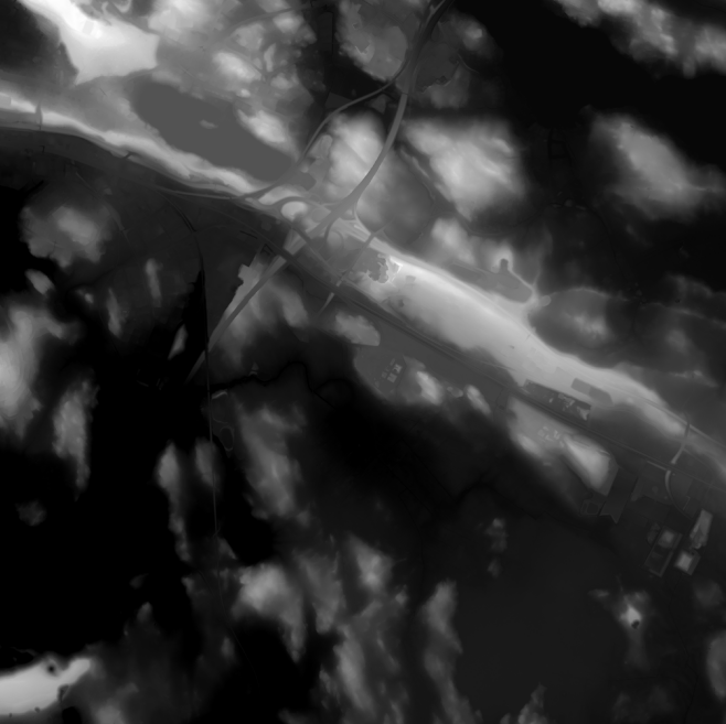
Elevation model 2 m
Elevation model 2 m is a model depicting the elevation of the ground surface in relation to sea level. Its grid size is 2 m x 2 m. The dataset is based on laser scanning data, the point density of which is at least 0.5 points per square metre. The product's coverage is based on nationwide laser scanning. In some parts of the outer archipelago or the eastern border, the elevation model is not available.
Elevation model 2 m is produced in two quality classes: the elevation accuracy in class I is on average 0.3 metres and the elevation accuracy in class II varies between 0.3 metres and one metre.
The product belongs to the open data of the National Land Survey of Finland.
Simple
- Alternate title
-
Digital elevation model 2 m
- Alternate title
-
Digital elevation model 2 m
- Date (Revision)
- 2010-04-01
- Purpose
-
The elevation model allows for example simulation of areas with a high risk of flooding or that of receiving, coverage and service areas. The model can also be used for mass calculation of excavated material and land-fill and for calculating inclinations, steepness or profiles. Application areas are found, for example in geol-ogy, geography and forestry.
- Point of contact
-
Organisation name Individual name Electronic mail address Role National Land Survey of Finland
Owner
- Maintenance and update frequency
- As needed
- Maintenance note
-
The product is updated as necessary. The elevation model is updated according to the laser scanning of the previous season if significant changes have been detected on the Earth's surface.
Map of the current status: https://tilannekartta.maanmittauslaitos.fi/km2
The product is available from the NLS MapSite's Download geospatial data -section according to the above-described updating rhythm.
- Metadata author
-
Organisation name Individual name Electronic mail address Role National Land Survey of Finland
Owner
-
GEMET - INSPIRE themes, version 1.0
-
-
Elevation
-
- Keywords
-
-
Arctic SDI_DEM
-
-
Paikkatietohakemiston asiasanasto
-
-
Elevation
-
avoindata.fi
-
- Access constraints
- Other restrictions
- Other constraints
- no limitations to public access
- Use constraints
- Other restrictions
- Other constraints
- Attribution 4.0 International (CC BY 4.0)
- Other constraints
-
Mention the name of the Licensor (the National Land Survey of Finland), the name of the dataset(s) and the time when the National Land Survey has delivered the dataset(s) (e.g.: contains data from the National Land Survey of Finland Topographic Database 06/2014).
- Spatial representation type
- Grid
- Distance
- 2 m
- Language
- Finnish
- Character set
- 8859 Part 10
- Character set
- 8859 Part 15
- Topic category
-
- Location
- Elevation
- Description
-
Osa Suomea
))
- Number of dimensions
- 2
- Dimension name
- Row
- Dimension size
- 3000
- Resolution
- 2 m
- Dimension name
- Column
- Dimension size
- 3000
- Resolution
- 2 m
- Transformation parameter availability
- No
- Distribution format
-
Name Version Ascii grid
1
GeoTiff
1
Distributor
- Distributor contact
-
Organisation name Individual name Electronic mail address Role National Land Survey of Finland
Owner
- OnLine resource
-
Protocol Linkage Name WWW:LINK-1.0-http--link
https://asiointi.maanmittauslaitos.fi/karttapaikka/tiedostopalvelu/korkeusmalli MapSite Download gespatial data section
- OnLine resource
-
Protocol Linkage Name WWW:LINK-1.0-http--link
https://www.maanmittauslaitos.fi/paikkatiedon-tiedostopalvelu Paikkatiedon tiedostopalvelu (OGC API Processes) (in Finnish)
- OnLine resource
-
Protocol Linkage Name WWW:LINK-1.0-http--link
https://www.paikkatietohakemisto.fi/geonetwork/srv/api/records/174c57fd-deaa-4af4-aa9d-eafdd469382e Ortokuvien ja korkeusmallien kyselypalvelu (WCS) palvelukuvaus
https://avoin-paikkatieto.maanmittauslaitos.fi/tiedostopalvelu/ogcproc/v1/ Paikkatiedon tiedostopalvelun (OGC API Processes) rajapintaosoite
https://avoin-karttakuva.maanmittauslaitos.fi/ortokuvat-ja-korkeusmallit/wcs/v2?service=WCS&request=GetCapabilities Ortokuvien ja korkeusmallien kyselypalvelu (WCS) rajapintaosoite
- Date (Revision)
- 2022-01-01
- Other citation details
-
Elevation model 2 m depicts the height of the terrain above sea level. The height values are in accordance with the system N2000.
Elevation model 2 m is the most accurate elevation model of Finland which covers extensive areas. Approximately 40,000 square kilometres are added into the model every year.
- File identifier
- 053a0a20-abfa-4bf9-ac74-270e845654d1 XML
- Metadata language
- Finnish
- Character set
- 8859 Part 10
- Hierarchy level
- Dataset
- Hierarchy level name
-
Aineisto
- Date stamp
- 2025-03-04T14:38:51
- Metadata standard name
-
ISO 19115:2003/19139
- Metadata standard version
-
1.0
- Metadata author
-
Organisation name Individual name Electronic mail address Role National Land Survey of Finland
Point of contact
- Other language
-
Language Character encoding Swedish UTF-8 English UTF-8 Finnish UTF8