 Paikkatietohakemisto
service
Type of resources
Available actions
Topics
Keywords
Contact for the resource
Provided by
Years
Formats
Representation types
Update frequencies
Service types
Scale
Resolution
-
Harvester Seasons is a service designed to help with estimating evolving trafficability conditions in forested terrain based on weather and model forecast information. The full service is currently provided for the geographical area of Finland.
-
Sitowisen tuottama asemakaavayhdelmä sisältää kuntien rajapinnoista luettavat ajantasa-asemakaavat, jotka kootaan yhteen. Asemakaava-aineistot luetaan kuntien WFS- ja WMS-rajapinnoista ja sisältö vaihtelee kunnittain. Aineisto on saatavilla Liiterin käyttäjille tai Sitowisen Aino-palvelun kautta. Aineistot päivittyvät kuntien palveluissa kuntien omaan tahtiin. Rajapintaosoitteiden päivitykset tehdään kerran vuodessa, yleensä syksyisin. Viimeisin päivitys 01/2024. Aineiston lähde: kukin kunta. Palveluntarjoaja ei vastaa mistään vahingoista tai muista haitallisuuksista, joita virheelliset tai riittämättömät aineistot ja tiedot mahdollisesti aiheuttavat Käyttäjälle tai kolmansille osapuolille. Käyttäjän tulee tarvittaessa varmistaa aineiston oikeellisuus ja riittävyys asiasta vastaavalta viranomaiselta.
-
NLS-FI INSPIRE View Service for Orthoimagery Theme is an INSPIRE compliant Web Map Service. It contains the following harmonized INSPIRE map layers: OrthoimageCoverage. The service is based on the NLS orthophotos dataset. The dataset is administrated by the National Land Survey of Finland.
-
NLS-FI INSPIRE Download Service (OGC API Features) BETA for Buildings/Polygon is a direct access OGC API Features service that delivers data according to the draft version of INSPIRE alternative encodings for GeoJSON. It contains the following INSPIRE feature types: Building The service is based on the dataset “Kansallisen maastotietokannan Rakennukset”. The dataset is administrated by the National Land Survey of Finland. The service contains all features from the dataset that are modelled as polygons.
-
DVV INSPIRE View Service (WMS) for Addresses Theme is an INSPIRE compliant Web Map Service. It contains the following harmonized INSPIRE map layers: Address. The service is based on the DVV INSPIRE Addresses Theme Dataset. The dataset is administrated by the Digital and Population Data Services Agency (Digi- ja väestötietovirasto).
-
The EMODnet (European Marine Observation and Data network) Geology project collects and harmonizes marine geological data from the European sea areas to support decision making and sustainable marine spatial planning. The project partnership consists mainly of the marine departments of the geological surveys of Europe (through the Association of European Geological Surveys-EuroGeoSurveys), which have assembled marine geological information at various scales from all European sea areas (e.g., the White Sea, Baltic Sea, Barents Sea, the Iberian Coast, and the Mediterranean Sea within EU waters), the Caspian Sea and the Caribbean Sea. EMODnet seabed substrate data products include datasets at 1:1 000 000, 1:250 000, 1:100 000 and high-resolution scales (1:1 500, 1:5 000, 1:10 000, 1:15 000, 1:20 000, 1:25 000, 1:30 000, 1:45 000, 1: 50 000, 1:60 000, 1:70 000). Traditionally, European countries have conducted their marine geological surveys according to their own national standards and classified substrates on the grounds of their national classification schemes. These national classifications are harmonised into a shared EMODnet schema using Folk's sediment triangle with a hierarchy of 16, 7 and 5 substrate classes. The data describes the seabed substrate from the uppermost 30 cm of the sediment column. The datasets have been compiled at different scales from background information that depends on the original producer. In cases, the data has been generalized into a target scales. Coarser scale data (1M, 250k and 100k) describes the seabed substrate at a general level only and is not suitable for a detailed analysis. High-resolution material includes multiple scales from 1:1 500 to 1:70 000 and the user should assess its suitability for the intended purpose. The smallest cartographic unit within the data is about 4 km2 at 1:1M, 0,3km2 at 1:250k and 0,05km2 at 1:100k scale. Further information about the EMODnet Geology project is available on the centralized EMODnet portal https://emodnet.ec.europa.eu/en/geology.
-
NLS-FI INSPIRE View Service for Geographical Names Theme is an INSPIRE compliant Web Map Service. It contains the following harmonized INSPIRE map layers: NamedPlace. The service is based on the Geographic Names Register of the National Land Survey of Finland. The dataset is administrated by the National Land Survey of Finland.
-
WFS download service for EMODnet Seabed substrate dataset: EMODnet Seabed substrate multiscale 1:1 000 000 –Europe (Seabed_substrate:multiscale_1m), EMODnet Seabed substrate multiscale 1:250 000 –Europe (Seabed_substrate:multiscale_250k), EMODnet Seabed substrate multiscale 1:100 000 –Europe (Seabed_substrate:multiscale_100k), EMODnet Seabed substrate multiscale 1:50 000 –Europe (Seabed_substrate:multiscale_50k), EMODnet Seabed substrate 1:100 000 –Europe (Seabed_substrate:seabed_substrate_100k), EMODnet Seabed substrate 1:250 000 –Europe (Seabed_substrate:seabed_substrate_250k), EMODnet Seabed substrate 1:1 000 000 –Europe (Seabed_substrate:seabed_substrate_1m), EMODnet Sedimention rates –Europe (Seabed_substrate:sedimentation_rates). The service is based on the EMODnet Geology dataset. The dataset is administrated by the Geological Survey of Finland. The service contains all features from the dataset that are modelled as polygons.
-
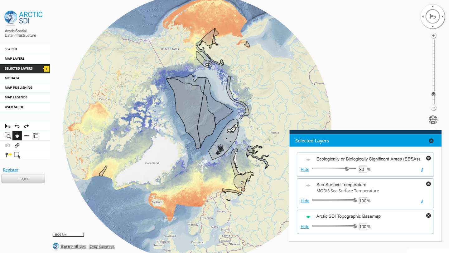
The Arctic SDI Geoportal provides access to geospatial data and services available via the Arctic SDI to support and facilitate monitoring, management and decision making, and support sustainable development in the Arctic. Specifically, the Arctic SDI Geoportal facilitates the discovery, visualization, evaluation, download and integration of geographic data from a variety of sources for the Arctic. The Arctic SDI Geoportal is the result of cooperative efforts between the National Mapping Agencies (NMAs) of the eight Arctic Council Member countries - Canada, Denmark, Finland, Iceland, Norway, Russia, Sweden and the United States. The Arctic SDI Geoportal includes reference data (such as the Arctic SDI topographic basemap or Pan-Arctic Digital Elevation Model) and thematic data from various sources. Thematic data section includes themes such as oceans, climatology and geoscientific information. Most of the data covers the Arctic or the involved Arctic countries, but new data sources with a smaller or larger geographical extent may be accepted. The Geoportal allows searching placenames via a circumpolar gazetteer, and embedding interactive maps to any website. Some of the features require registration.
-
The Arctic SDI Gazetteer Service is a service that contains authoritative place names data from the arctic area. The service can be used for searching place names and performing reverse geocoding. The service contains about 2.87 million place name locations with about 3.15 million place names. It contains data from following sources: * Canada (Natural Resources Canada, updated: 02/2018) * Denmark (including Greenland) (SDFE, updated: 05/2017) * Finland (National Land Survey of Finland, updated: 04/2017) * GEBCO Undersea feature names gazetteer (updated: 04/2019) * Iceland (National Land Survey of Iceland, updated: 08/2017) * Norway (Norwegian Mapping Authority, updated: 08/2017) * Russia (Russian Mapping Agency, updated: 04/2019) * Sweden (Swedish National Mapping Agency, updated: 05/2017) * USA (US Geological Survey, updated: 05/2017)