 Paikkatietohakemisto
Samples
Type of resources
Topics
Keywords
Contact for the resource
Provided by
Formats
Representation types
status
Scale
-
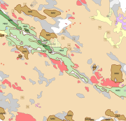
The Superficial deposits 1:20 000 / 1:50 000 data include material produced during the period 1972-2007 for land use planning, for the mapping and inventory of the natural resources as well as for environmental management and for scientific research. The main mapping scale has been 1:10 000. The data contains a sediment as a basal deposit at a depth of one metre. The minimum size of the basal deposit polygon is two hectares, with islands, mire and field enclosures, as well as geologically significant sites as an exception. The 0.4-0.9 m thick layers are described as overlying the basal deposit and, in geologically or economically significant cases, such layers could be even thicker. The minimum polygon size of the overlying deposit is usually four hectares. Thin covering layers under 0.4 m in thickness, which are difficult to delimit but effect an area of at least four hectares, are displayed as point data. Besides the deposits Quaternary geological formations formed in different ways, such as eskers and hummocky moraines, are described in the data. Other mapping sites such as small rock exposures, dunes and raised beaches are shown as point or line data. Coordinate reference system of the Superficial deposits 1:20 000 / 1:50 000 was transformed in March 2013. The transformation from Finnish National Grid Coordinate System (Kartastokoordinaattijärjestelmä, KKJ) Uniform Coordinate Frame to ETRS-TM35FIN projection was done by using the three-dimensional transformation in accordance with the recommendations for the public administration JHS154.