 Paikkatietohakemisto
Buildings
Type of resources
Available actions
Topics
Keywords
Contact for the resource
Provided by
Years
Formats
Representation types
Update frequencies
Service types
Scale
-
NLS-FI INSPIRE Download Service (WFS) for Buildings/Polygon is an INSPIRE compliant direct access Web Feature Service. It contains the following INSPIRE feature types: Building The service is based on the NLS-FI INSPIRE Buildings Theme Dataset. The dataset is administrated by the National Land Survey of Finland. The service contains all features from the dataset that are modelled as polygons.
-
DVV INSPIRE Download Service (WFS) for Buildings is an INSPIRE compliant direct access Web Feature Service. It contains the following INSPIRE feature types: Building. The service is based on the DVV INSPIRE Buildings Theme dataset. The dataset is administrated by the Digital and Population Data Services Agency (Digi- ja väestötietovirasto).
-
DVV INSPIRE View Service for Buildings Theme is an INSPIRE compliant Web Map Service. The service is based on the DVV INSPIRE View Service for Buildings Theme dataset. The dataset is administrated by the Digital and Population Data Services Agency (Digi- ja väestötietovirasto). The service is free to use and there are no access constraints.
-
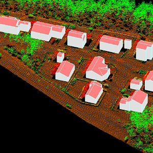
The 3D vectors for buildings are three-dimensional instances of the Building target category in the National Topographic Database (KMTK). The 3D vectors are produced with a high degree of automation from laser scanning data 5 p based on 2D vectors for buildings in KMTK. For the time being, data is available only from a few example areas, but the coverage will be extended to the whole of Finland as the laser scanning programme proceeds. The product belongs to the open data of the National Land Survey of Finland.
-
NLS-FI INSPIRE Download Service (OGC API Features) BETA for Buildings/Polygon is a direct access OGC API Features service that delivers data according to the draft version of INSPIRE alternative encodings for GeoJSON. It contains the following INSPIRE feature types: Building The service is based on the dataset “Kansallisen maastotietokannan Rakennukset”. The dataset is administrated by the National Land Survey of Finland. The service contains all features from the dataset that are modelled as polygons.
-
DVV INSPIRE Buildings Theme Dataset is a dataset depicting the Buildings covering the whole of Finland. It contains the following INSPIRE feature types: Buildings The elements are updated weekly. The dataset is based on "Väestötietojärjestelmän rakennus- ja huoneistotiedot" by the Digital and Population Data Services Agency (Digi- ja väestötietovirasto). Id-attribute indicates the permanent building number for buildings (VTJ-PRT). The dataset is available via the DVV INSPIRE Download Service (WFS) for Buildings Theme and it can be viewed via the DVV INSPIRE View Service (WMS) for Buildings.
-
NLS-FI INSPIRE Buildings Theme Dataset is a dataset depicting the Buildings covering the whole of Finland. It contains the following INSPIRE feature types: Building The elements are updated weekly. The dataset is based on the NLS Topographic database: http://www.paikkatietohakemisto.fi/geonetwork/srv/en/main.home?uuid=cfe54093-aa87-46e2-bfa2-a20def7b036f. Id-attribute indicates the topographic database id for features (mtk-id). The dataset is available via the NLS-FI INSPIRE Download Service (WFS) for Buildings Theme and it can be viewed via the NLS-FI INSPIRE View Service (WMS) for Buildings.
-
NLS-FI INSPIRE View Service for Buildings Theme is an INSPIRE compliant Web Map Service. It contains the following harmonized INSPIRE map layers: Building. The service is based on the NLS-FI INSPIRE Buildings Dataset. The dataset is administrated by the National Land Survey of Finland.
-
NLS-FI INSPIRE Download Service (WFS) for Buildings/Point is an INSPIRE compliant direct access Web Feature Service. It contains the following INSPIRE feature types: Building The service is based on the NLS-FI INSPIRE Buildings Theme Dataset. The dataset is administrated by the National Land Survey of Finland. The service contains all features from the dataset that are modelled as points.
-
Aineisto sisältää päivittäistavarakauppojen ja oppilaitosten saavutettavuusvyöhykkeet sekä taajamien ja asemakaavoitetun alueen lievealueet. Vyöhykkeiden ja lievealueiden etäisyydet on mitattu linnuntietä pitkin. Vyöhykkeiden ominaisuustietoina ovat yksilöivä tunnus, vuosi ja pinta-ala (m2) sekä koulujen ja kauppojen vyöhykkeissä etäisyys. Asemakaavoitetun alueen lievealue: Asemakaavoitetuille alueille on muodostettu yhden kilometrin lievealueet. Etäisyys on mitattu asemakaavoitetun alueen reunasta ulospäin. Oppilaitosten saavutettavuusvyöhykkeet: Oppilaitoksille (ala-asteet, yläasteet ja lukiot) on muodostettu 250, 500, 1 000, 2 000, 3 000 ja 5 000 metrin etäisyysvyöhykkeet. Jos samassa rakennuksessa on esim. sekä ala- että yläaste, löytyvät etäisyysvyöhykkeet sekä ala-asteiden että yläasteiden saavutettavuusvyöhykkeistä. Päivittäistavarakauppojen saavutettavuusvyöhykkeet: Päivittäistavarakaupoille on muodostettu 250, 500, 1 000, 2 000 ja 5 000 metrin etäisyysvyöhykkeet. Taajamien lievealueet: Taajamille on muodostettu yhden kilometrin lievealueet. Etäisyys on mitattu taajaman reunasta ulospäin. Aineistoista on saatavilla uusin vuosi.