 Paikkatietohakemisto

Type of resources
Available actions
Topics
Keywords
Contact for the resource
Provided by
Years
Formats
Representation types
Update frequencies
status
Service types
Scale
Resolution
-
LUOMUS WFS is an API to the geospatial information provided by the Finnish Museum of Natural History. The use of the service is free and doesn't require authentication.
-

The Geological Survey of Finland (GTK) has carried out systematic aerogeophysical low-altitude surveys during the period 1972-2007. The flight altitude (main terrain clearance) has been 30-40 m with a nominal flight line spacing of 200 m. The standard flight lines chosen run North-South and East-West and follow the main geological trends. The distance between the measuring points along the survey lines has been 6-50 m. The geophysical parameters measured include Earth's magnetic field, the electromagnetic field and natural gamma radiation. Magnetic measurements determine the Earth's magnetic field strength (magnetic flux density), and the parameter obtained is the total magnetic intensity. The measurements have been made with one to three proton magnetometers until 1991 and thereafter with one or two cesium magnetometers. Most of the land area has been flown using two magnetometers.
-
NLS-FI INSPIRE View Service for Hydrography Theme is an INSPIRE compliant Web Map Service. It contains the following harmonized INSPIRE map layers: Land-water Boundary, Waterbodies, Man-made Objects, Hydro Point of Interest. The service is based on the NLS-FI INSPIRE Hydrography Physical Waters dataset. The dataset is administrated by the National Land Survey of Finland.
-
DVV INSPIRE View Service (WMS) for Addresses Theme is an INSPIRE compliant Web Map Service. It contains the following harmonized INSPIRE map layers: Address. The service is based on the DVV INSPIRE Addresses Theme Dataset. The dataset is administrated by the Digital and Population Data Services Agency (Digi- ja väestötietovirasto).
-
NLS-FI INSPIRE View Service for Geographical Names Theme is an INSPIRE compliant Web Map Service. It contains the following harmonized INSPIRE map layers: NamedPlace. The service is based on the Geographic Names Register of the National Land Survey of Finland. The dataset is administrated by the National Land Survey of Finland.
-
DVV INSPIRE Download Service (WFS) for Buildings is an INSPIRE compliant direct access Web Feature Service. It contains the following INSPIRE feature types: Building. The service is based on the DVV INSPIRE Buildings Theme dataset. The dataset is administrated by the Digital and Population Data Services Agency (Digi- ja väestötietovirasto).
-
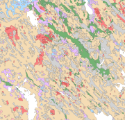
The Superficial deposits of Finland 1:200 000 (sediment polygons) contains data produced from the whole of Finland during the period 2002-2009. The data set can be used in regional planning, in military defence, in soil mapping (EU) and in joint mapping projects in various areas. The mapping scale has been 1:50 000-1:200 000. In compiling the medium-scale data set, generalised 1:20 000, 1:50 000 and 1:100 000 superficial deposits maps have been used and a new map product at a scale of 1:200 000 that is based on interpretation and field mapping. The minimum size of the sediment polygons is about six hectares. Exceptions are glaciofluvial, marginal till and hummocky moraine deposits, which are presented in the data set as areas with a surface area greater than two hectares. The blanketing peat overburden has been described in the new map product as a peat-covered area (0-0.3 m of peat), thin peat (0.3-0.6 m of peat) and thick peat (over 0.6 m of peat). Peat-covered areas, stone fields and uncovered bedrock areas have been added to the new production map by generalising the corresponding polygons in the terrain database of the National Land Survey of Finland (NLS). In connection with the generation of new production map, field observations have been gathered on the overburden thickness and the stratigraphic sequence at a depth of one metre as well as on rock exposures. Coordinate reference system of the Superficial deposits of Finland 1:200 000 (sediment polygons) was transformed in March 2013. The transformation from Finnish National Grid Coordinate System (Kartastokoordinaattijärjestelmä, KKJ) Uniform Coordinate Frame to ETRS-TM35FIN projection was done by using the three-dimensional transformation in accordance with the recommendations for the public administration JHS154.
-
NLS-FI INSPIRE Download Service (WFS) for Geographical Names Theme is an INSPIRE compliant direct access Web Feature Service. It contains the following INSPIRE feature types: NamedPlace. The service is based on the Geographic Names Register of the National Land Survey of Finland. The dataset is administrated by the National Land Survey of Finland.
-
NLS-FI INSPIRE Download Service (WFS) for Administrative Units Theme is an INSPIRE compliant direct access Web Feature Service. It contains the following INSPIRE feature types: AdministrativeUnit, AdministrativeBoundary, Baseline, MaritimeZone, MaritimeBoundary. The service is based on the NLS-FI INSPIRE Administrative Units dataset. The dataset is administrated by the National Land Survey of Finland.
-
NLS-FI INSPIRE View Service for Cadastral Parcels Theme is an INSPIRE compliant Web Map Service. It contains the following harmonized INSPIRE map layers: CadastralParcel, CadastralBoundary. The service is based on the NLS-FI INSPIRE Cadastral Parcels dataset. The dataset is administrated by the National Land Survey of Finland.